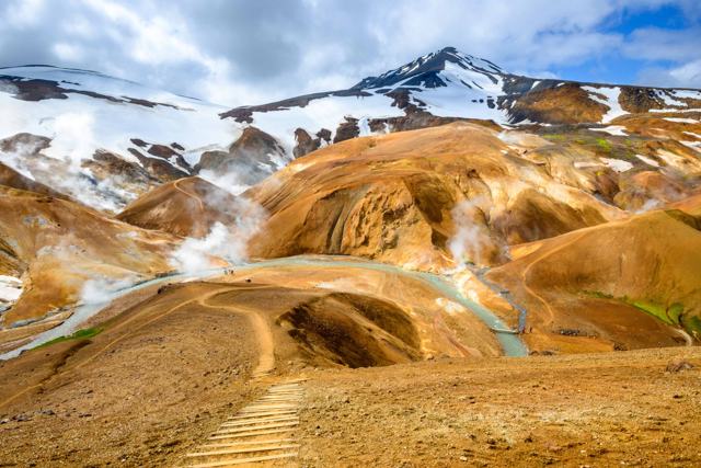
Kerlingarfjöll is a volcanic mountain range in the central highlands, between the Langjökull and Hofsjökull glaciers, and one of the best hiking areas in Iceland. The most popular walk is the 4 km Hveradalir circle through steaming, colourful rhyolite slopes, but there are also summit routes, canyon walks and a three-day loop. The hiking season runs from about mid-June to September, when the Kjölur road is open.

About Kerlingarfjöll
Kerlingarfjöll means roughly "the mountains of the old woman". The name comes from Kerling, a rock pillar about 24 metres tall that stands on the western side of the range. According to folklore she was a troll who was turned to stone by the sun.
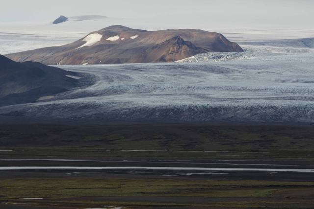
The range is a central volcano with red and yellow rhyolite peaks, snowfields and one of the largest geothermal areas in the highlands. The volcanic system covers roughly 100 square kilometres, and the highest peak, Snækollur, reaches 1,477 metres. An area of about 367 square kilometres is now protected as a nature reserve. See our Kerlingarfjöll place guide for more background.
Getting to Kerlingarfjöll
Kerlingarfjöll is about 190 km from Reykjavík, close to 4 hours by car in summer. You drive the Golden Circle route past Geysir and Gullfoss, then continue north on Route 35, the Kjölur highland road (Kjalvegur). The asphalt ends soon after Gullfoss. Near the middle of Kjölur you turn east onto F347, which leads to the Highland Base service centre in the Ásgarður valley.
Neither road has river fords, and the southern part of Kjölur is usually in fair condition. But F347 is an F-road, so by law you need a 4×4, and rental companies have their own rules about highland driving. Check your rental terms and road.is before you go, and fill the tank before you leave the lowlands.
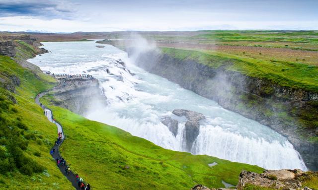
If you would rather not drive yourself, summer bus transfers and highland tours go to Kerlingarfjöll. Our Kerlingarfjöll Hiking Tour from Reykjavík runs from June to September, with a stop at Gullfoss on the way and a guided walk in Hveradalir. Outside the summer season, access is only by super jeep with a professional driver.
When to go hiking in Kerlingarfjöll
The Kjölur road usually opens in mid-June and closes some time in September, depending on snow and weather. The best hiking is from July to early September. In June and early July there can still be snow on the higher trails, and even in August you may cross small snowfields around Hveradalir.
The base area sits at about 700 metres and the geothermal area higher still, so it is colder and windier than the lowlands. Snow and freezing temperatures are possible in any month. Long summer daylight helps on longer hikes; see our daylight hours guide and our guides to Iceland in July and August.
Hveradalir: the geothermal valleys
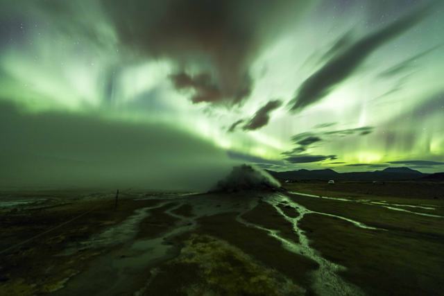
Hveradalir ("hot spring valleys") is the reason most people come to Kerlingarfjöll. Steam rises from vents and mud pots, and the slopes are streaked with red, orange, yellow and green minerals, often with snow patches right beside the hot ground. It is not a bathing area.
The official Hveradalahringur (Hveradalir circle) is a marked 4 km loop from the Hveradalir parking area, with about 100 metres of climbing. Allow 1–2 hours, or longer if you stop for photos. There are wooden steps and platforms in places, but the paths can be muddy and slippery, and some sections are steep.
The Hveradalir car park is about 6 km from Highland Base up a rough gravel track. You can also walk all the way from Ásgarður on the marked Neðri-Hveradalir trail: about 10 km with roughly 400 metres of climbing, a good half-day hike.
Other day hikes in Kerlingarfjöll
The Environment Agency of Iceland publishes a trail guide for the nature reserve. These are the main routes, with distances from that guide:
- Ásgarðsfjall (2.5 km, 1–2 hours, easy): a short climb from Highland Base with views to Hofsjökull. A good first walk on arrival.
- Snækollur and Fannborg (9 km, 5–6 hours, difficult): an unmarked mountain route from the Keis car park over the highest peaks, with about 650 metres of climbing and a fixed wire on the last steep section. On a clear day you see both glaciers and far across the highlands. Only for experienced hikers in good weather.
- Kerling (7.5 km, 2–3 hours, moderate): a marked walk from the Skeljafell car park to the rock pillar that gave the range its name.
- Hvinur and Fossrófur (2–3 hours): a river canyon walk with several waterfalls, starting at the bridge over Jökulfall.
- Skuggafoss (15 km, 5–6 hours): an unmarked route to a waterfall in a narrow ravine near Hofsjökull.
The Kerlingarfjöll hot pool
A natural hot pool lies in the Ásgarðsá river valley, a walk of about 1.5 km from Highland Base along the river gorge. It is an easy path with little climbing, and there is a simple wooden changing platform. The water is warm rather than hot, around 34–37°C. It makes a good end to a day of hiking.
Highland Base also has the Highland Baths, with a geothermal pool, cold plunge and sauna. They are open to day visitors from 15 June to 30 September, 11:00–23:00. Admission is ISK 5,500 for adults, and booking ahead is advised. For more soaking spots, see our guide to hidden hot springs in Iceland.
Hringbrautin: the three-day Circle trek
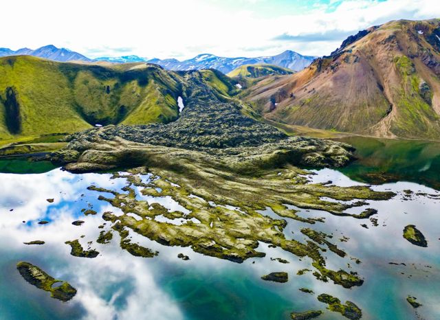
For experienced hikers, Hringbrautin ("the Circle") is a 47 km, three-day loop around the Kerlingarfjöll range. Day one runs about 17 km from Ásgarður to the Kisubotnar hut. Day two is about 7 km to the Klakkur hut, through Kisugljúfur canyon and with river wading. Day three is the hardest, about 23 km back to Ásgarður past Mænir and Neðri-Hveradalir.
The huts are basic and have no services, so you carry everything: food, stove, sleeping bag and wading shoes. Navigation skills and a GPS track are essential, as the route is remote and mobile coverage is unreliable. Hiring a local guide is a sensible choice if you have not done a highland trek before. See our camping packing list.
Safety and trail rules
- Stay on marked paths. Leaving the trail in Hveradalir is prohibited. The crust can be thin, new hot springs can open without warning, and boiling water or mud can lie just under the surface.
- Protect the plants. The growing season is short, and moss and lichen take decades to recover from footprints.
- Leave no trace. Take all your litter back with you, and do not pick plants or disturb birds and other wildlife.
- Check the forecast and conditions on vedur.is, road.is and safetravel.is, and leave a travel plan with SafeTravel for longer hikes.
- Expect poor mobile coverage. In an emergency call 112.
- Turn back in fog or strong wind, especially on the unmarked summit routes.
Where to stay
Highland Base in the Ásgarður valley, formerly the Kerlingarfjöll Mountain Resort, is the only accommodation in Kerlingarfjöll. It has hotel rooms, lodges, mountain huts with dormitory beds and a campsite, plus a restaurant and the Highland Baths. Summer fills up, so book early. Campers need a warm sleeping bag, as nights at 700 metres can drop close to freezing. Read our camping in Iceland guide for general tips.
What to pack for hiking in Kerlingarfjöll
- Waterproof jacket and rain trousers
- Warm layers: thermal base layer, fleece or wool jumper, hat and gloves
- Waterproof hiking boots with good grip for mud and snow
- Trekking poles for the steep, slippery sections
- A daypack with room for water, food, a spare layer and your camera
- A refillable water bottle, food and snacks. There are no shops and few places to refill on the trails, so carry enough for the whole hike
- Offline map or GPS track
- Swimwear and a quick-dry towel for the hot pool
- Sunglasses and sun cream for snowfields and long days
Tours to Kerlingarfjöll
A guided trip is the easiest way to see Kerlingarfjöll if you do not have a 4×4 or want someone else to handle the highland roads. Day tours from Reykjavík usually combine the Golden Circle with a walk in Hveradalir, and some also stop at Hveravellir or the edge of Langjökull. Browse our highland tours and hiking tours.
If you like Kerlingarfjöll, you will also enjoy the highland trails further south, and our Landmannalaugar Private Tour takes you there by super jeep with your own guide. Read our guides to hiking in Landmannalaugar and hiking in Þórsmörk.
- Kerlingarfjöll Hiking Tour from Reykjavík: a long summer day with pick-up in Reykjavík, Gullfoss on the way and a guided walk through the Hveradalir geothermal valleys.
- Landmannalaugar Private Tour: a private super jeep day in the southern highlands, with Háifoss, Ljótipollur and a choice of a guided hike or a soak in the hot spring.
- Golden Circle Private Tour from Reykjavík: Þingvellir, Geysir and Gullfoss at your own pace with a local guide, if you want the lowland part of the Kjölur route without the highland drive.
Questions people ask
How long is the Hveradalir hike in Kerlingarfjöll?
The marked Hveradalir circle is about 4 km with around 100 metres of climbing and takes 1–2 hours from the Hveradalir car park. Walking there from Highland Base on the Neðri-Hveradalir trail is about 10 km.
Do I need a 4×4 to get to Kerlingarfjöll?
Yes. The last stretch is F347, an F-road, so a 4×4 is required by law. There are no river fords on the way, but check your rental terms and road.is before you go, or join a highland tour.
When is the best time to hike in Kerlingarfjöll?
July to early September. The Kjölur road usually opens in mid-June and closes in September, and early summer can still bring snow on the higher trails.
Can you bathe in the hot springs at Kerlingarfjöll?
Not in Hveradalir, which is a protected geothermal area. You can bathe in the natural hot pool in the Ásgarðsá valley near Highland Base, or in the Highland Baths at the base.
What is the highest peak in Kerlingarfjöll?
Snækollur, at 1,477 metres. It is reached on an unmarked, demanding route of about 9 km that takes 5–6 hours.