 Iceland Travel GuideLOCAL TRAVEL AGENCY IN ICELAND
My trip
Talk to a local
Iceland Travel GuideLOCAL TRAVEL AGENCY IN ICELAND
My trip
Talk to a local
Local guides to places all around Iceland.
281 places · more guides are being added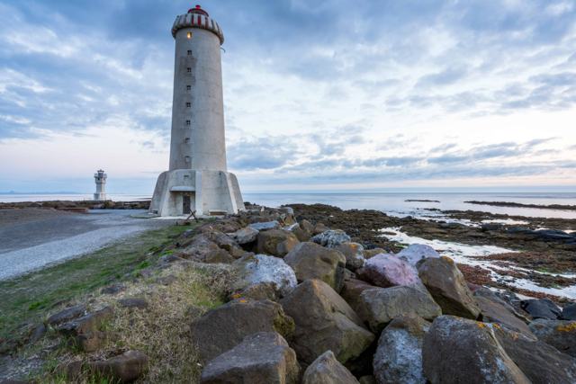 West Iceland · TownAkranesAkranes is a fishing town of about 8,500 people on the west coast, around 50 km from Reykjavík through the Hvalfjörður tunnel, roughly 40–45.
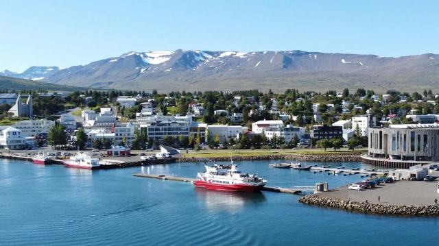 North Iceland · TownAkureyriAkureyri sits at the head of Eyjafjörður, Iceland's longest fjord, and is often called the capital of the north.
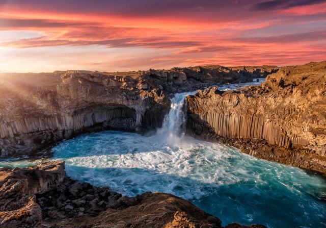 North Iceland · WaterfallAldeyjarfossAldeyjarfoss is a 20-metre waterfall on the Skjálfandafljót river in upper Bárðardalur, North Iceland, framed by dark basalt columns.
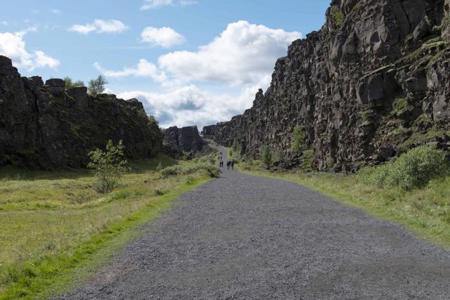 Golden Circle · CanyonAlmannagjáAlmannagjá is the great rift wall of Þingvellir National Park on the Golden Circle, the edge of the North American plate and the place where.
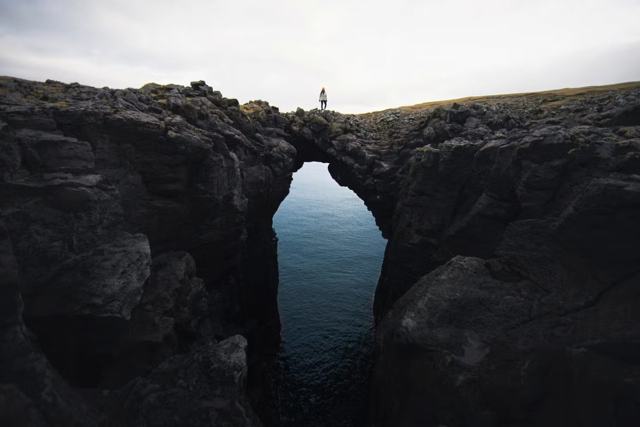 Snæfellsnes · VillageArnarstapiArnarstapi, also called Stapi, is a small fishing village and harbour on the south coast of the Snæfellsnes Peninsula, known for its basalt .
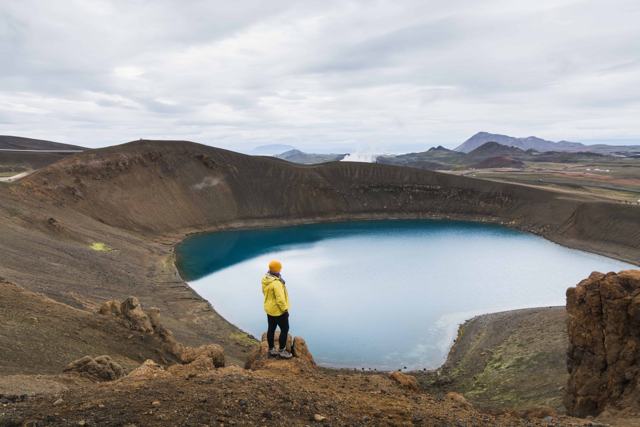 Highlands · VolcanoAskjaAskja is a vast volcanic caldera in the Dyngjufjöll mountains of Iceland's central Highlands, within Vatnajökull National Park.Highlands · WaterfallAxlafossAxlafoss is a small, remote waterfall on the Hólmsá river in the southern Highlands of Iceland, off the F210 mountain road.West Iceland · WaterfallBarnafossBarnafoss is a narrow, fast waterfall on the Hvítá river in Borgarfjörður, West Iceland, just upstream from Hraunfossar and often visited to.
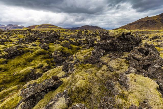 Snæfellsnes · Lava fieldBerserkjahraunBerserkjahraun is a roughly 4,000-year-old lava field on the north side of the Snæfellsnes peninsula, covered in thick, soft moss and named .Snæfellsnes · WaterfallBjarnarfossBjarnarfoss is an 80-metre waterfall that drops in two tiers off a basalt cliff below Mælifell mountain, just above the historic settlement .East Iceland · VillageBorgarfjörður eystriBorgarfjörður eystri (Bakkagerði) is a fishing village of about 100 people on a remote fjord in East Iceland, about 70 km (around 1 hour) fr.
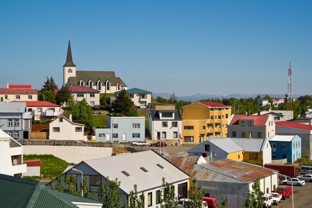 West Iceland · TownBorgarnesBorgarnes is a town of about 2,000 people on a small peninsula in West Iceland, about 75 km (around 1 hour) from Reykjavík.
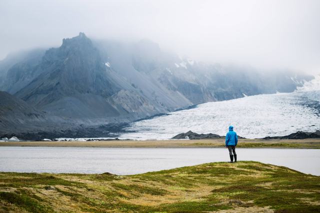 Southeast Iceland · Glacier lagoonBreiðárlónBreiðárlón is a glacier lagoon in Vatnajökull National Park in Southeast Iceland, on the Breiðamerkurjökull glacier and close to Fjallsárlón.
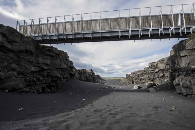 Reykjanes · LandmarkBridge Between ContinentsThe Bridge Between Continents is a small footbridge at Sandvík on the Reykjanes Peninsula, built over a fissure that marks the divide betwee.
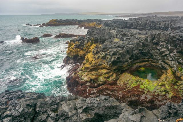 Reykjanes · LandmarkBrimketillBrimketill is a natural pool in the lava shore near Grindavík on the Reykjanes Peninsula, shaped by the sea over thousands of years.
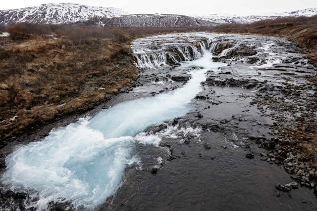 Golden Circle · WaterfallBrúarfossBrúarfoss, often called Iceland's bluest waterfall, sits on the Brúará river near Laugarvatn, just off the Golden Circle.
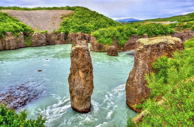 Golden Circle · CanyonBrúarhlöðBrúarhlöð is a narrow gorge on the Hvítá river about 3 km south of Gullfoss on the Golden Circle route, where the river has carved the rock .Westfjords · VillageBíldudalurBíldudalur is a small village of around 240 people on the south shore of Arnarfjörður in the Westfjords.
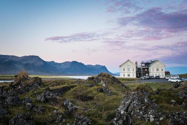 Snæfellsnes · ChurchBúðirBúðir is a tiny hamlet on the south side of the Snæfellsnes Peninsula in West Iceland, built around a black wooden church, a country hotel a.
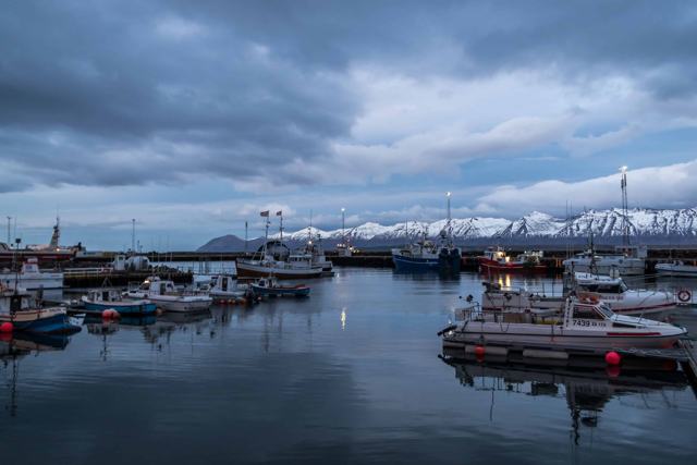 North Iceland · VillageDalvíkDalvík is a small fishing village on the Tröllaskagi peninsula in North Iceland, about 45 km (around 40 minutes) north of Akureyri.
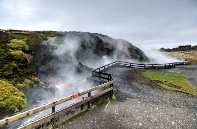 West Iceland · Hot springDeildartunguhverDeildartunguhver is a hot spring in the Reykholtsdalur valley of West Iceland, about 100 km (around 1 hour 30 minutes) from Reykjavík.
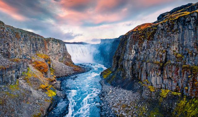 North Iceland · WaterfallDettifossDettifoss is a 44-metre waterfall on the Jökulsá á Fjöllum river in North Iceland, part of Vatnajökull National Park and a highlight of the .
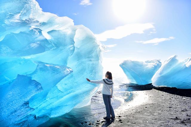 Southeast Iceland · BeachDiamond BeachDiamond Beach is a black sand beach on the south side of the Ring Road, directly opposite Jökulsárlón glacier lagoon, in Southeast Iceland.North Iceland · Lava fieldDimmuborgirDimmuborgir is a field of tall, dark lava pillars and small caves on the eastern side of Lake Mývatn in North Iceland, about 470 km (around .
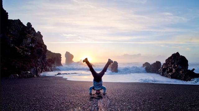 Snæfellsnes · BeachDjúpalónssandurDjúpalónssandur is a black pebble beach on the south coast of the Snæfellsnes Peninsula, inside Snæfellsjökull National Park, known for dram.
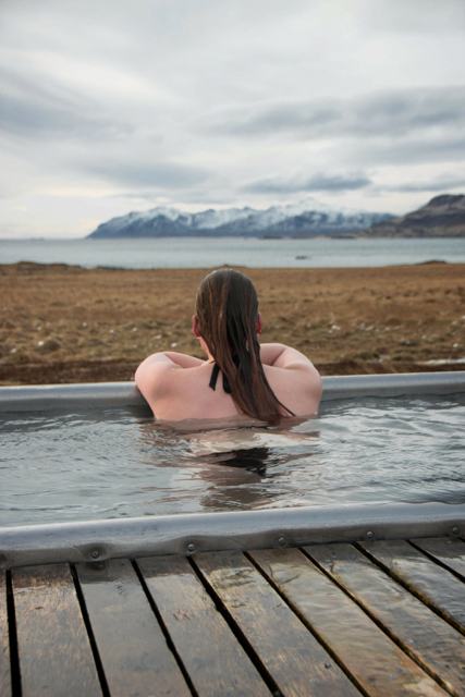 East Iceland · Hot springDjúpavogskörinDjúpavogskörin hot springs is a small hot pool close to Djúpivogur in East Iceland, a few minutes off the Ring Road and tucked behind a rock.
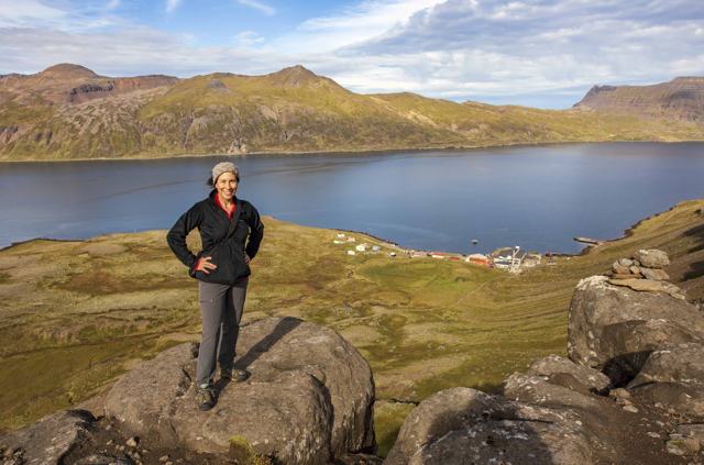 Westfjords · VillageDjúpavíkDjúpavík is a tiny village at the head of Reykjarfjörður on the Strandir coast in the Westfjords, built around a herring factory from the 19.
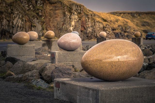 East Iceland · VillageDjúpivogurDjúpivogur is a small fishing village on a headland in East Iceland, about 570 km (around 6.5–7 hours) from Reykjavík by road.
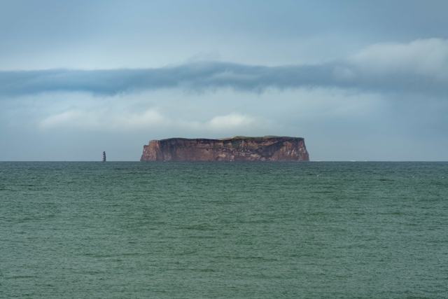 North Iceland · IslandDrangeyDrangey is an uninhabited island about 180 metres high in the Skagafjörður fjord, North Iceland, known for its seabird colonies and as the p.Westfjords · Hot springDrangsnes hot tubsThe Drangsnes hot tubs are three free geothermal pots on the seafront in Drangsnes, a small village on the Strandir coast of the Westfjords.
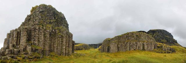 South Iceland · LandmarkDverghamrarDverghamrar (“Dwarf Rocks”) are two small cliffs of hexagonal basalt columns right beside the Ring Road in South Iceland, just east of the F.
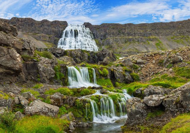 Westfjords · WaterfallDynjandiDynjandi, also called Fjallfoss, is a waterfall in the Westfjords that fans out as it drops about 100 metres down a mountainside above Arnar.
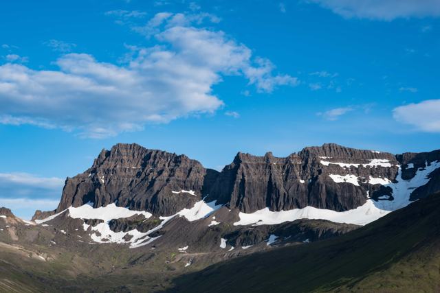 East Iceland · MountainDyrfjöllDyrfjöll (“the door mountains”) is a mountain range in East Iceland, near Borgarfjörður eystri, with a peak of 1,136 metres and a famous gap.
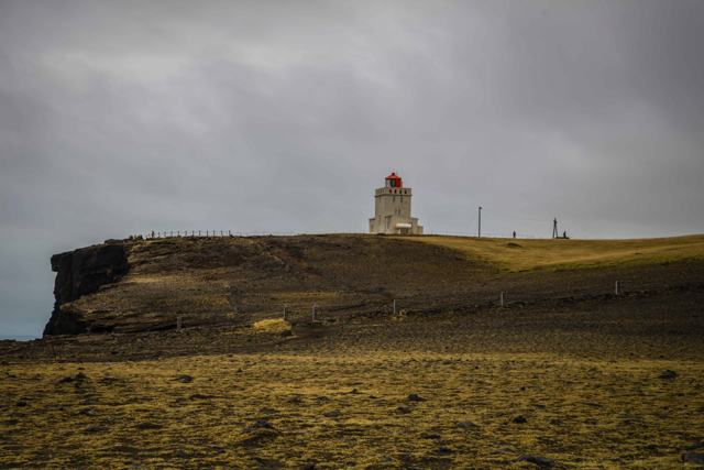 South Iceland · CliffsDyrhólaeyDyrhólaey is a 120-metre-high former island, now a peninsula, on the South Coast just west of Vík: about 6 km away in a straight line, but a.
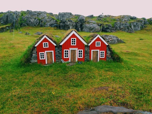 East Iceland · TownEgilsstaðirEgilsstaðir is the largest town in East Iceland, on the eastern bank of the lake-like river Lagarfljót.Highlands · MountainEinhyrningurEinhyrningur, meaning "one horn", is a standalone mountain about 750 m high on the edge of the highlands beyond Fljótshlíð, between the Tind.West Iceland · LandmarkEiríksstaðirEiríksstaðir is a reconstructed turf longhouse in Dalir, West Iceland, built near the ruins believed to be the farm of Erik the Red, father .
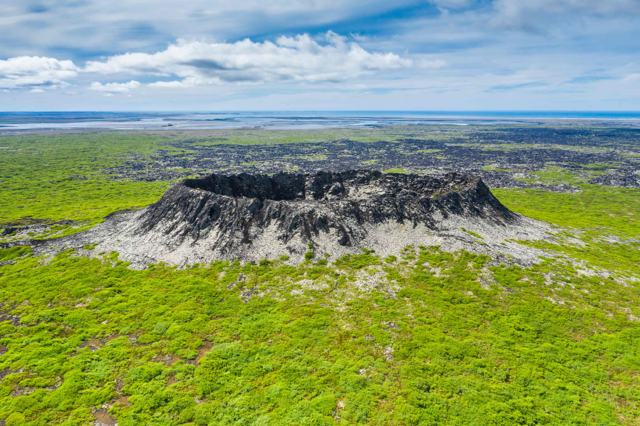 West Iceland · CraterEldborgEldborg is a 60-metre spatter cone crater in the Hnappadalur valley in West Iceland, reached by an easy round-trip hike of about 6.6 km from.
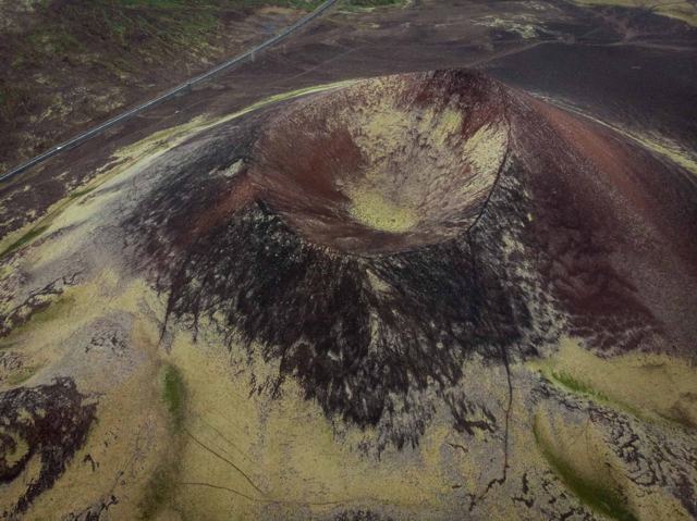 Highlands · CanyonEldgjáEldgjá (“Fire Canyon”) is a huge volcanic fissure in the southern Highlands of Iceland, with a main canyon of about 8.5 km.
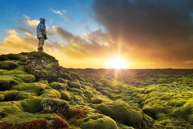 South Iceland · Lava fieldEldhraunEldhraun is one of the largest lava fields in the world, covering about 565 km² of South Iceland between Vík and Kirkjubæjarklaustur, right .
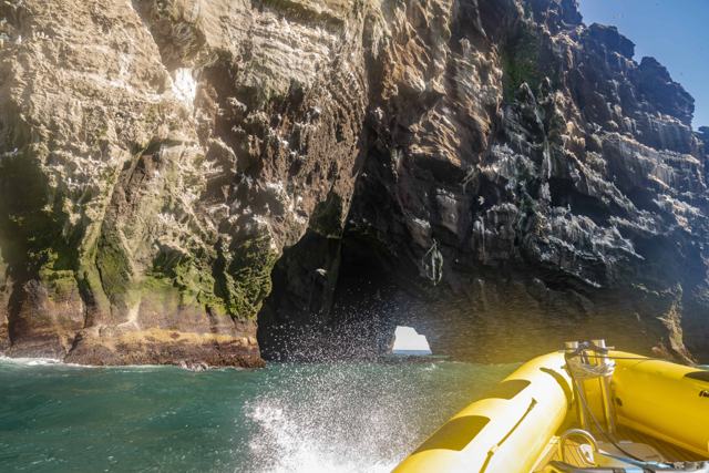 Westman Islands · CliffsElephant RockElephant Rock is a basalt sea cliff on the north-west coast of Heimaey, the main island of the Westman Islands, shaped by the sea to look li.
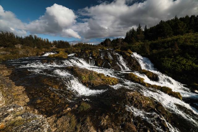 Reykjavík · ParkElliðaárdalurElliðaárdalur is a long, green valley park running through the middle of Reykjavík, with about 10 km of paths along the Elliðaá river.West Iceland · Hot springEnglandshverirEnglandshverir is a small, lukewarm natural hot spring on a river in Lundarreykjadalur, West Iceland, reached by a gravel road and a short w.
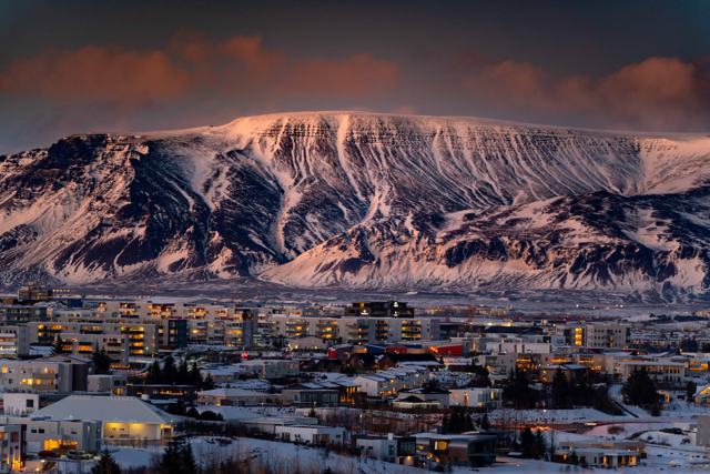 Reykjavík · MountainEsjaEsja is a volcanic mountain range across the bay from Reykjavík, about 10 km from the city in a straight line, with its highest point at 914.
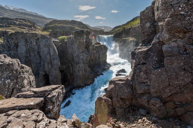 East Iceland · VillageEskifjörðurEskifjörður is a small fishing village on the fjord of the same name in East Iceland, backed by steep mountains that drop almost straight in.
 South Iceland · GlacierEyjafjallajökullEyjafjallajökull is an ice-capped volcano in South Iceland, best known for its 2010 eruption, which sent an ash cloud across Europe and grou.
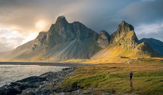 East Iceland · MountainEystrahornEystrahorn is a steep coastal mountain of about 756 m in East Iceland, at the eastern end of the Lón lagoon and about 50 km east of Höfn.Reykjanes · VolcanoFagradalsfjallFagradalsfjall is a volcanic system on the Reykjanes Peninsula, about 45 minutes from Reykjavík, that produced repeated eruptions between 20.
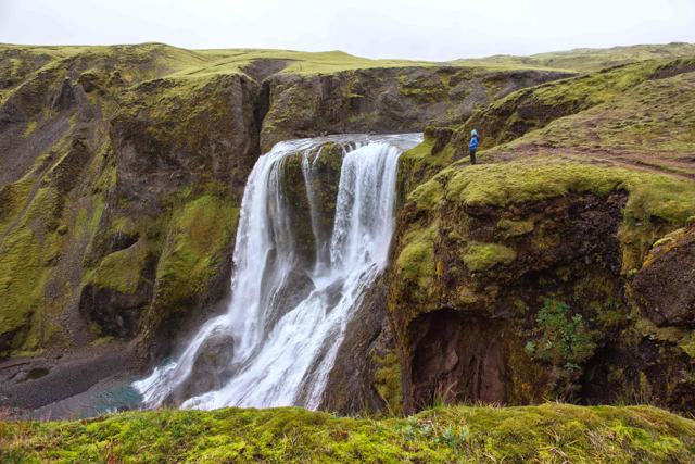 Highlands · WaterfallFagrifossFagrifoss is a wide waterfall of about 80 m on the Geirlandsá river, beside the F206 highland road that leads to the Lakagígar craters, abou.
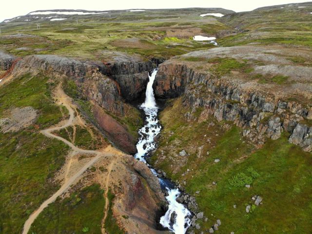 East Iceland · WaterfallFardagafossFardagafoss is a waterfall about 20 metres high on an easy trail near Egilsstaðir in East Iceland, just off the road up to Seyðisfjörður.
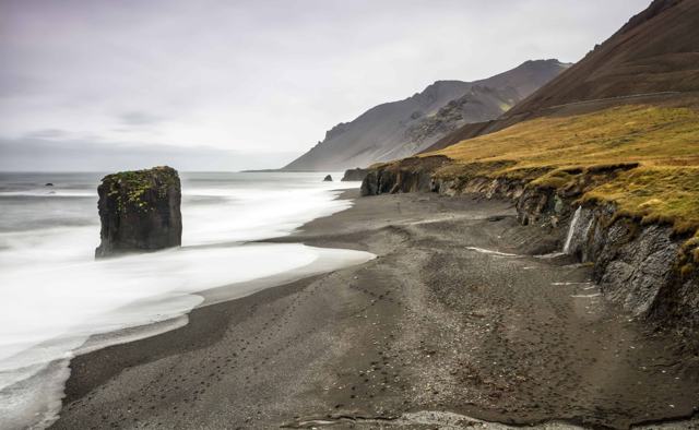 East Iceland · BeachFauskasandurFauskasandur is a black sand beach directly beside Route 1 in East Iceland, on the coast between Höfn and Djúpivogur, about 30 minutes' driv.
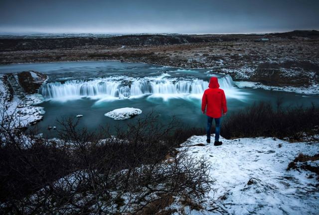 Golden Circle · WaterfallFaxiFaxi, also known as Vatnsleysufoss, is a wide waterfall on the Tungufljót river near Skálholt, close to the Golden Circle route in South Ice.
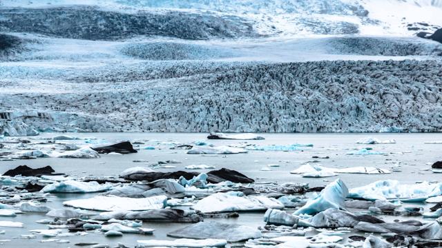 Southeast Iceland · Glacier lagoonFjallsárlónFjallsárlón is a glacier lagoon in Southeast Iceland, fed by Fjallsjökull, an outlet glacier of Vatnajökull, inside Vatnajökull National Par.
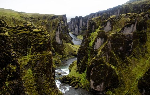 South Iceland · CanyonFjaðrárgljúfurFjaðrárgljúfur is a winding canyon in South Iceland, up to about 100 metres deep and roughly 2 km long, cut by the Fjaðrá river.
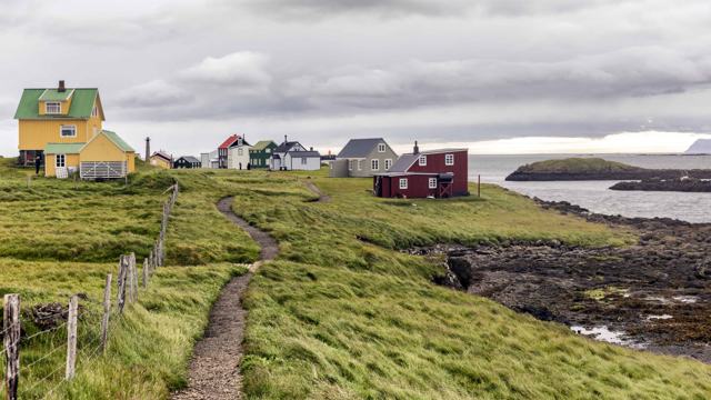 West Iceland · IslandFlateyFlatey is a flat island about 2 km long and 1 km wide in the Breiðafjörður bay in West Iceland.
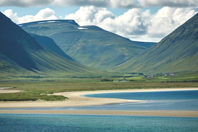 Westfjords · VillageFlateyriFlateyri is a small fishing village of around 200 people on Önundarfjörður in the Westfjords, a short drive from Ísafjörður through the Vest.
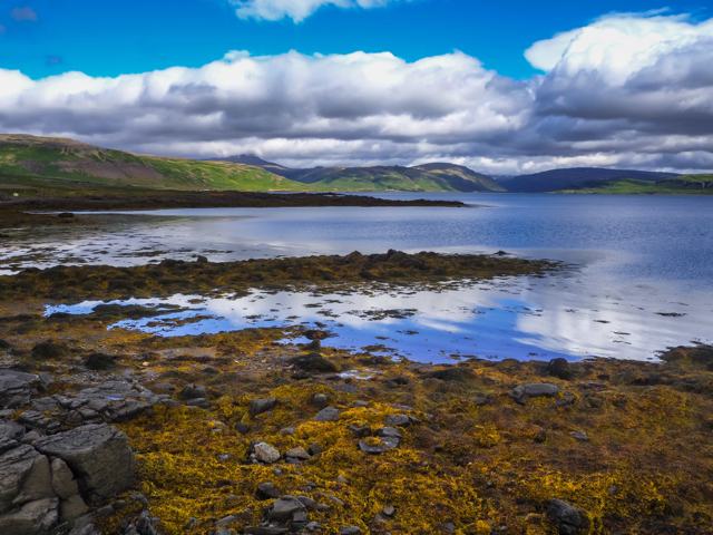 Westfjords · VillageFlókalundurFlókalundur is a tiny settlement at the junction of Route 60 and Route 62 in Vatnsfjörður nature reserve, on the south coast of the Westfjor.
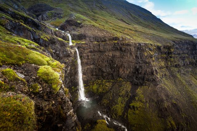 East Iceland · WaterfallFlögufossFlögufoss is a 60-metre waterfall in the Breiðdalur valley in East Iceland, the tallest waterfall in the valley and one of the region's quie.
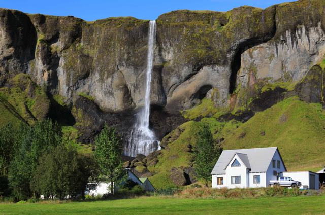 South Iceland · WaterfallFoss á SíðuFoss á Síðu is a slim waterfall about 30 metres high, dropping over a basalt cliff right beside a farm on the Ring Road, about 10 km east of.
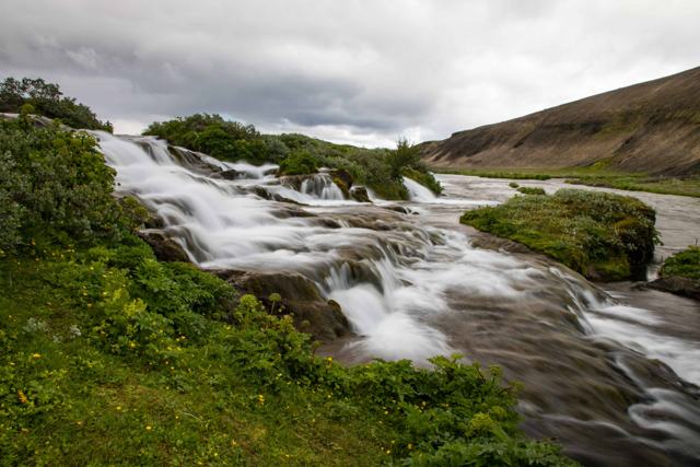 Highlands · WaterfallFossabrekkurFossabrekkur is a green oasis of small waterfalls and rapids, about 150 metres wide, where the western branch of the Ytri-Rangá river drops .
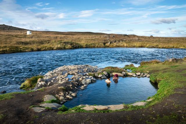 North Iceland · Hot springFosslaugFosslaug is a small natural hot spring in Skagafjörður, North Iceland, on the river bank just above Reykjafoss waterfall, about 7 km south o.
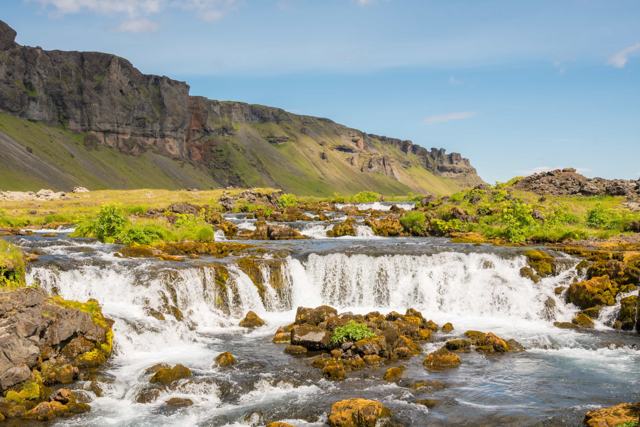 South Iceland · WaterfallFossálarFossálar is a small waterfall, or really a row of low cascades, where the Fossálar river steps down over dark lava ledges right beside the R.
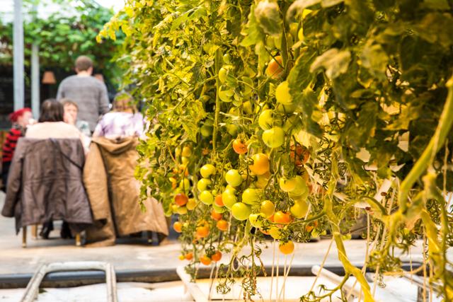 Golden Circle · FarmFriðheimarFriðheimar is a family-run tomato farm in Reykholt, South Iceland, where you eat lunch inside a working greenhouse heated with geothermal en.
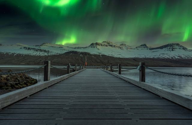 East Iceland · VillageFáskrúðsfjörðurFáskrúðsfjörður is a small fishing village in the Eastfjords of Iceland, known for its French history and French street signs.
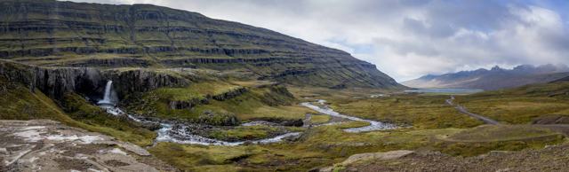 East Iceland · WaterfallFólaldafossFólaldafoss is a waterfall on the Berufjarðará river, right beside the Öxi mountain road (Route 939) above Berufjörður in East Iceland.
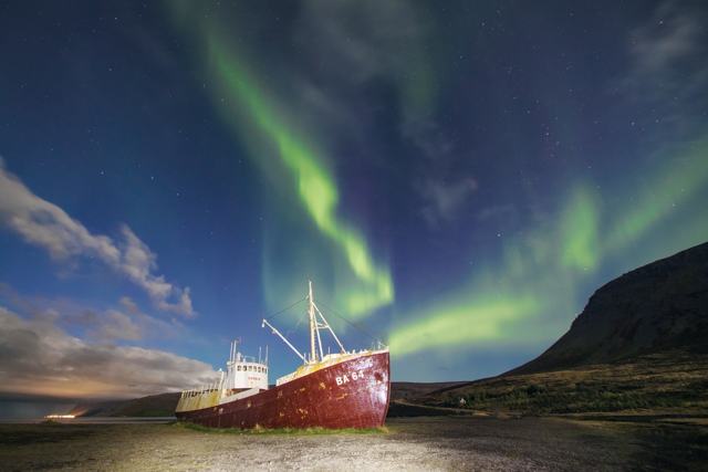 Westfjords · LandmarkGarðar BA 64Garðar BA 64 is the rusting hull of a steel ship built in Norway in 1912, beached on the shore at Skápadalur in the southern Westfjords, on .Reykjanes · LandmarkGarðskagiGarðskagi is the northwest tip of the Reykjanes peninsula, near the village of Garður, with two lighthouses: a small one from 1897 and the t.
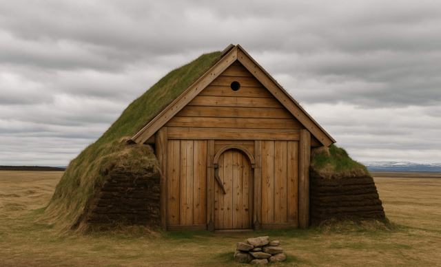 East Iceland · ChurchGeirsstaðakirkjaGeirsstaðakirkja is a replica of a Viking Age turf church, built in 1999 to 2001 on the site of the excavated ruins near Egilsstaðir in East.
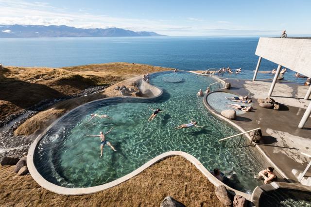 North Iceland · Swimming poolGeoSeaGeoSea is a geothermal sea bath on the Húsavíkurhöfði headland, on the northern edge of Húsavík in North Iceland, with infinity-edge pools l.North Iceland · LakeGeothermal Goldfish PondThe geothermal goldfish pond in Húsavík is a small, naturally warm pond about 2 km south of the town in North Iceland, known for the goldfis.
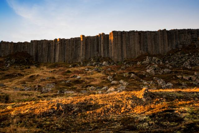 Snæfellsnes · CliffsGerðubergGerðuberg is a wall of regular basalt columns, about 7–14 metres high, on the south side of the Snæfellsnes peninsula beside Route 54.
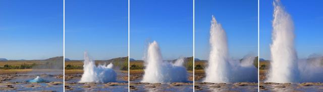 Golden Circle · Geothermal areaGeysirGeysir is a geothermal area in the Haukadalur valley on the Golden Circle in South Iceland, home to Strokkur, a geyser that erupts every 5–1.
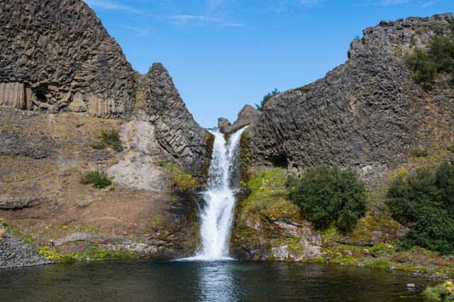 South Iceland · ValleyGjáinGjáin is a small, green valley with waterfalls, basalt columns and pools, tucked into the edge of the Þjórsárdalur highlands in South Icelan.
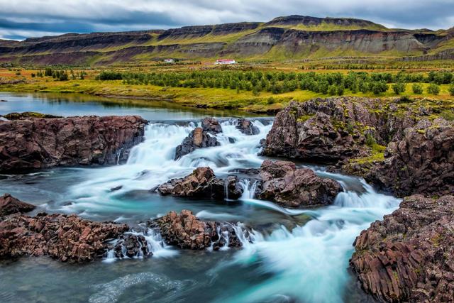 West Iceland · WaterfallGlanniGlanni is a waterfall on the Norðurá river near the village of Bifröst in West Iceland, part of the Silver Circle route, about 1.5 hours fro.
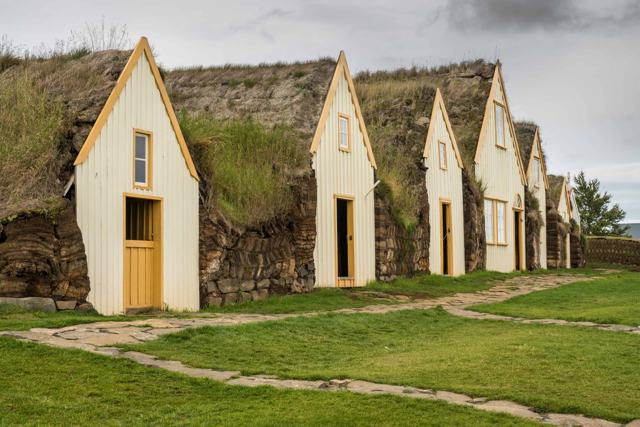 North Iceland · Turf housesGlaumbærGlaumbær is a preserved turf farm in Skagafjörður, North Iceland, made up of 13 connected buildings and run as a museum.
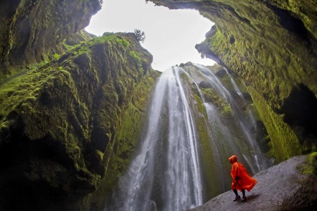 South Iceland · WaterfallGljúfrabúiGljúfrabúi is a 40-metre waterfall hidden inside a narrow, moss-covered canyon a short walk from Seljalandsfoss in South Iceland.
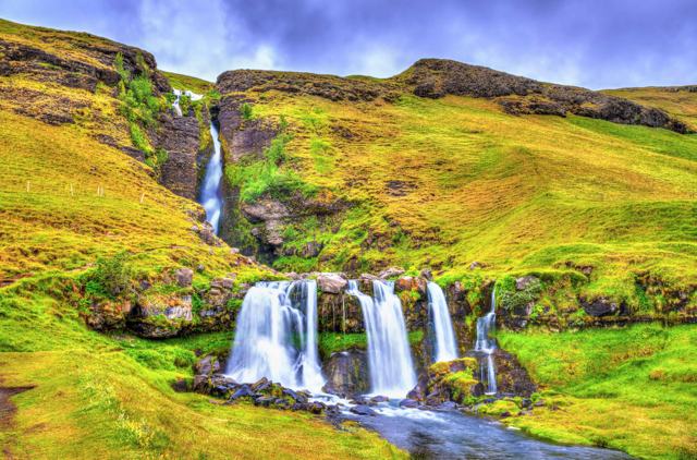 South Iceland · WaterfallGluggafossGluggafoss, also known as Merkjárfoss, is a waterfall on the river Merkjá in Fljótshlíð, South Iceland, with a total drop of about 52 metres.
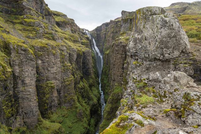 West Iceland · WaterfallGlymurGlymur is a 198-metre waterfall in Hvalfjörður, West Iceland, and one of Iceland's tallest.
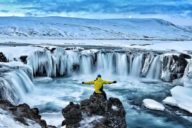 North Iceland · WaterfallGoðafossGoðafoss is a horseshoe-shaped waterfall on the Skjálfandafljót river in North Iceland, about 12 metres high and 30 metres wide, right besid.
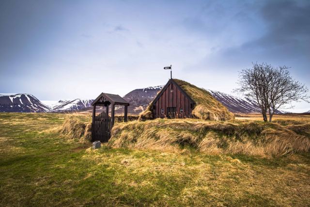 North Iceland · ChurchGrafarkirkjaGrafarkirkja is a small turf church on the Höfðaströnd coast in Skagafjörður, close to Hofsós in North Iceland.North Iceland · Hot springGrettislaugGrettislaug is a pair of small geothermal pools at Reykir on Reykjaströnd, on the west shore of Skagafjörður in North Iceland, about 25–30 k.
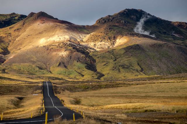 Reykjanes · TownGrindavíkGrindavík is a fishing town on the Reykjanes peninsula, close to the Blue Lagoon and about 50 km (around 45 minutes) from Reykjavík.
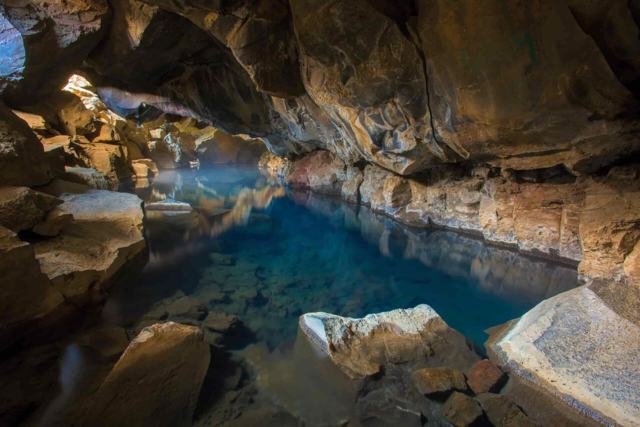 North Iceland · Lava caveGrjótagjáGrjótagjá is a small lava cave near Lake Mývatn in North Iceland, with a geothermal hot spring inside that glows a striking blue.
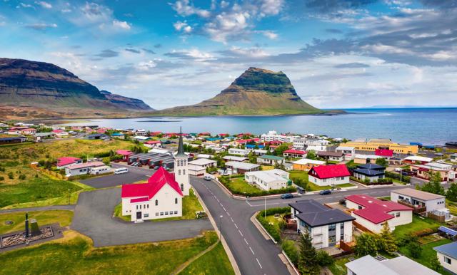 Snæfellsnes · VillageGrundarfjörðurGrundarfjörður is a fishing village of about 900 people on the north coast of the Snæfellsnes peninsula in West Iceland, best known as the b.
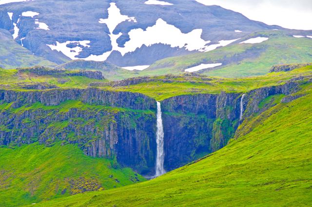 Snæfellsnes · WaterfallGrundarfossGrundarfoss is a waterfall of about 70 metres on the Grundará river, just east of Grundarfjörður on the Snæfellsnes peninsula.
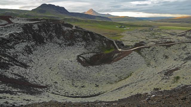 West Iceland · CraterGrábrókGrábrók is a crater beside the Ring Road (Route 1) near Bifröst in West Iceland, about 100–110 km north of Reykjavík.
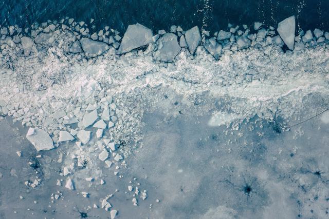 Southeast Iceland · LakeGrænalónGrænalón (“Green Lagoon”) is a glacial lake beside the north-western edge of the Skeiðarárjökull glacier, part of Vatnajökull.North Iceland · IslandGrímseyGrímsey is a small island about 40 km off the north coast of Iceland and the only part of Iceland that lies on the Arctic Circle.Highlands · Hot springGrímsfjall hot springGrímsfjall is a mountain on the western part of Vatnajökull glacier, at about 1,725 metres above sea level, where geothermal heat from the G.Reykjavík · Nature reserveGróttaGrótta is a small nature reserve with a white lighthouse at the western tip of the Seltjarnarnes peninsula, on the edge of Reykjavík.
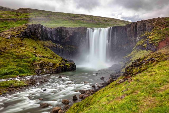 East Iceland · WaterfallGufufossGufufoss is a waterfall on Route 93, the road between Egilsstaðir and Seyðisfjörður in East Iceland.
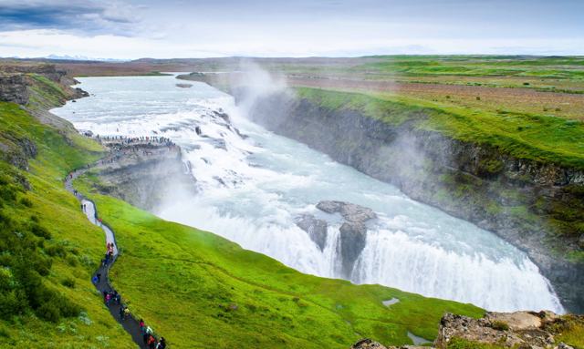 Golden Circle · WaterfallGullfossGullfoss is a 32-metre, two-step waterfall on the Hvítá river in South Iceland and one of the three main stops on the Golden Circle, togethe.
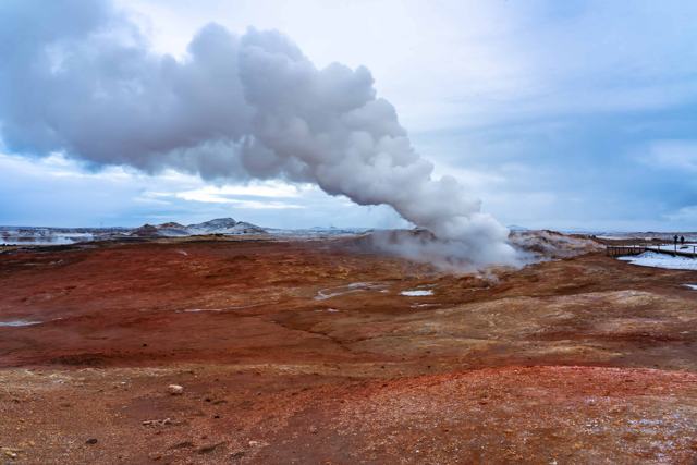 Reykjanes · Geothermal areaGunnuhverGunnuhver is a geothermal area on the southwestern tip of the Reykjanes peninsula, with boiling mud pools, steam vents and a boardwalk viewi.
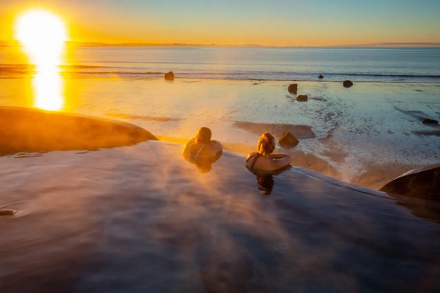 West Iceland · Hot springGuðlaugGuðlaug is a small, three-tier geothermal bathing spot on Langisandur beach in Akranes, about 50 km from Reykjavík (around 40–45 minutes by .
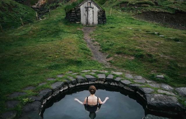 West Iceland · Hot springGuðrúnarlaugGuðrúnarlaug hot spring is a small, round, stone-lined pool at Laugar in Sælingsdalur, about 20 km north of Búðardalur in West Iceland.
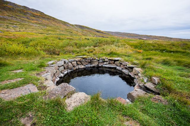 Westfjords · Hot springGvendarlaugGvendarlaug is a historic hot spring in Bjarnarfjörður on the Strandir coast of the Westfjords, about 26 km from Hólmavík.
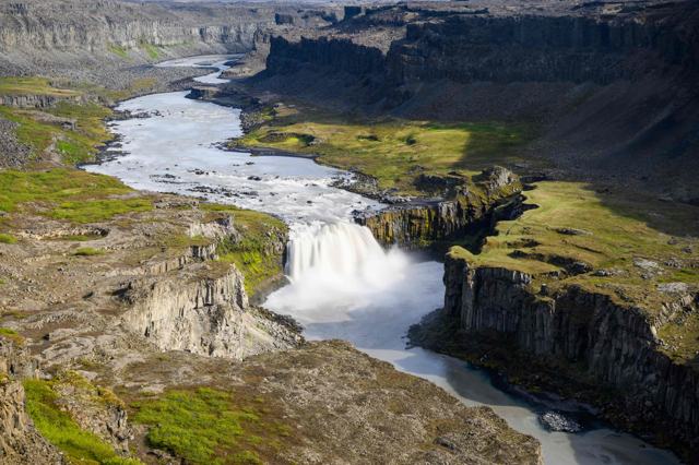 North Iceland · WaterfallHafragilsfossHafragilsfoss is a 27-metre waterfall on the glacial river Jökulsá á Fjöllum, about 2.5 km downstream from Dettifoss in the Jökulsárgljúfur .
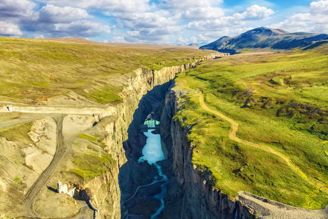 East Iceland · CanyonHafrahvammagljúfurHafrahvammagljúfur, also known as Dimmugljúfur ("the dark canyon"), is a gorge about 200 metres deep and 8 km long, cut by the glacial river.
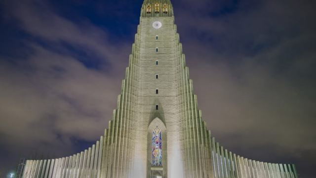 Reykjavík · ChurchHallgrímskirkjaHallgrímskirkja is a 74.5-metre Lutheran church in the centre of Reykjavík, built to resemble Iceland's basalt columns and glaciers.
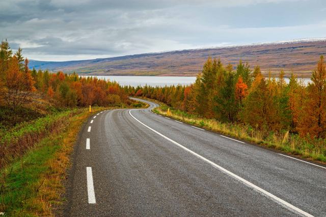 East Iceland · ForestHallormsstaðaskógurHallormsstaðaskógur is the largest forest in Iceland, about 25 km from Egilsstaðir on the shore of Lagarfljót lake in East Iceland.
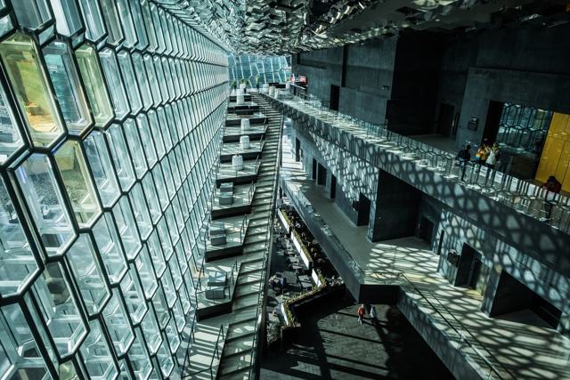 Reykjavík · LandmarkHarpaHarpa is Reykjavík's concert hall and conference centre, right on the harbour front in the city centre.
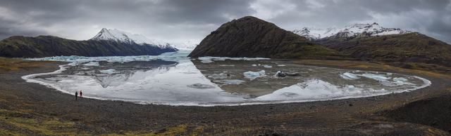 Southeast Iceland · Glacier lagoonHeinabergslónHeinabergslón is a glacier lagoon fed by the Heinabergsjökull outlet glacier, part of Vatnajökull, in Southeast Iceland.
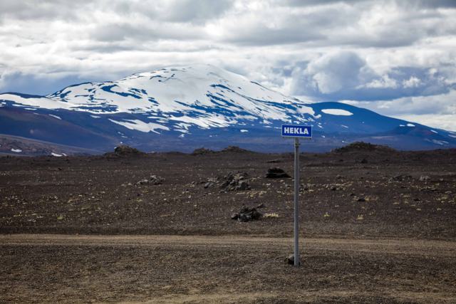 South Iceland · VolcanoHeklaHekla is a 1,491-metre volcano in South Iceland, one of the country's most active and historically feared, once nicknamed the "Gateway to He.
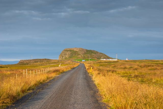 Snæfellsnes · MountainHelgafellHelgafell is a low basalt hill, 73 metres high, just south of Stykkishólmur on the Snæfellsnes peninsula, around 165 km (about 2 hours 10 mi.
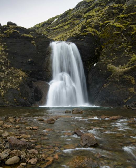 Reykjavík · WaterfallHelgufossHelgufoss is a waterfall of about 12 m on the Kaldakvísl river in Mosfellsdalur, the valley behind Mosfellsbær, about 20 km and 30 minutes b.
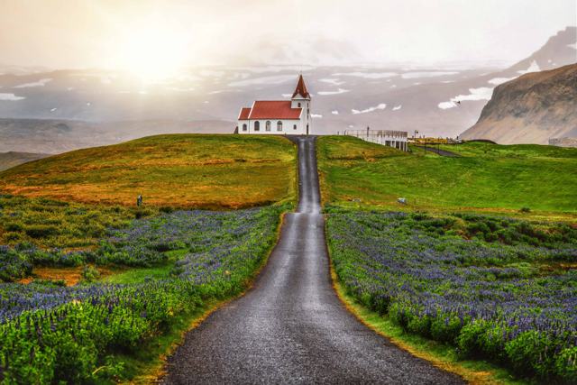 Snæfellsnes · VillageHellissandurHellissandur is a small fishing village at the western end of the Snæfellsnes peninsula, known as the street art capital of Iceland for its .
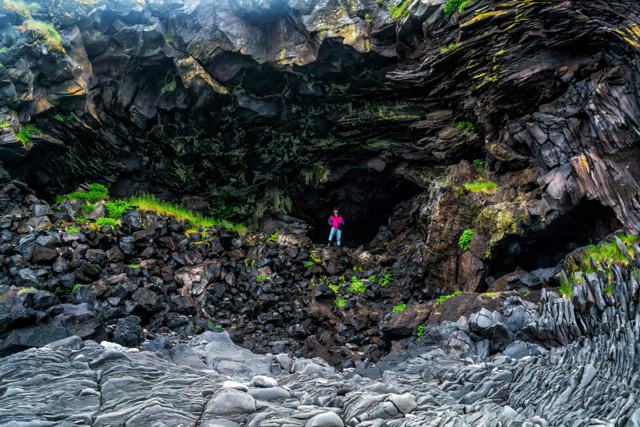 Snæfellsnes · VillageHellnarHellnar is a small former fishing village on the south coast of the Snæfellsnes peninsula, about 193 km (around 2.5 hours) from Reykjavík an.
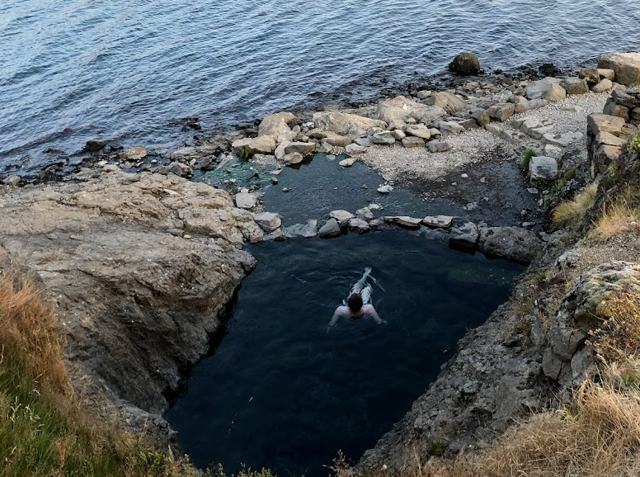 Westfjords · Hot springHellulaugHellulaug is a small natural hot spring right by the sea in Vatnsfjörður in the southern Westfjords, a few metres from a roadside car park n.
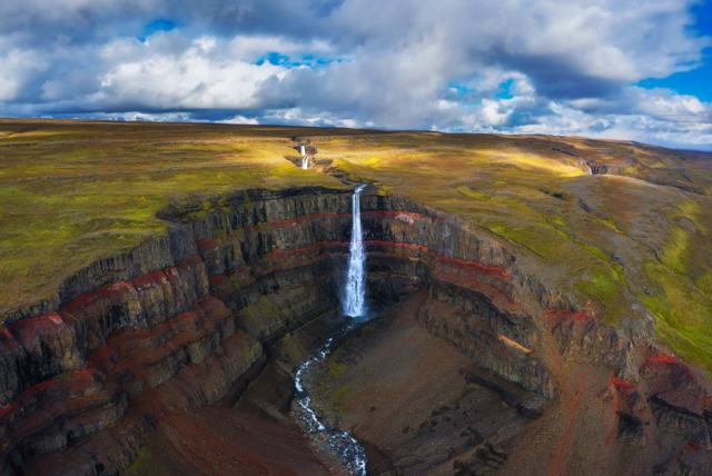 East Iceland · WaterfallHengifossHengifoss is a 128-metre waterfall above Lagarfljót lake in East Iceland, about 35 km (roughly 30 minutes) from Egilsstaðir.
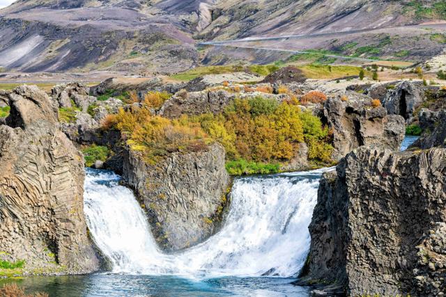 South Iceland · WaterfallHjálparfossHjálparfoss is a twin waterfall in the Þjórsárdalur valley in South Iceland, where the Fossá river splits into two falls just before joining.
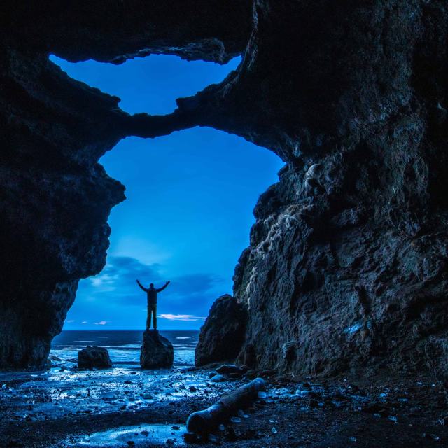 South Iceland · LandmarkHjörleifshöfði and the Yoda CaveHjörleifshöfði is a 221-metre promontory on the South Coast, about 14 km east of Vík, that was once an island and is now surrounded by black.
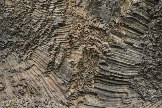 North Iceland · LandmarkHljóðaklettarHljóðaklettar, meaning "Echo Rocks", is a group of twisted basalt formations in Vesturdalur in the Jökulsárgljúfur canyon, part of Vatnajöku.
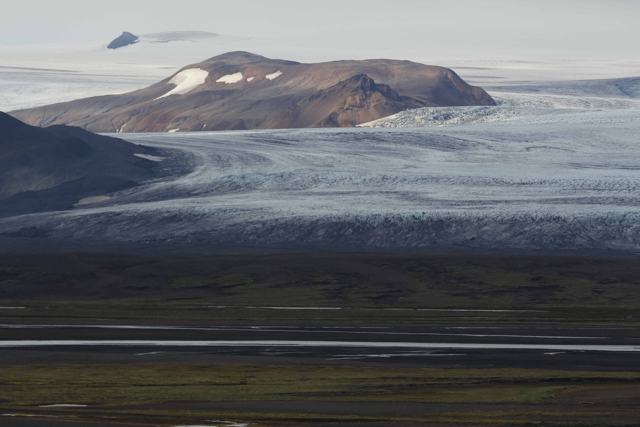 Highlands · GlacierHofsjökullHofsjökull is Iceland's third-largest glacier, an ice cap covering about 830 km² in the Central Highlands, with an active volcano and calder.
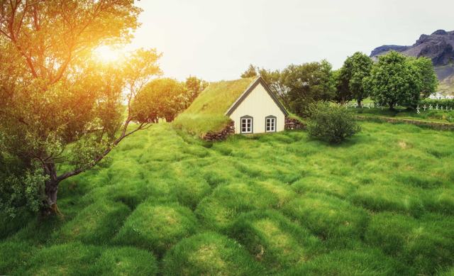 Southeast Iceland · ChurchHofskirkjaHofskirkja is a small turf church at Hof in the Öræfi district of Southeast Iceland, built in 1883–84 and often called the last turf church .
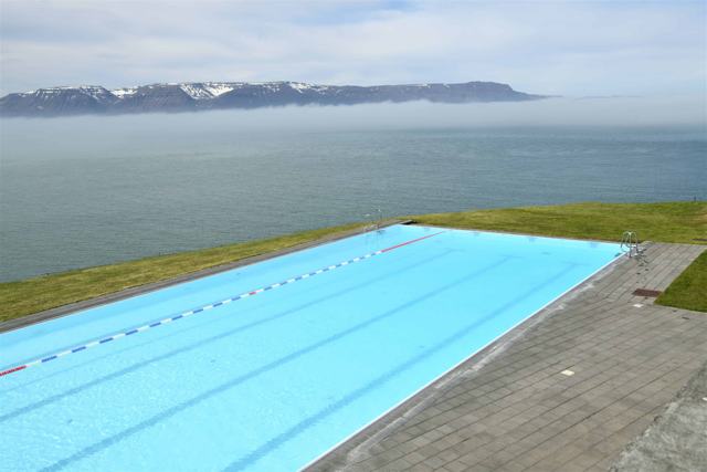 North Iceland · Swimming poolHofsós swimming poolHofsós swimming pool is a 25 m outdoor geothermal pool in the village of Hofsós, overlooking Skagafjörður fjord and Drangey island in North .Westfjords · Nature reserveHornstrandirHornstrandir is a roadless nature reserve covering about 580 km² at the northern tip of the Westfjords, reached only by boat from Ísafjörður.
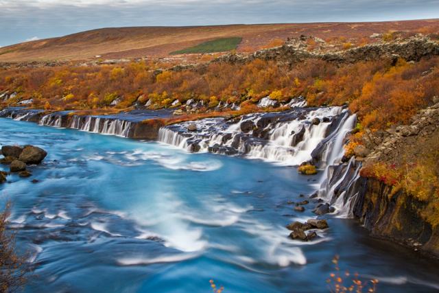 West Iceland · WaterfallHraunfossarHraunfossar ("lava falls") is a series of small waterfalls in Borgarfjörður, West Iceland, formed by water seeping out from beneath the Hall.
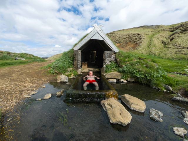 Golden Circle · Hot springHrunalaugHrunalaug is a small geothermal bathing place with three stone-lined pools on private farmland near Flúðir, about 100 km (roughly 1 hour 30 .
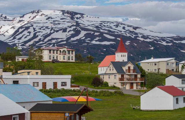 North Iceland · IslandHríseyHrísey is a small island in Eyjafjörður fjord in North Iceland, reached by a short ferry from Árskógssandur, north of Akureyri.
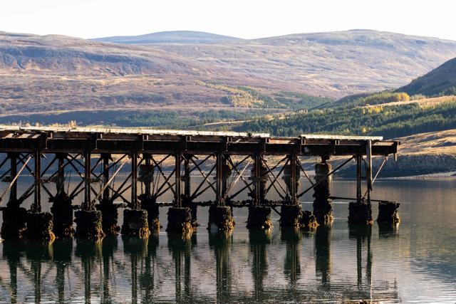 West Iceland · LandmarkHvalfjörðurHvalfjörður ("Whale Fjord") is a roughly 30-kilometre fjord in West Iceland, just north of Reykjavík, mostly bypassed today by the Hvalfjörð.
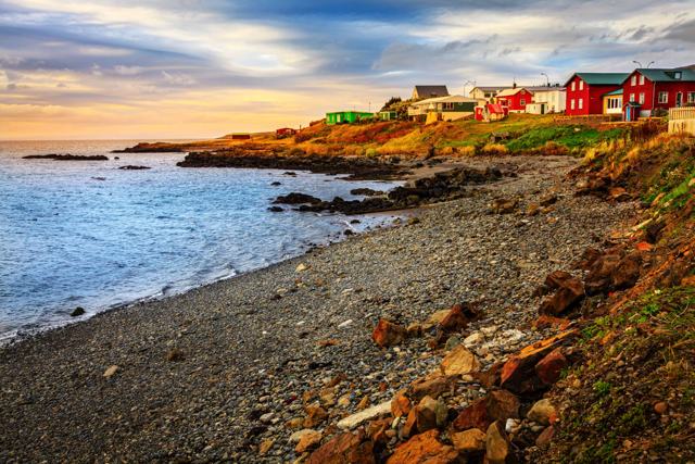 North Iceland · VillageHvammstangiHvammstangi is a small fishing village of about 600 people on Miðfjörður in North Iceland, about 6 km off the Ring Road and around 176 km fr.
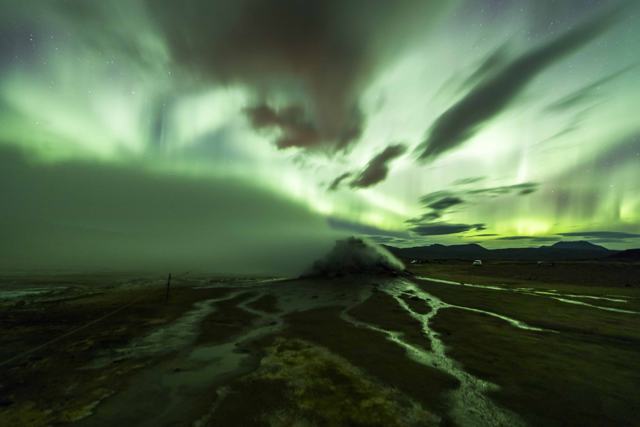 Highlands · Geothermal areaHveravellirHveravellir is a geothermal area in the central Highlands, on the Kjölur route (F35) between the glaciers Langjökull and Hofsjökull.
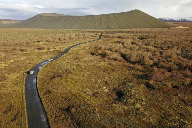 North Iceland · CraterHverfjallHverfjall is a tephra crater about 1 km across on the east side of Lake Mývatn in North Iceland, formed in an eruption about 2,500 years ago.
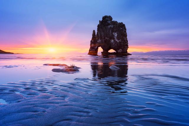 North Iceland · LandmarkHvítserkurHvítserkur is a 15-metre basalt sea stack standing just off the coast of the Vatnsnes peninsula in North Iceland, with two holes at its base.West Iceland · WaterfallHvítserkur waterfallHvítserkur waterfall is a little-known falls on the Fitjaá river, in the gully Hvítserksgljúfur above Skorradalur in West Iceland.
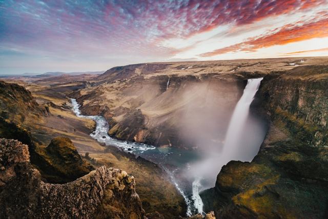 South Iceland · WaterfallHáifossHáifoss is one of Iceland's tallest waterfalls, dropping about 122 metres into a canyon in Þjórsárdalur valley, near its twin Granni.South Iceland · CaveHálsanefshellirHálsanefshellir is a shallow sea cave with basalt columns at the eastern end of Reynisfjara black sand beach, near Vík, about 180 km (2.5 ho.
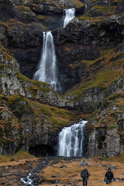 East Iceland · WaterfallHænubrekkufossHænubrekkufoss is a three-step waterfall of about 53 m on the Berufjarðará river in East Iceland.
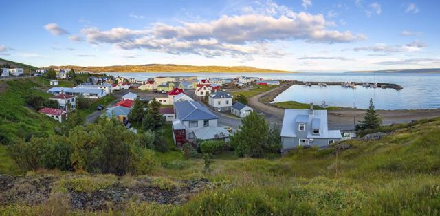 Westfjords · TownHólmavíkHólmavík is a small fishing town on the east side of the Westfjords, at the start of the Strandir coast road.
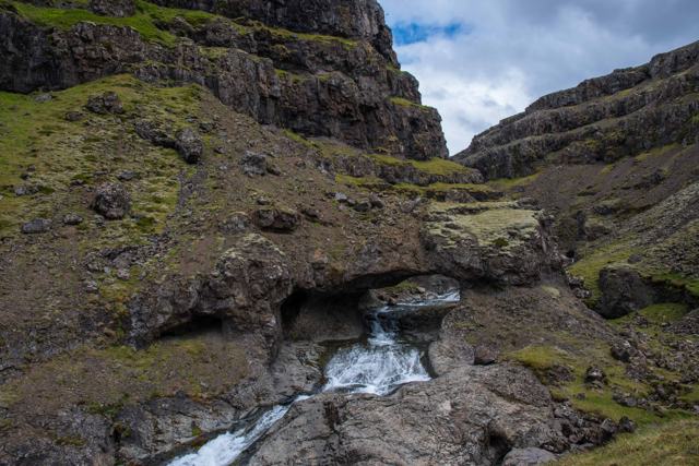 Southeast Iceland · TownHöfn í HornafirðiHöfn í Hornafirði is a fishing town on a small peninsula in Southeast Iceland, known across the country for langoustine (locally called lobs.
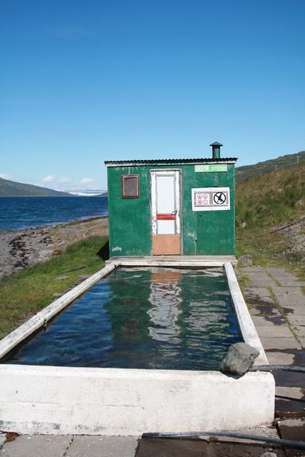 Westfjords · Hot springHörgshlíðarlaugHörgshlíðarlaug is a little-known hot spring in the Westfjords: a small concrete pool right on the shore of Mjóifjörður, beside Route 633 of.West Iceland · VillageHúsafellHúsafell is a highland resort area in West Iceland, on the edge of the Borgarfjörður highlands, about 130 km (around 1.5–2 hours) from Reykj.
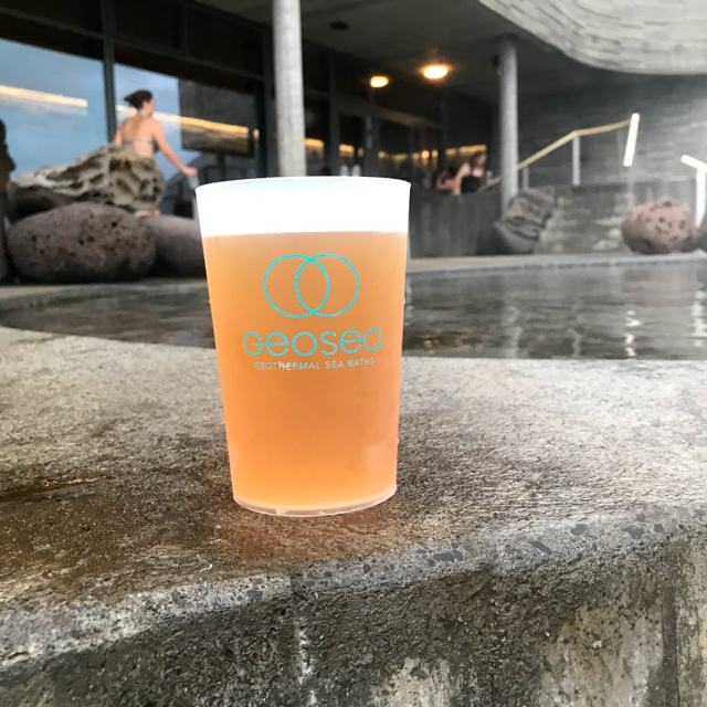 North Iceland · TownHúsavíkHúsavík is a fishing town of around 2,400 people on Skjálfandi Bay in North Iceland, about 480 km (around 5.5 hours) from Reykjavík.
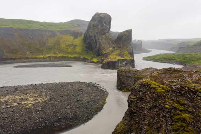 North Iceland · CanyonJökulsárgljúfurJökulsárgljúfur is a canyon about 25 km long and over 100 m deep, cut by the Jökulsá á Fjöllum river and glacial floods in North Iceland.
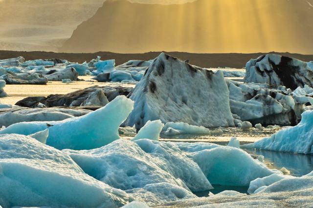 Southeast Iceland · Glacier lagoonJökulsárlónJökulsárlón is a glacier lagoon in Southeast Iceland, filled with icebergs that calve from the Breiðamerkurjökull outlet glacier and drift o.
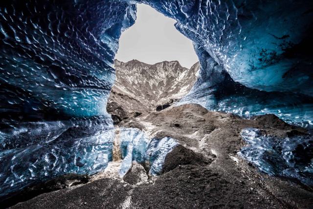 South Iceland · VolcanoKatlaKatla is a large, mostly ice-covered volcano beneath the Mýrdalsjökull glacier in South Iceland, near the village of Vík í Mýrdal.Reykjanes · TownKeflavíkKeflavík is a coastal town on the Reykjanes peninsula, right next to Keflavík International Airport, Iceland's main airport.
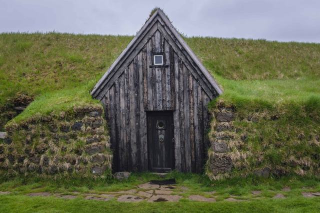 South Iceland · Turf housesKeldurKeldur is a farm of old turf buildings in South Iceland, near the volcano Hekla and about 20 minutes from Hella.
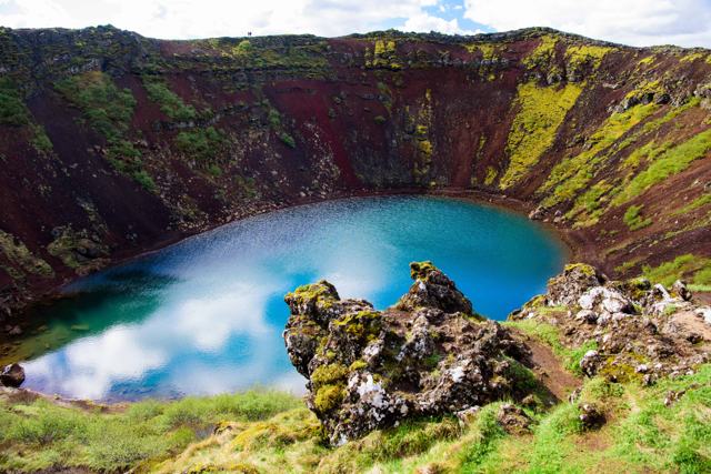 Golden Circle · CraterKeriðKerið is a volcanic crater about 6,500 years old, roughly 170 metres wide and 55 metres deep, with a blue-green lake at the bottom and reddi.
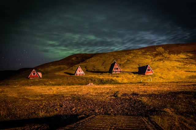 Highlands · Geothermal areaKerlingarfjöllKerlingarfjöll is a rhyolite mountain range in the central Highlands, home to the colourful Hveradalir geothermal area of steaming vents and.Reykjavík · WaterfallKermóafossKermóafoss is a small waterfall on the Elliðaá river, tucked inside Elliðaárdalur valley in the middle of Reykjavík.
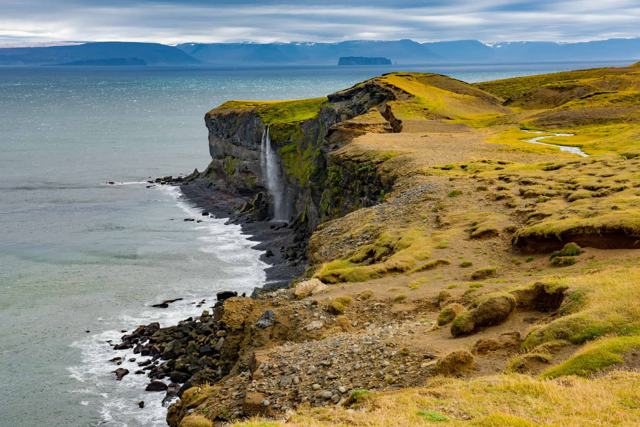 North Iceland · CliffsKetubjörgKetubjörg is a 122 m sea cliff on the Skagi peninsula in North Iceland, reached by the gravel Route 745 and a short walk.
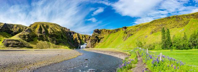 South Iceland · VillageKirkjubæjarklausturKirkjubæjarklaustur, often shortened to Klaustur, is a small village on the Ring Road in South Iceland, between the black sand beach at Vík .
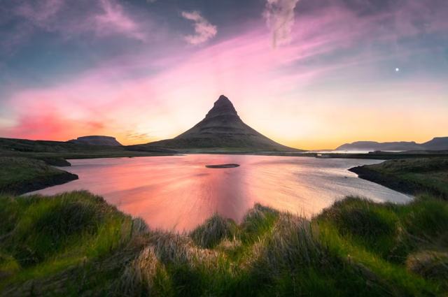 Snæfellsnes · MountainKirkjufellKirkjufell ("Church Mountain") is a 463-metre, cone-shaped mountain on the north coast of the Snæfellsnes Peninsula, right next to the small.
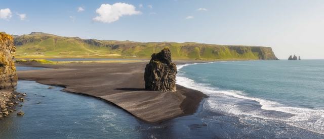 South Iceland · BeachKirkjufjaraKirkjufjara is a black sand beach at the foot of Dyrhólaey on the South Coast, across the lagoon outlet from the better-known Reynisfjara an.
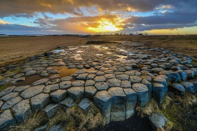 South Iceland · LandmarkKirkjugólfKirkjugólf (“the church floor”) is a small pavement of hexagonal basalt columns, about 80 square metres in size, just outside the village of.
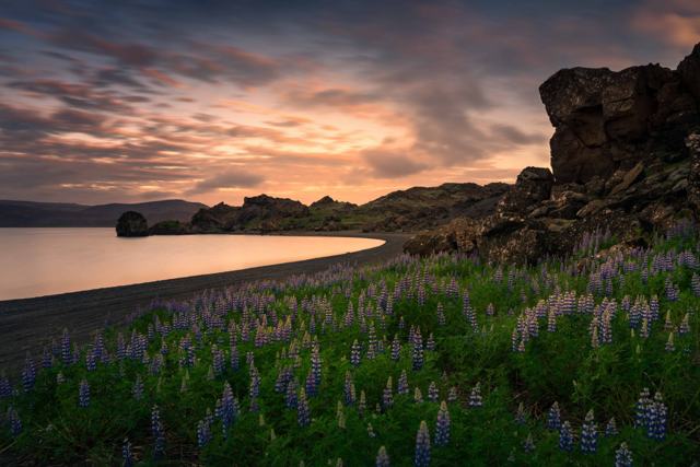 Reykjanes · LakeKleifarvatnKleifarvatn is the largest lake on the Reykjanes Peninsula, sitting in a stark volcanic landscape close to the Krýsuvík geothermal area.
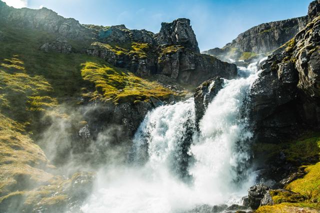 East Iceland · WaterfallKlifbrekkufossarKlifbrekkufossar is a spring-fed waterfall in about seven steps, roughly 90 metres in total height, on the road down into the remote fjord o.
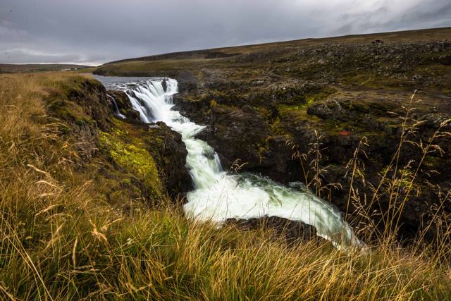 North Iceland · CanyonKolugljúfurKolugljúfur is a narrow canyon on the salmon river Víðidalsá in Víðidalur, North Iceland, with a run of waterfalls known as Kolufossar.
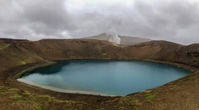 North Iceland · VolcanoKraflaKrafla is an active volcanic area in North Iceland, near Lake Mývatn, best known for the explosion crater Víti and the steaming Leirhnjúkur .West Iceland · Hot springKraumaKrauma is a geothermal spa at Deildartunguhver, Europe's most powerful hot spring, in West Iceland.
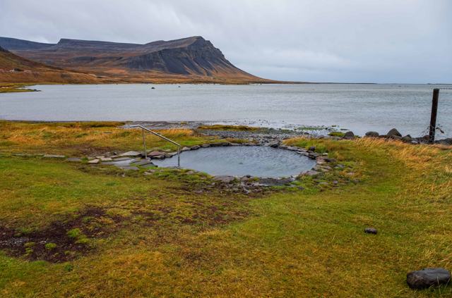 Westfjords · Hot springKrosslaugKrosslaug is a small geothermal pool site at Laugarnes on Barðaströnd, on the south coast of the Westfjords, beside Route 62 and Breiðafjörð.
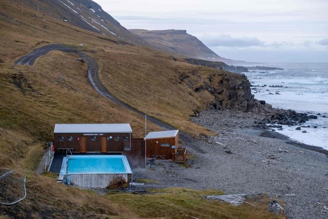 Westfjords · Swimming poolKrossneslaugKrossneslaug is a geothermal outdoor pool and hot tub right on the shore at Krossnes, at the far end of the Strandir coast in the Westfjords.
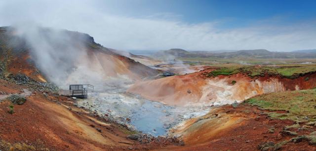 Reykjanes · Geothermal areaKrýsuvíkKrýsuvík, centred on the Seltún geothermal field, is a small but colourful area of hot springs, mud pools and steam vents on the Reykjanes P.
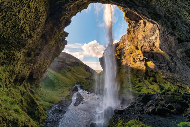 South Iceland · WaterfallKvernufossKvernufoss is a waterfall of 30–40 metres on the Kverná river, a short walk from the Skógar Museum car park in South Iceland.
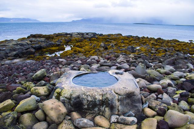 Reykjavík · Hot springKvika Foot BathKvika is a small geothermal foot bath carved into a rock on the shore of Seltjarnarnes, at the western edge of the Reykjavík area, close to .
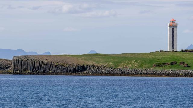 North Iceland · CliffsKálfshamarsvíkKálfshamarsvík is a small cove on the northern coast of the Skagi peninsula in North Iceland, known for its basalt columns, a white lighthou.
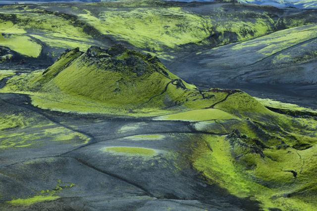 Highlands · CraterLakagígarLakagígar (the Laki craters) is a long row of more than 130 volcanic craters formed in the 1783–1784 Skaftáreldar eruption, one of the most .Reykjanes · CanyonLambafellsgjáLambafellsgjá is a narrow fissure, about 50 metres deep, cutting through the small Lambafell hill on the Reykjanes Peninsula.
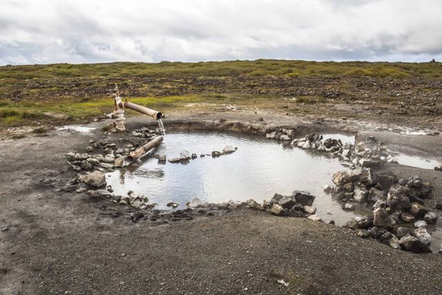 Snæfellsnes · Hot springLandbrotalaugLandbrotalaug is a small, natural geothermal hot spring on the eastern Snæfellsnes Peninsula in West Iceland, about 115–120 km (around 1 hou.
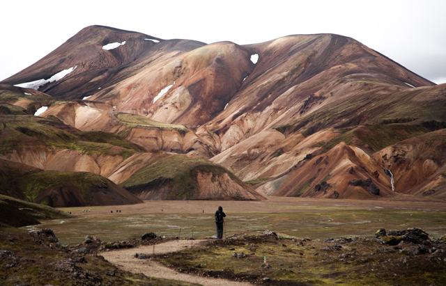 Highlands · Geothermal areaLandmannalaugarLandmannalaugar is a highland area in the Fjallabak Nature Reserve known for its colourful rhyolite mountains, lava fields and a natural hot.
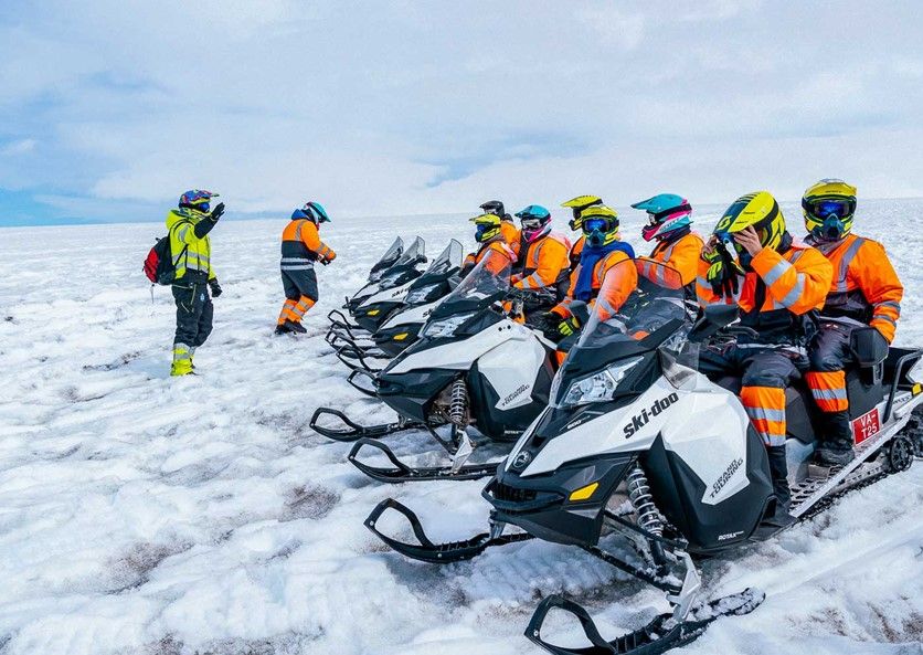 West Iceland · GlacierLangjökullLangjökull, meaning "long glacier", is Iceland's second-largest ice cap at roughly 870–950 km², sitting in the western highlands about 140 k.
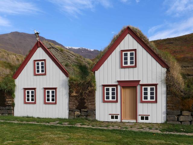 North Iceland · Turf housesLaufásThe Laufás turf houses are a large 19th-century turf farmstead and church on the east shore of Eyjafjörður in North Iceland, about 30 km fro.West Iceland · Hot springLaugaland hot springLaugaland hot spring is a small, little-known natural hot pool by Þorskafjörður, on the Reykjanes peninsula north-west of Reykhólar, where W.
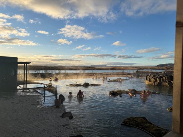 Golden Circle · LagoonLaugarás LagoonLaugarás Lagoon is a geothermal spa beside the Hvítá river in Laugarás, on the Golden Circle route in South Iceland.
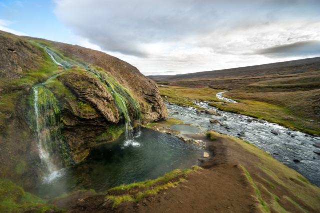 Highlands · Hot springLaugavallalaugLaugavallalaug is a natural, unmanaged hot spring in Laugavalladalur valley, in the highlands of East Iceland north of the Kárahnjúkar dam.Reykjavík · LandmarkLaugavegurLaugavegur is the main shopping street in downtown Reykjavík and one of the oldest streets in the city.
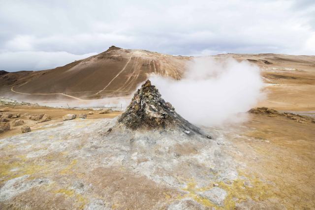 North Iceland · Lava fieldLeirhnjúkurLeirhnjúkur (often written Leirhnjukur) is a steaming lava and geothermal area in the Krafla volcanic system near Mývatn, a short drive from.
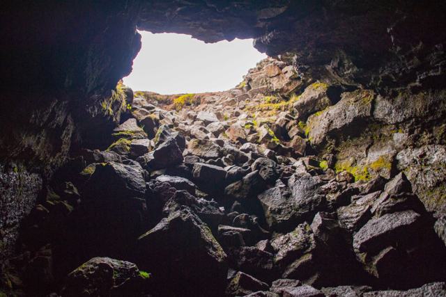 Reykjanes · Lava caveLeiðarendiLeiðarendi is a lava tube of about 900 m near Bláfjöll, roughly 25–40 minutes by car from Reykjavík, reached from Route 417.
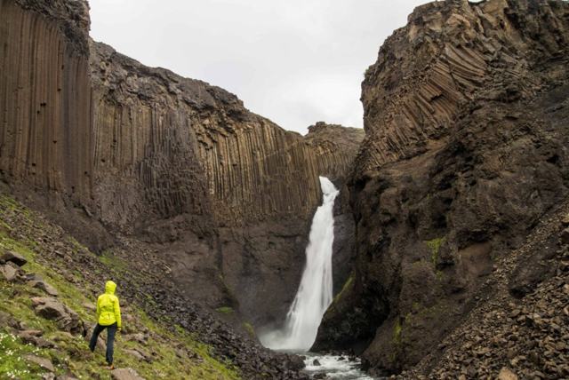 East Iceland · WaterfallLitlanesfossLitlanesfoss is a roughly 30-metre waterfall in a bowl of tall, straight basalt columns, on the hiking trail up to Hengifoss in East Iceland.
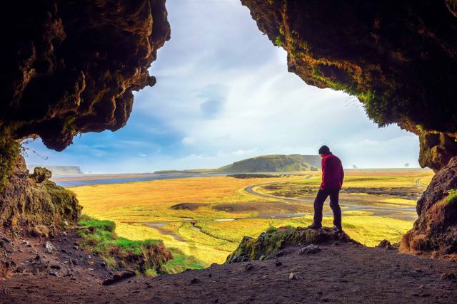 South Iceland · LandmarkLoftsalahellirLoftsalahellir is a small cave on the south-west side of Geitafjall, about 2.5 km up Road 218 from the Ring Road, on the way to Dyrhólaey ne.
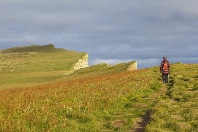 Westfjords · CliffsLátrabjargLátrabjarg is a 14 km line of sea cliffs at the westernmost point of Iceland, rising to over 440 metres at its highest.
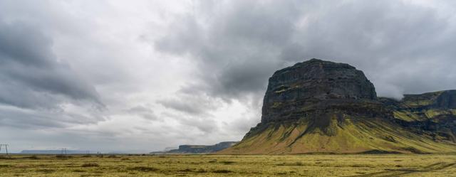 Southeast Iceland · MountainLómagnúpurLómagnúpur is a 764 m mountain with a sheer cliff face about 670 m high, rising out of the black sands of Skeiðarársandur near Núpsstaður in.
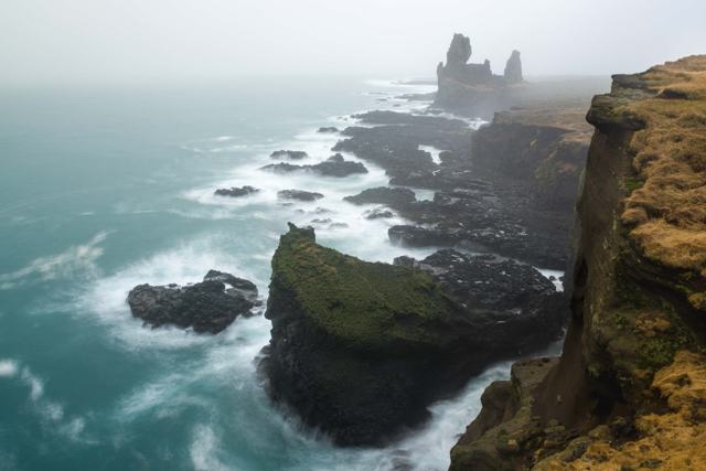 Snæfellsnes · CliffsLóndrangarLóndrangar is a pair of basalt sea stacks on the south coast of the Snæfellsnes Peninsula, inside Snæfellsjökull National Park in West Icela.
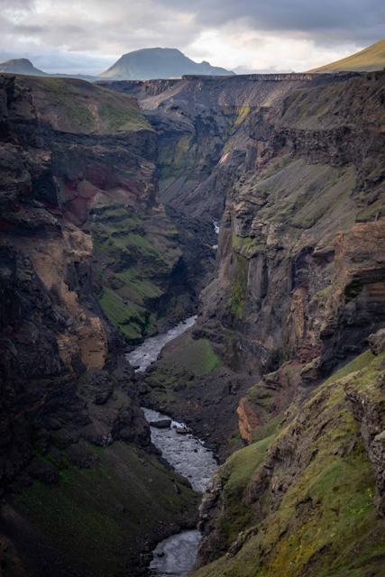 Highlands · CanyonMarkarfljótsgljúfurMarkarfljótsgljúfur is a deep river canyon in the southern Highlands, about 200 metres deep and around 4 km long, cut by a glacial flood fro.Golden Circle · Hot springMarteinslaugMarteinslaug is a small natural hot spring beside a stream in Haukadalsskógur forest, about 2 km north of the Geysir geothermal area on the .Reykjavík · Lava caveMaríuhellarMaríuhellar is a group of three lava caves in the Heiðmörk area, about 12 km south of central Reykjavík.
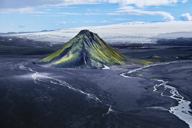 Highlands · MountainMælifellMælifell is a 799-metre, cone-shaped volcano covered in green moss, rising about 200 m above the black sand plain of Mælifellssandur in the .
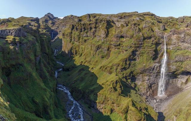 Southeast Iceland · CanyonMúlagljúfurMúlagljúfur is a canyon in Southeast Iceland, about 12 km west of Jökulsárlón glacier lagoon, with two waterfalls, Hangandifoss and Múlafoss.
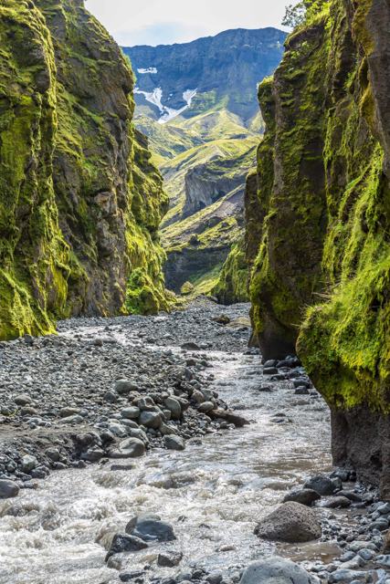 South Iceland · GlacierMýrdalsjökullMýrdalsjökull is Iceland's fourth largest ice cap, covering nearly 600 km² of South Iceland and hiding the active Katla volcano underneath.
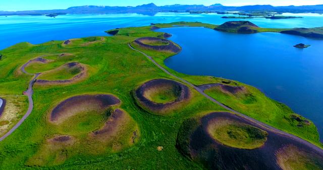 North Iceland · LakeMývatnLake Mývatn is a shallow, volcanically formed lake in North Iceland, about 480 km (6–7 hours) from Reykjavík but only around 100 km (1.5 hou.Westfjords · Hot springNauteyrarlaugNauteyrarlaug is a small natural hot spring beside Route 635 at Nauteyri in Ísafjarðardjúp, Westfjords.
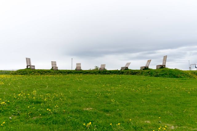 Reykjavík · LagoonNauthólsvíkNauthólsvík is a small, man-made beach in Reykjavík with imported golden sand, a seawater lagoon warmed with geothermal run-off water, and h.
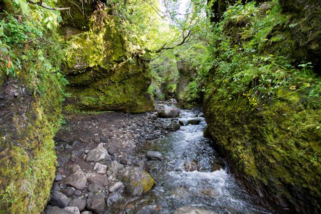 South Iceland · CanyonNauthúsagilNauthúsagil is a narrow ravine at the foot of Eyjafjallajökull in South Iceland, beside the farm Stóra-Mörk on Road 249, the road towards Þó.
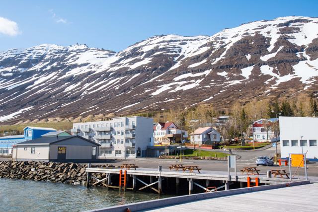 East Iceland · TownNeskaupstaðurNeskaupstaður is a fishing town of around 1,500 people on the Norðfjörður fjord in East Iceland, at the end of the road through the Norðfjar.
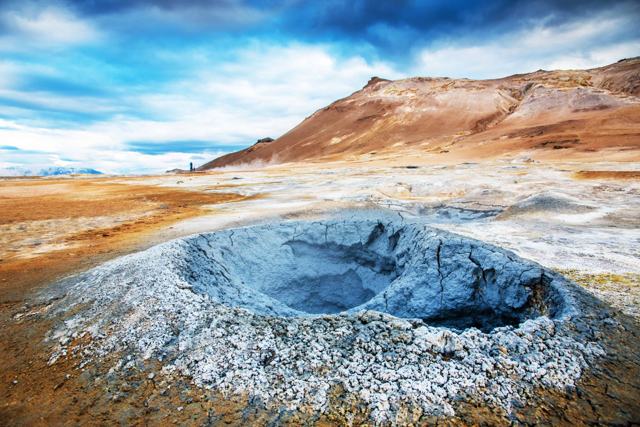 North Iceland · Geothermal areaNámafjallNámafjall, often called Hverir, is a geothermal area of bubbling mud pools, hissing steam vents and orange-red earth beside a low mountain n.North Iceland · Geothermal areaNámaskarð and HveraröndNámaskarð and Hverarönd, often just called Hverir, is a geothermal area of boiling mud pools, steam vents and mineral-stained ground beside .
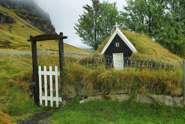 South Iceland · Turf housesNúpsstaðurNúpsstaður is a small turf church and old farm in Fljótshverfi, in the shadow of the mountain Lómagnúpur, just off the Ring Road between Kir.
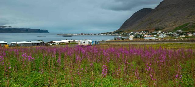 Westfjords · TownPatreksfjörðurPatreksfjörður is the largest town in the southern Westfjords, home to around 780 people, and the natural base for visiting Látrabjarg bird .
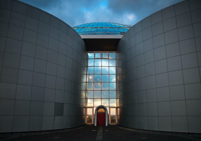 Reykjavík · MuseumPerlanPerlan is a glass-domed building on Öskjuhlíð hill above Reykjavík, built over the city's hot water storage tanks.
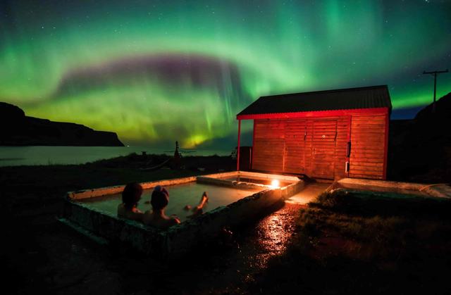 Westfjords · Hot springPollurinnPollurinn is a small hot spring with a few concrete pools in the hills above Tálknafjörður in the Westfjords.Reykjavík · LandmarkRainbow StreetRainbow Street is the everyday name for Skólavörðustígur, the rainbow-painted street that runs uphill from Laugavegur to Hallgrímskirkja chu.
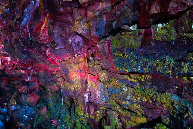 South Iceland · Lava caveRaufarhólshellirRaufarhólshellir is a 1,360-metre lava tube in South Iceland, the fourth-longest in the country, about 30 minutes' drive from Reykjavík.
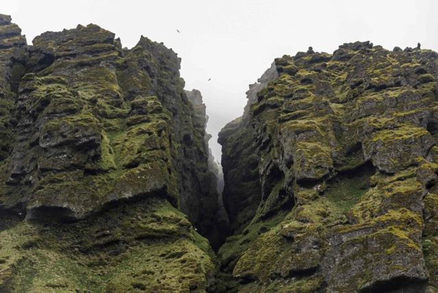 Snæfellsnes · CanyonRauðfeldsgjáRauðfeldsgjá is a narrow gorge, often called Rauðfeldsgjá canyon, cut into the side of Botnsfjall mountain near Arnarstapi on the Snæfellsne.
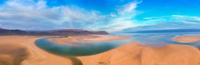 Westfjords · BeachRauðisandurRauðisandur is a roughly 10 km stretch of red and golden sand in the Westfjords, near the bird cliffs of Látrabjarg.South Iceland · WaterfallRauðárfossRauðárfoss is a waterfall of about 20 m on the Rauðá river, close to Kirkjubæjarklaustur on the South Coast of Iceland.
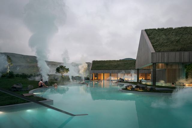 South Iceland · LagoonReykjaböð Hot SpringsReykjaböð Hot Springs is a new geothermal bathhouse at the start of the Reykjadalur valley, just above Hveragerði in South Iceland, about 35.
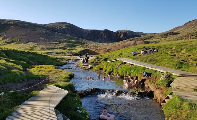 South Iceland · Hot springReykjadalurReykjadalur ("Steam Valley") is a geothermal river in the hills above Hveragerði where you can bathe in naturally warm water after a hike in.Westfjords · Hot springReykjafjarðarlaugReykjafjarðarlaug is a concrete geothermal pool with a small natural hot pool beside it, by the shore of Reykjafjörður, a small fjord off Ar.
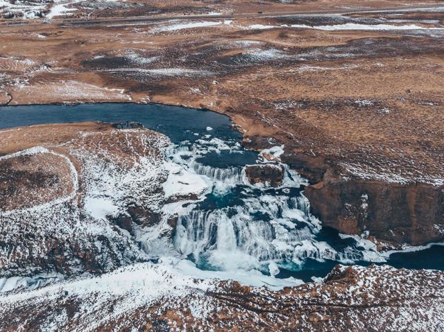 North Iceland · WaterfallReykjafossReykjafoss is a 20-metre waterfall on the Svartá river in Skagafjörður, North Iceland, about 7 km south of Varmahlíð.Reykjanes · ViewpointReykjanestáReykjanestá is the rocky southwestern tip of the Reykjanes Peninsula, marked by Iceland's oldest lighthouse and surrounded by sea cliffs, st.
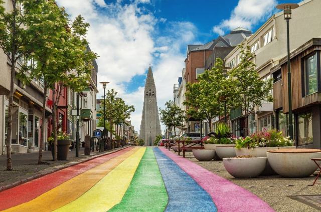 Reykjavík · TownReykjavíkReykjavík is Iceland's capital and by far its biggest city, with about 140,000 residents in the city and roughly 250,000 in the wider capita.Reykjavík · ZooReykjavík Family Park and ZooThe Reykjavík Family Park and Zoo (Húsdýragarðurinn) is a small zoo and playground in the Laugardalur valley, a few minutes from central Rey.
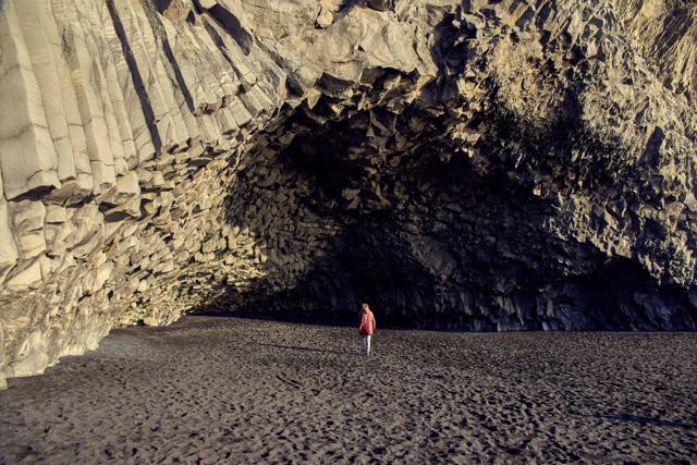 South Iceland · BeachReynisfjaraReynisfjara is a black sand beach on the south coast, about 7 km west of the village of Vík í Mýrdal and around 180 km (2 hours 30 minutes) .
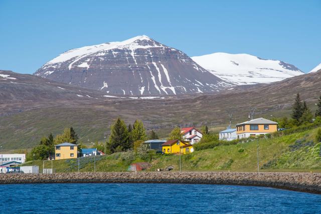 East Iceland · VillageReyðarfjörðurReyðarfjörður is a town of about 1,400 people at the head of the longest fjord on the east coast of Iceland.
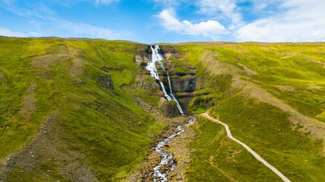 East Iceland · WaterfallRjúkandiRjúkandi is a two-step waterfall in the Jökuldalur valley in East Iceland, visible from Route 1 as you drive between Egilsstaðir and Mývatn.
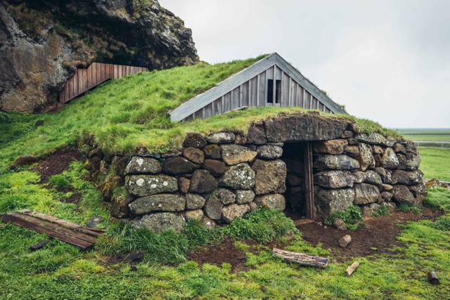 South Iceland · CaveRútshellirRútshellir is a cave cut by hand into the sandstone hillside at Hrútafell in South Iceland, close to the Ring Road west of Skógar.
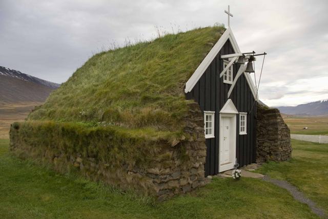 North Iceland · ChurchSaurbæjarkirkjaSaurbæjarkirkja is an original turf church built in 1858 in the Eyjafjörður valley, about 25 to 30 km south of Akureyri in North Iceland.
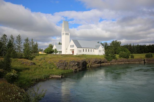 South Iceland · TownSelfossSelfoss is the largest town in South Iceland, on the banks of the Ölfusá river about 50 km (45–60 minutes) from Reykjavík, just off the Ring.North Iceland · WaterfallSelfossSelfoss is a wide, horseshoe-shaped waterfall about 10 metres high on the Jökulsá á Fjöllum river, a short walk upstream from the much large.
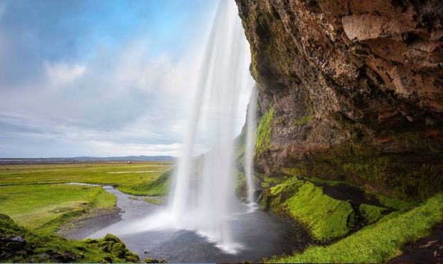 South Iceland · WaterfallSeljalandsfossSeljalandsfoss is a 60-metre waterfall on the Seljalandsá river in South Iceland, about 120 km (around 1 hour 40 minutes) from Reykjavík.
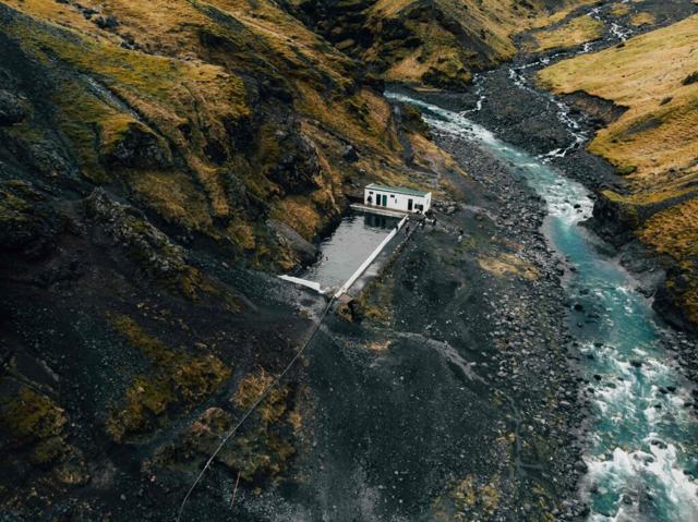 South Iceland · Swimming poolSeljavallalaugSeljavallalaug is a geothermally heated swimming pool built in 1923 into a hillside near Seljavellir, close to Skógar in South Iceland.
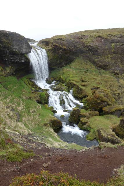 Snæfellsnes · WaterfallSelvallafossSelvallafoss, also called the Sheep's Waterfall, is a small, little-known waterfall on the stream Fossá, below the Vatnaleið rest area on Ro.
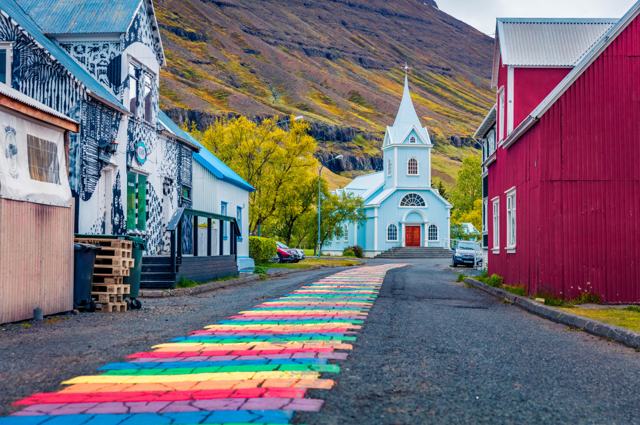 East Iceland · VillageSeyðisfjörðurSeyðisfjörður is a small town at the end of a long, steep-sided fjord in East Iceland, about 27 km (25–30 minutes) from Egilsstaðir over the.
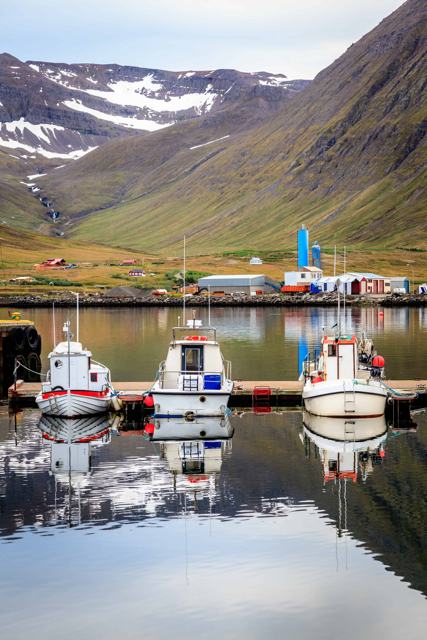 North Iceland · TownSiglufjörðurSiglufjörður is a small fishing town on the Tröllaskagi peninsula in North Iceland, and the northernmost town on the Icelandic mainland, wit.
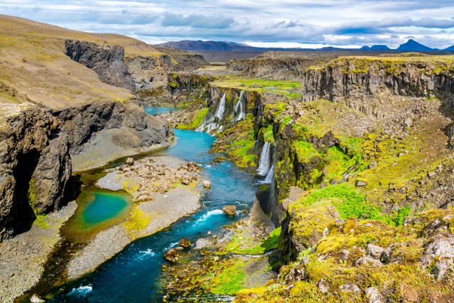 Highlands · CanyonSigöldugljúfurSigöldugljúfur canyon, known as the Valley of Tears, is a narrow, moss-lined canyon fed by dozens of small waterfalls near the Sigalda power.
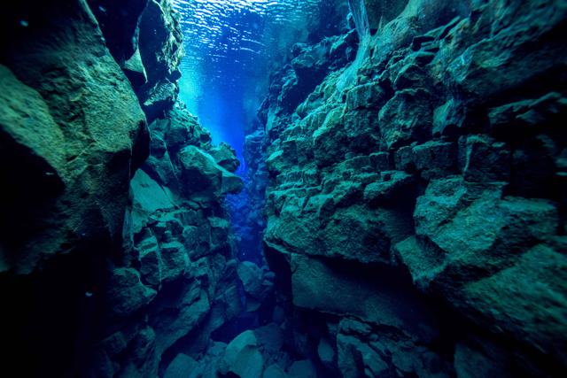 Golden Circle · LandmarkSilfraSilfra is a narrow, water-filled fissure in Þingvellir National Park on the Golden Circle, about 50 km (around 45 minutes) from Reykjavík.
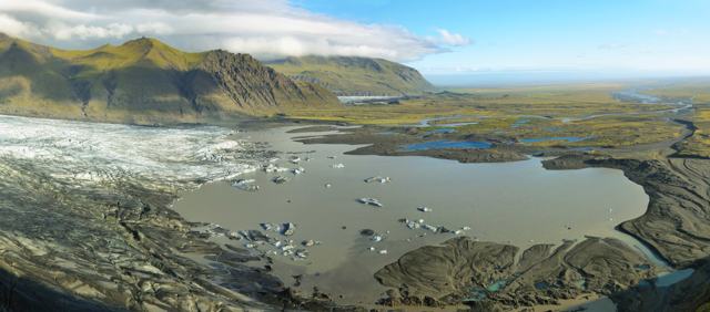 Southeast Iceland · ViewpointSjónarnípaSjónarnípa is a viewing point high above Skaftafellsjökull glacier in Skaftafell, part of Vatnajökull National Park in Southeast Iceland.
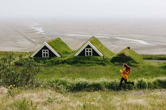 Southeast Iceland · Nature reserveSkaftafellSkaftafell is a hiking area within Vatnajökull National Park in Southeast Iceland, about 330 km (4–5 hours) from Reykjavík.
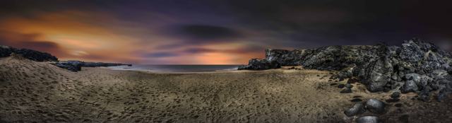 Snæfellsnes · BeachSkarðsvíkSkarðsvík is a small cove with pale golden sand on the far western tip of the Snæfellsnes peninsula, inside Snæfellsjökull National Park, a .
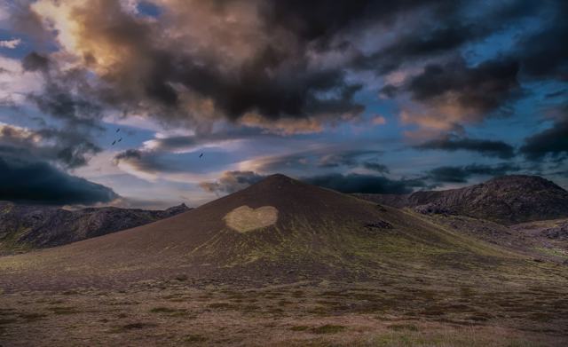 Reykjanes · Hot springSkátalaugSkátalaug is a small, quiet geothermal pool on the Reykjanes peninsula, 200–300 metres off Route 42, about midway between the south end of L.
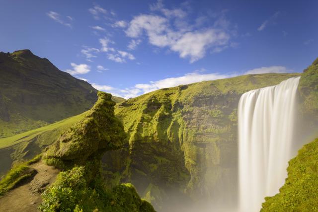 South Iceland · WaterfallSkógafossSkógafoss is a 60-metre waterfall on the Skógá river in South Iceland, right beside the village of Skógar, about 150 km (around 2 hours) fro.
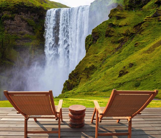 South Iceland · VillageSkógarSkógar is a small village of around 25 people on the South Coast Ring Road, best known as the site of Skógafoss waterfall and the Skógar fol.
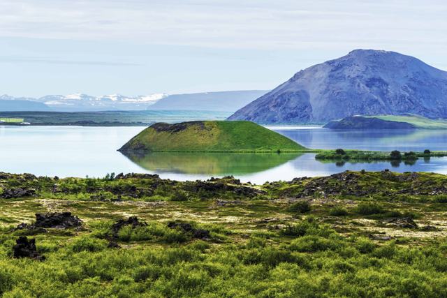 North Iceland · CraterSkútustaðagígarSkútustaðagígar is a group of pseudocraters on the south shore of Lake Mývatn in North Iceland, right beside the Ring Road near the village .
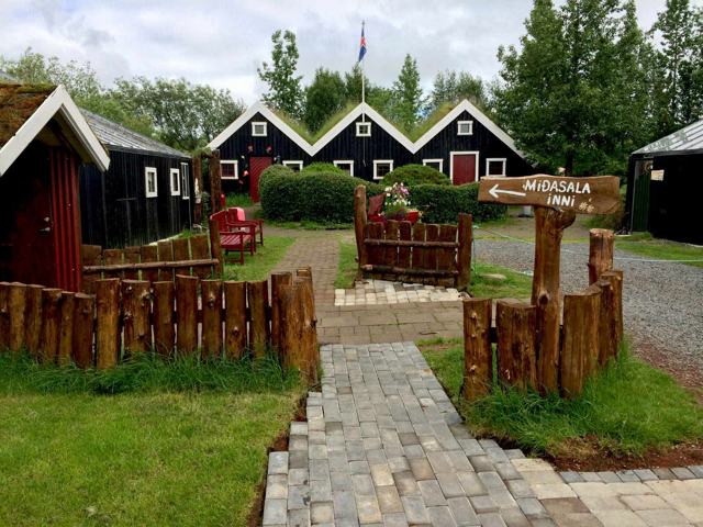 Golden Circle · ZooSlakki Petting ZooSlakki is a family-run petting zoo in Laugarás, on the southern side of the Golden Circle, about 95 km (around 1 hour 15 minutes) from Reykj.
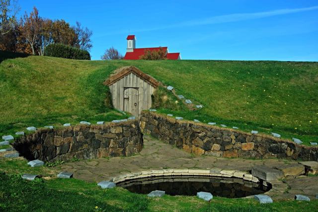 West Iceland · Hot springSnorralaugSnorralaug is a small, stone-lined geothermal pool in the village of Reykholt in Borgarfjörður, West Iceland, linked to the medieval writer .
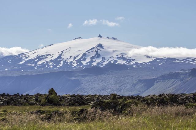 Snæfellsnes · GlacierSnæfellsjökullSnæfellsjökull is a 1,446-metre glacier-capped stratovolcano at the western tip of the Snæfellsnes peninsula, the centrepiece of Snæfellsjök.Snæfellsnes · National parkSnæfellsjökull National ParkSnæfellsjökull National Park covers about 170 square kilometres at the western tip of the Snæfellsnes peninsula in West Iceland, centred on .
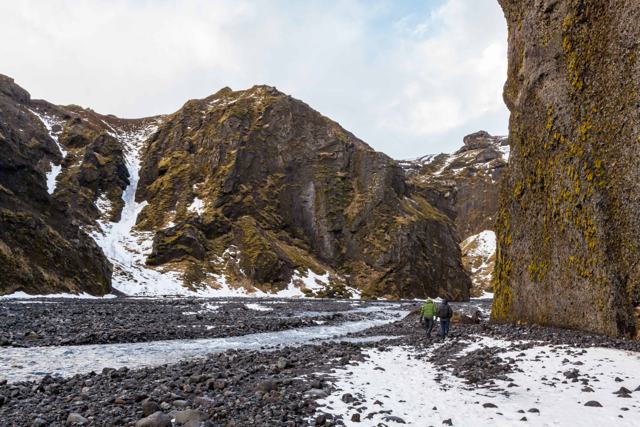 Highlands · CanyonStakkholtsgjáStakkholtsgjá is a narrow gorge, up to about 100 m deep, on the way into Þórsmörk in the southern highlands, reached from Seljalandsfoss alo.
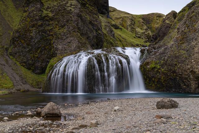 South Iceland · WaterfallStjórnarfossStjórnarfoss is a small, wide waterfall on the river Stjórn at Kleifar, a few minutes outside the village of Kirkjubæjarklaustur in South Ic.
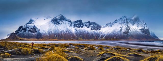 Southeast Iceland · LandmarkStokksnesStokksnes is a peninsula on the Southeast coast, about 17 km from Höfn and 465 km (around 6 hours) from Reykjavík, known for views of the ja.East Iceland · WaterfallStrútsfossStrútsfoss is a tall, two-step waterfall of about 120 metres in the Suðurdalur valley, near Egilsstaðir in East Iceland.Highlands · Hot springStrútslaugStrútslaug is a remote natural hot spring in the southern highlands, in the valley Hólmsárbotnar between the glaciers Torfajökull and Mýrdal.
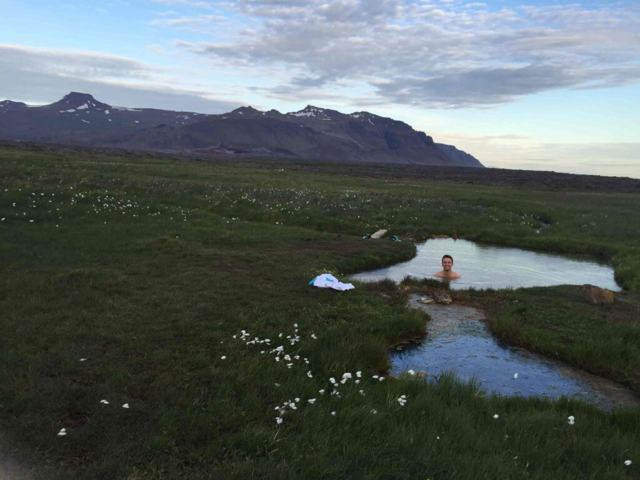 West Iceland · Hot springSturlungalaugSturlungalaug is a pair of natural hot pools in the hills at the eastern edge of the Snæfellsnes peninsula in West Iceland.
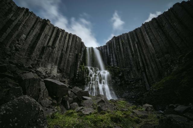 East Iceland · WaterfallStuðlafossStuðlafoss is a waterfall framed by basalt columns in Jökuldalur, East Iceland, reached on foot along the trail towards the famous Stuðlagil.
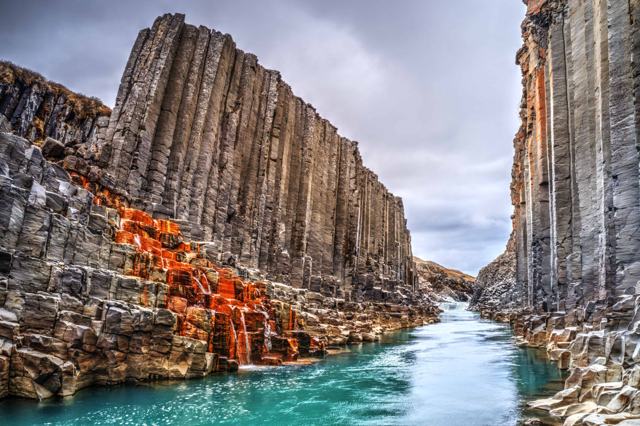 East Iceland · CanyonStuðlagil CanyonStuðlagil is a canyon of basalt columns and a blue-green river in the Jökuldalur valley in East Iceland, about 70 km (a little over an hour).
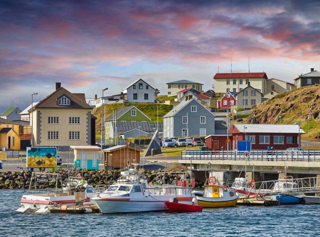 Snæfellsnes · TownStykkishólmurStykkishólmur is a fishing town of about 1,100 people on the north coast of the Snæfellsnes peninsula in West Iceland, about 170–175 km (aro.
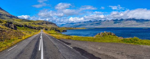 East Iceland · VillageStöðvarfjörðurStöðvarfjörður is a small fishing village of around 180 people in the Eastfjords, and the Ring Road runs straight through it.
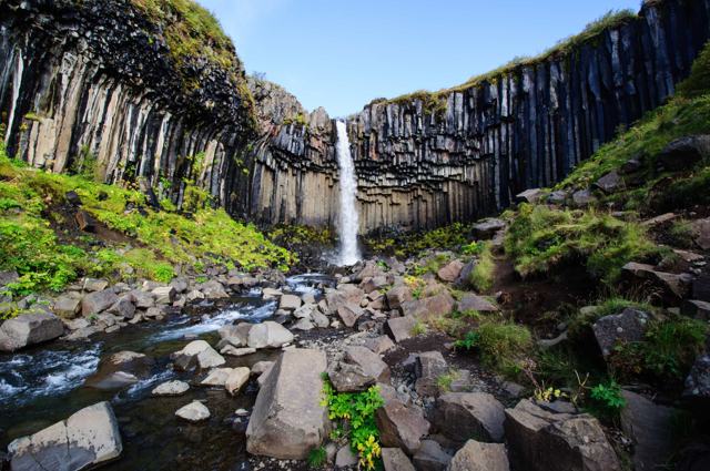 Southeast Iceland · WaterfallSvartifossSvartifoss (“Black Fall”) is a 20-metre waterfall in Skaftafell, Vatnajökull National Park, framed by dark hexagonal basalt columns.
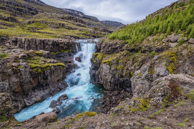 East Iceland · WaterfallSveinstekksfossSveinstekksfoss, also called Nykurhylsfoss, is a 15-metre waterfall on the Fossá river in the Fossárdalur valley, about 15 km from Djúpivogu.
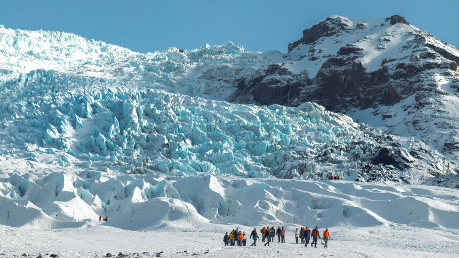 Southeast Iceland · GlacierSvínafellsjökullSvínafellsjökull is an outlet glacier flowing down from Vatnajökull, Europe's largest ice cap, close to the Skaftafell area of Vatnajökull N.
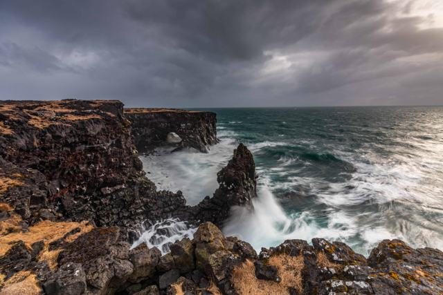 Snæfellsnes · CliffsSvörtuloftSvörtuloft is a 4 km stretch of black lava cliffs on the westernmost point of the Snæfellsnes peninsula, marked by the small orange Svörtulo.
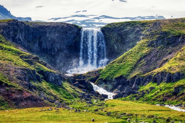 Snæfellsnes · WaterfallSvöðufossSvöðufoss is a waterfall on the Hólmkelsá river in the western part of the Snæfellsnes peninsula, just off Route 574 between Ólafsvík and Ri.
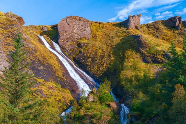 South Iceland · WaterfallSystrafossSystrafoss (“Sisters’ Falls”) is a waterfall with two streams on a cliff right above the village of Kirkjubæjarklaustur on Iceland’s South C.
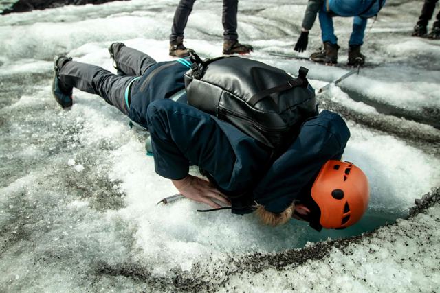 South Iceland · GlacierSólheimajökullSólheimajökull is an outlet glacier of Mýrdalsjökull on the south coast, about 174 km (around 2 hours 40 minutes) from Reykjavík.
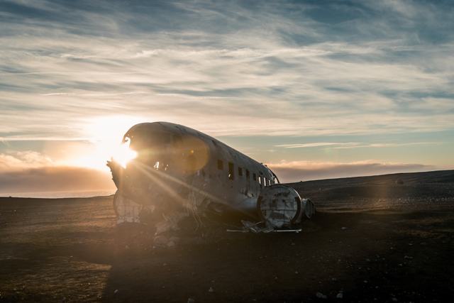 South Iceland · LandmarkSólheimasandur plane wreckThe Sólheimasandur plane wreck is the rusted hull of a US Navy Douglas Super DC-3 that made an emergency landing on this black sand plain in.
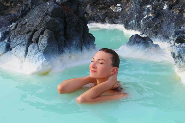 Reykjanes · LagoonThe Blue LagoonThe Blue Lagoon (Bláa lónið in Icelandic) is a milky-blue geothermal spa on the Reykjanes peninsula, just outside Grindavík.
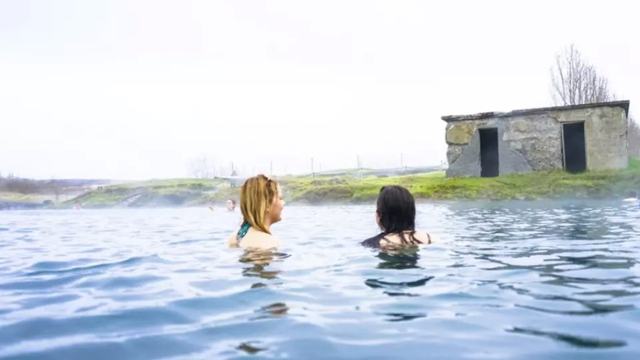 Golden Circle · Hot springThe Secret LagoonThe Secret Lagoon, also called Gamla Laugin ("the old pool"), is a natural geothermal pool in Flúðir, a short detour from the Golden Circle .
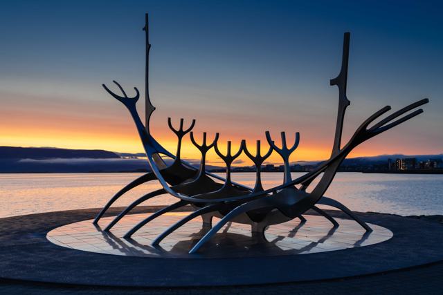 Reykjavík · LandmarkThe Sun VoyagerThe Sun Voyager (Sólfar) is a stainless steel sculpture on the Sæbraut waterfront in Reykjavík, unveiled on 18 August 1990.
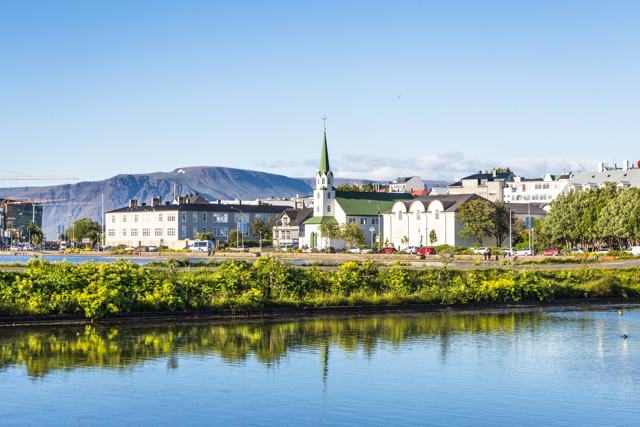 Reykjavík · LakeTjörninTjörnin is a shallow pond right in the centre of Reykjavík, next to City Hall, free to visit and open at all times.West Iceland · WaterfallTröllafossTröllafoss (“Troll Waterfall”) is a 20-metre waterfall on the Leirvogsá river in Mosfellsdalur valley, not far from Reykjavík.
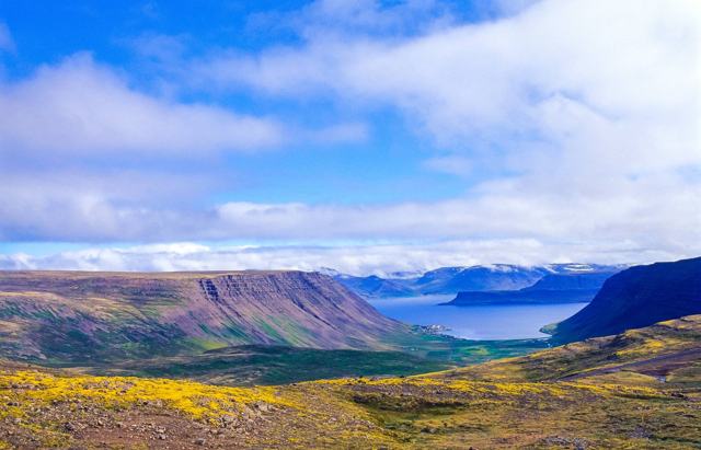 Westfjords · VillageTálknafjörðurTálknafjörður is a small fishing village of around 240 people on the south side of the Westfjords, between Patreksfjörður and Bíldudalur.
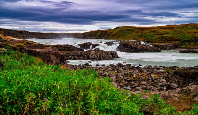 South Iceland · WaterfallUrriðafossUrriðafoss is a low but very wide waterfall on the Þjórsá, Iceland's longest river, with the highest average flow of any waterfall in Icelan.
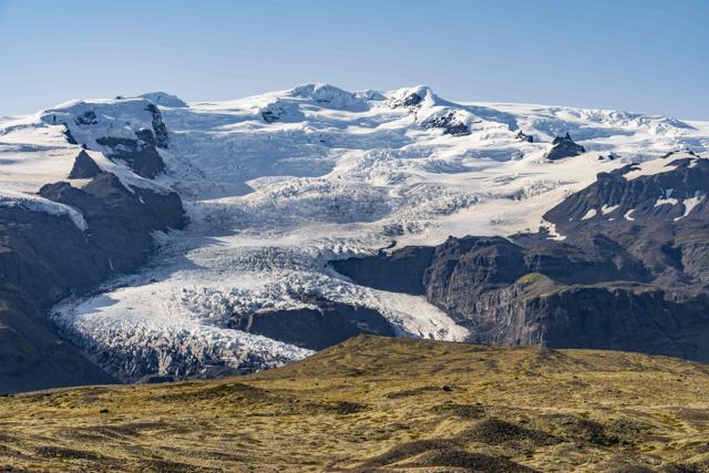 Southeast Iceland · GlacierVatnajökullVatnajökull is Iceland's largest glacier and, by volume, the largest ice cap in Europe, covering around 7,700 km², about 8% of the country.
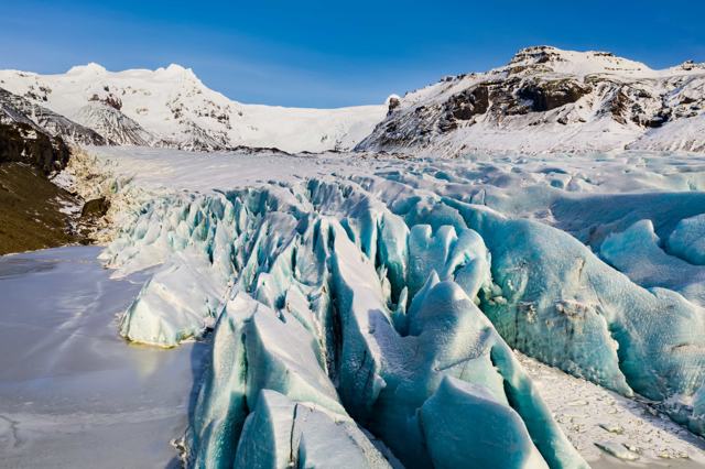 Southeast Iceland · National parkVatnajökull National ParkVatnajökull National Park is Iceland's largest national park, built around Europe's biggest ice cap, and covers roughly 14,967 km² (about 14.
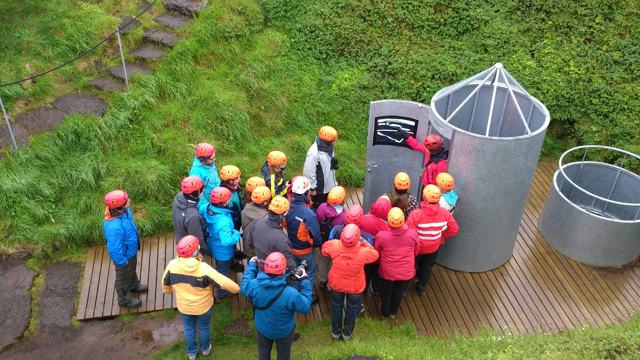 Snæfellsnes · Lava caveVatnshellirVatnshellir is a lava tube about 8,000 years old in Snæfellsjökull National Park, on the Snæfellsnes peninsula.Westfjords · Hot springVegavinnubaðiðVegavinnubaðið is a small natural hot spring in the southern Westfjords, where warm water runs out of the rock beside a waterfall.
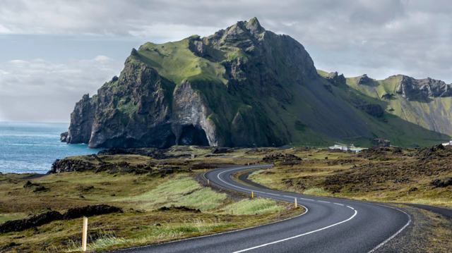 Westman Islands · IslandVestmannaeyjarVestmannaeyjar is a group of volcanic islands off the south coast of Iceland, with Heimaey as the only inhabited one.Southeast Iceland · LandmarkViking Village (Stokksnes)The Viking Village is a replica Viking settlement built as a film set at the foot of Vestrahorn mountain on Stokksnes, southeast Iceland, ar.
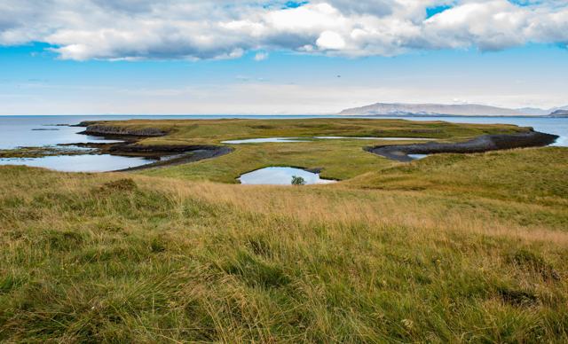 Reykjavík · IslandViðey IslandViðey is a small, car-free island about a kilometre off Reykjavík, with Iceland's oldest stone house, Richard Serra's Milestones sculptures .
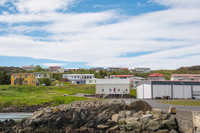 East Iceland · VillageVopnafjörðurVopnafjörður is a small fishing village of fewer than 700 people on the northeast coast of Iceland, on a wide fjord of the same name.
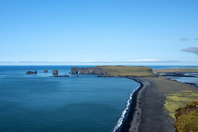 South Iceland · VillageVík í MýrdalVík í Mýrdal is Iceland's southernmost village, on the Ring Road in South Iceland, about 180 km (around 2 hours 30 minutes) from Reykjavík.
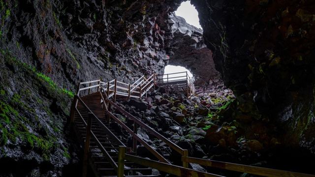 West Iceland · Lava caveVíðgelmirVíðgelmir is Iceland's largest lava cave, in the Hallmundarhraun lava field near Húsafell in West Iceland.
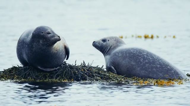 Snæfellsnes · BeachYtri TungaYtri Tunga beach is a small golden-sand beach on the south side of the Snæfellsnes Peninsula, known for its seal colony: wild harbour and gr.
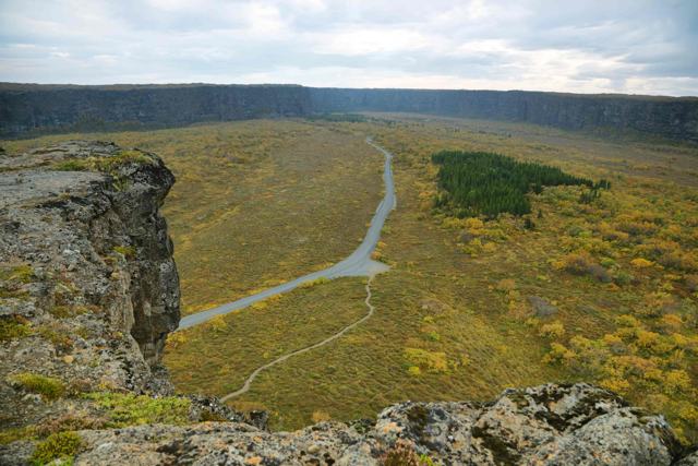 North Iceland · CanyonÁsbyrgiÁsbyrgi is a horseshoe-shaped canyon in North Iceland, part of Vatnajökull National Park and a stop on the Diamond Circle route.South Iceland · WaterfallÍráfossÍráfoss (also written Írárfoss, and sometimes called Árjánurfoss) is a narrow waterfall on the Írá river under the Eyjafjöll mountains in So.
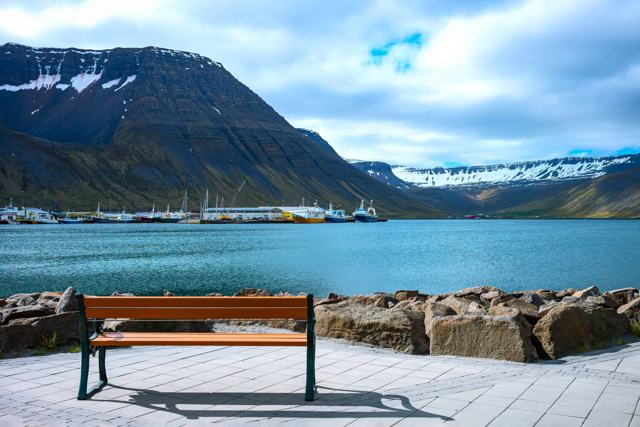 Westfjords · TownÍsafjörðurÍsafjörður is the largest town in the Westfjords, built on a narrow sandspit inside Skutulsfjörður and hemmed in by steep mountains.
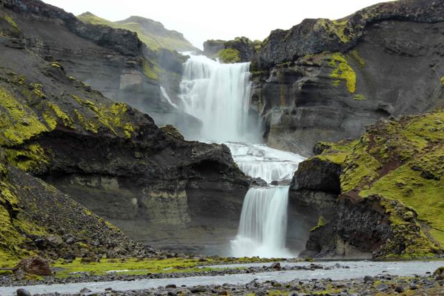 Highlands · WaterfallÓfærufossÓfærufoss is a two-step waterfall, about 40 metres high, inside Eldgjá, the long volcanic canyon in the Icelandic Highlands.
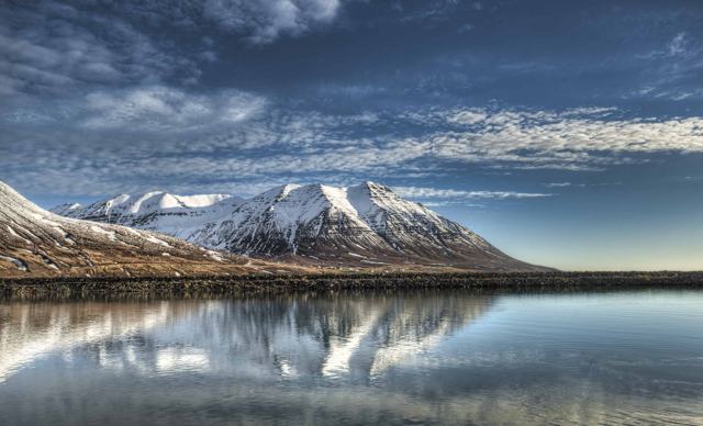 North Iceland · TownÓlafsfjörðurÓlafsfjörður is a small fishing town of around 800 people on the Tröllaskagi peninsula in North Iceland, reached by tunnel from Dalvík or Si.
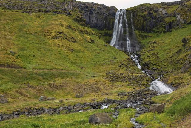 Snæfellsnes · TownÓlafsvíkÓlafsvík is a small fishing town of around 1,100 people on the north coast of the Snæfellsnes peninsula, about 187 km (around 2.5 hours) fro.
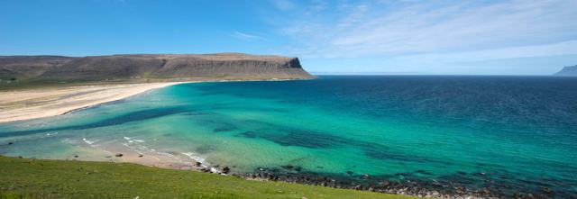 Westfjords · BeachÖrlygshöfnÖrlygshöfn is a bay of golden sand and a shallow lagoon on the south side of Patreksfjörður in the Westfjords, on Route 612 towards Látrabja.
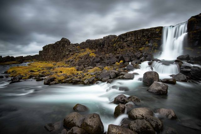 Golden Circle · WaterfallÖxarárfossÖxarárfoss is a 13-metre waterfall that drops into the Almannagjá gorge inside Þingvellir National Park, part of the Golden Circle.
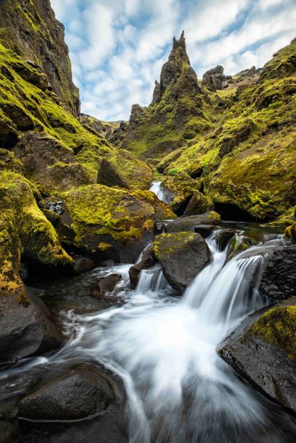 South Iceland · CanyonÞakgilÞakgil is a canyon and hiking area in the hills behind Vík í Mýrdal in South Iceland, with Rémundargil as its best-known side ravine.
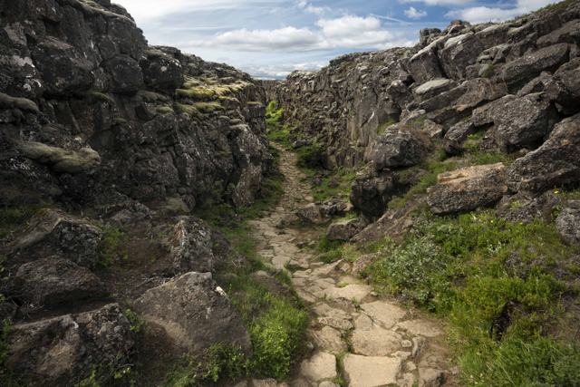 Golden Circle · National parkÞingvellir National ParkÞingvellir National Park (often written Thingvellir) is a rift valley in South Iceland where the North American and Eurasian tectonic plates.
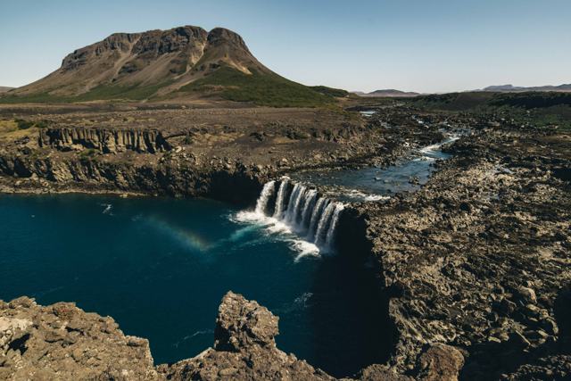 South Iceland · WaterfallÞjófafossÞjófafoss is a wide, horseshoe-shaped waterfall on the Þjórsá river in Þjórsárdalur, South Iceland, in view of Mount Hekla.South Iceland · ValleyÞjórsárdalurÞjórsárdalur is a wide valley in South Iceland at the edge of the highlands, home to waterfalls, lava fields and the ruins of Viking-age far.
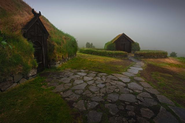 South Iceland · MuseumÞjóðveldisbærinn StöngÞjóðveldisbærinn (the Commonwealth Farm) is a full-scale reconstruction of a Viking-Age Icelandic longhouse, built in the Þjórsárdalur valle.
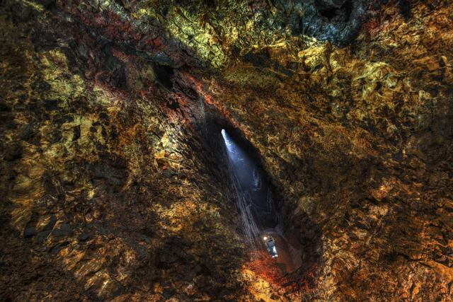 Reykjanes · VolcanoÞríhnúkagígurÞríhnúkagígur (Thrihnukagigur) is a dormant volcano in the Bláfjöll area, about 30 minutes from Reykjavík, and the only place where you can .South Iceland · MountainÞríhyrningurÞríhyrningur ("three-peaks") is a distinctive three-peaked mountain above Fljótshlíð in South Iceland, 678 m high and about 120 km from Reyk.Highlands · Nature reserveÞórsmörkÞórsmörk ("Thor's Forest") is a sheltered valley in the South Iceland highlands, surrounded by the glaciers Eyjafjallajökull, Mýrdalsjökull .
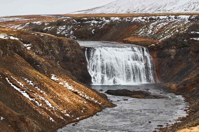 West Iceland · WaterfallÞórufossÞórufoss (Thorufoss) is a waterfall about 18 metres high on the Laxá í Kjós river, beside Route 48 in Kjósarskarð, a short detour from the G.