Basic Information
- Easily accessible.
- Parking lot and walking path leading up halfway to the waterfall.
- GPS: 64.84791, -23.4035
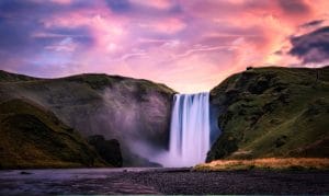
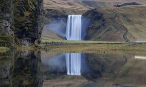
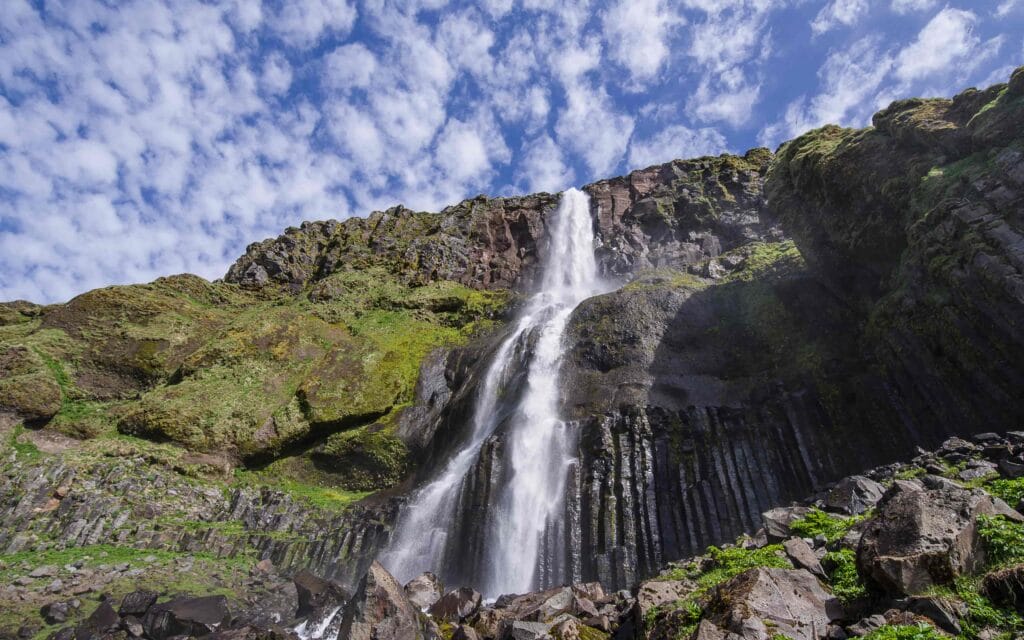
Surrounded by green fields and tall mountains in the background, Bjarnarfoss is located on the south of Snæfellsnes Peninsula. Sited in the river Bjarná, it falls 80 meters in two tiers from basalt cliffs. The upper tier of the waterfall can sometimes be blown upwards in strong winds. This magnificent waterfall is visible from road 54, the road you will be driving around the peninsula. The streams of water can also be seen on the way to Hellnar, Aranstapi, and Lóndrangar. It falls where the main road splits to Fróðaárheiði leading to Ólafsvík in the northern part and to Arnarstapi and Búðir on the south shore of the Snæfellsnes peninsula. The most enjoyable and interesting point of the waterfall is quite high in the cliffs and it takes an effort to walk up the steep slope.
The upper tier seems to be frequently pounded by the wind, causing the trail of water to dance all over the cliff face. When a strong gust hits the waterfall, the upper-tier even blows straight. The lower tier is a much more consolidated plunge, and it appears as if a part of the stream may drip into the ground between the two tiers.
Lady of The Mountain
Watching the waterfall falling in front of the magnificent basalt column that stretches out on both sides is what makes it stand out. There is also a story about this Bjarnafoss waterfall according to which “Fjallkonan” (Lady of the Mountain) stands under the waterfall. The spray from the waterfall falls on the shoulders of the lady, a national personification of Iceland. The Lady of the Mountain signifies what Icelanders consider to be genuine and purely Icelandic. She represents Iceland’s vision, the nation’s ultimate dream.
A parking space and a walking path leading up halfway to the waterfall have been built recently. Since it is situated at the side-line of route 54, the waterfall can be easily accessed. You can reach the parking space easily but to go all the way up to the main waterfall you need to climb the steep hill. After reaching the top, you will witness the exceptional variety of vegetation on both sides. Since the slope is steep and wet due to water droplets, you need to be cautious while climbing. If you like to go adventurous then take the hiking trail by the waterfall streams.

Reaching to Bjarnarfoss Waterfall
Though the roads to this waterfall are usually open during every month of the year visiting the waterfall in the winter season is quite risky. The hiking trail to reach the top of the waterfall becomes slippery. If you are planning for a road trip in the winters then you can have a glance at this waterfall from the roadside or the parking space. The path to the waterfall is easily accessible during summertime.
If you are starting from the capital city of Reykjavik, drive on to Ring Road 1 towards the north. When you reach the town of Borgarnes, take a left turn to move on to Route 54. Keep driving on this route for about an hour to reach the Bjarnarfoss waterfall. You can also visit the nearby locations including the Black Church of Búðir, Rauðfeldsgjá Canyon and Arnarstapi. Búðir is a small hamlet located at a distance of about 4 kilometers from the Bjarnarfoss. Surrounded by lava fields, this is located at the westernmost tip of the Snæfellsnes Peninsula. You can stay at the Búðir hotel which is known for its world-class amenities. It is one of the two buildings of Búðir and includes a restaurant, lounge, and bar. Travel a bit to reach Rauðfeldsgjá, a canyon which is a deep, high and narrow ravine in the cliffs south of the Snæfellsjökull glacier.
Map of Bjarnarfoss waterfall
Interesting locations in the area
Locations
Activities
- Horse Riding
- Whale Watching
- Puffin Watching
- Kayaking
Hotels & Restaurants
- Hotel Búðir
- Fosshotel Hellnar
- Hotel Langaholt
- Agnið Streetfood
- Langaholt Restaurant
- Bjargarsteinn Mathús


