The hike to Hengifoss is the most popular walk in East Iceland. A marked trail climbs about 2.5 km from the parking area above Lake Lagarfljót, passing Litlanesfoss and its basalt columns halfway, to the foot of Hengifoss, one of Iceland's highest waterfalls at 128 metres. Most people reach the top in 40 to 60 minutes and are back at the car within two hours.
Hengifoss and Litlanesfoss at a glance
- Location: Fljótsdalur valley, at the head of Lake Lagarfljót, about 35 km from Egilsstaðir
- Distance: about 2.5 km each way, roughly 5 km return
- Time: 40–60 minutes up, allow 1.5–2 hours in total
- Climb: around 250–300 metres, steepest near the start
- Difficulty: moderate, on a gravel path with some steep sections
- Waterfalls: Litlanesfoss (about 30 m) after roughly 1.2 km, Hengifoss (128 m) at the end
- Best time: June to September; icy and slippery in winter
- Parking: ISK 1,000 per car for the day, read by camera; pay at the kiosk or online before you leave
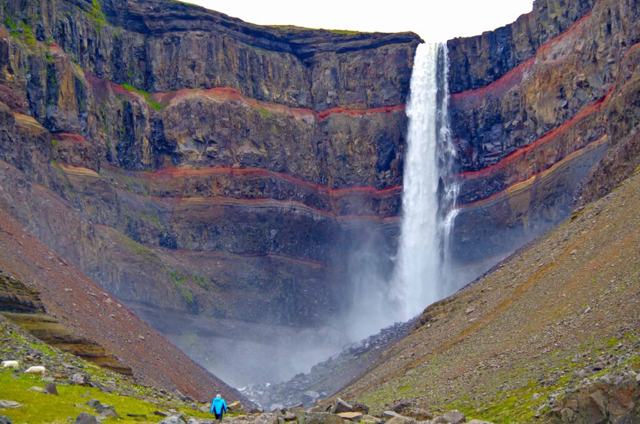
Hengifoss: the red-striped waterfall
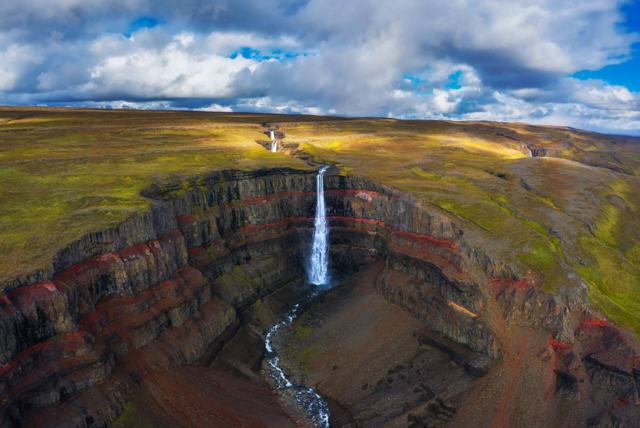
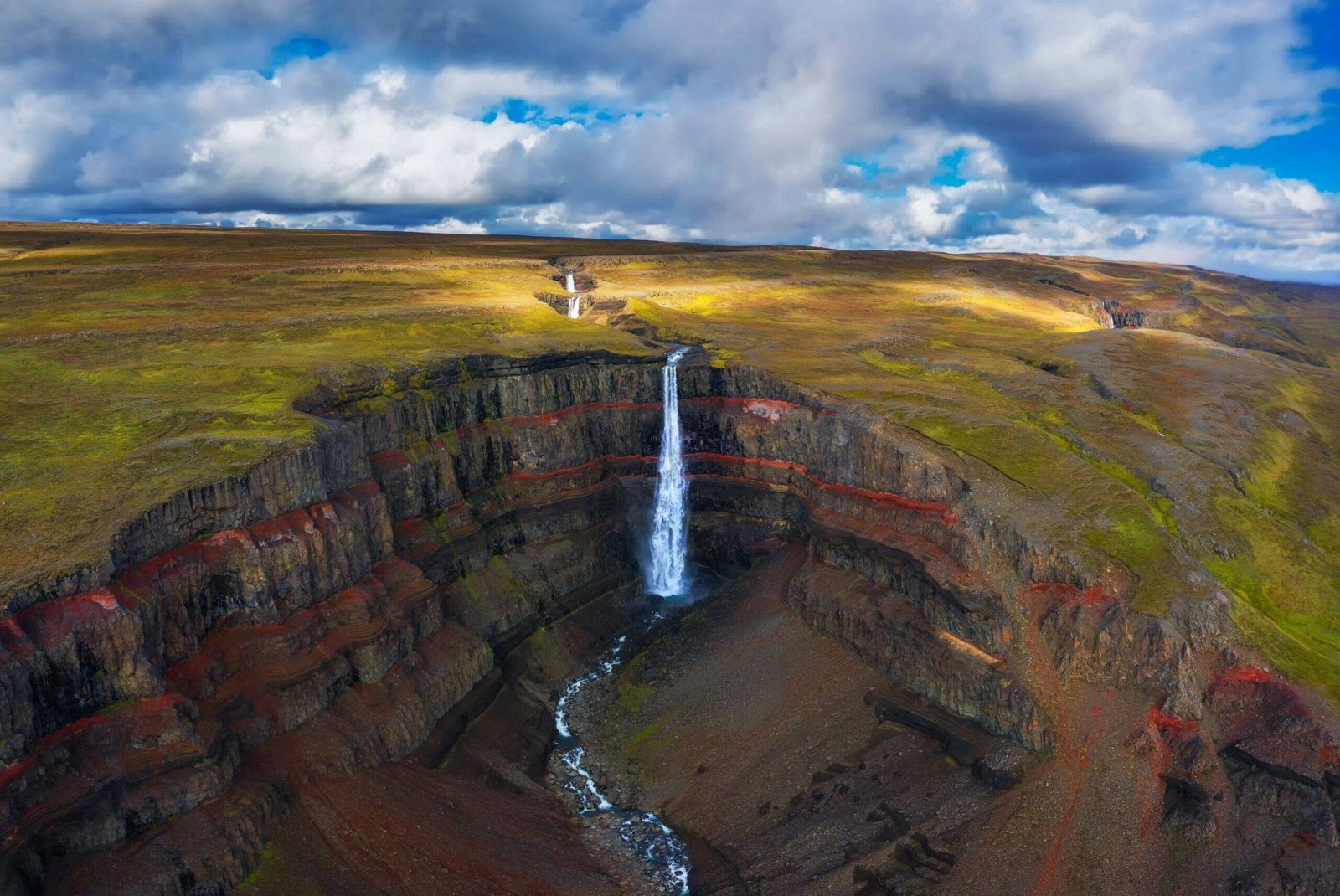
Hengifoss drops 128 metres from the edge of a plateau into a deep gorge on the Hengifossá river. It is usually listed as the third highest waterfall in Iceland. The name means roughly "hanging falls".
What makes it different from other tall falls is the cliff behind it. The rock is made of dark basalt layers from old lava flows, with thin red bands of clay in between. The red layers are old soils and volcanic ash that formed between eruptions, when the climate was much warmer than today. Later lava flows covered them and baked them red. In the same rock you can find fossilised trunks of conifer trees and lignite, more signs of that warmer past. Look for the heap of collapsed sandstone in the gorge below the falls.
The gorge faces south-east, so the light on the falls is best in the morning. On a bright morning, with the sun in the east, a rainbow, sometimes a double one, often stands over the pool at the bottom.
Litlanesfoss: the basalt column waterfall
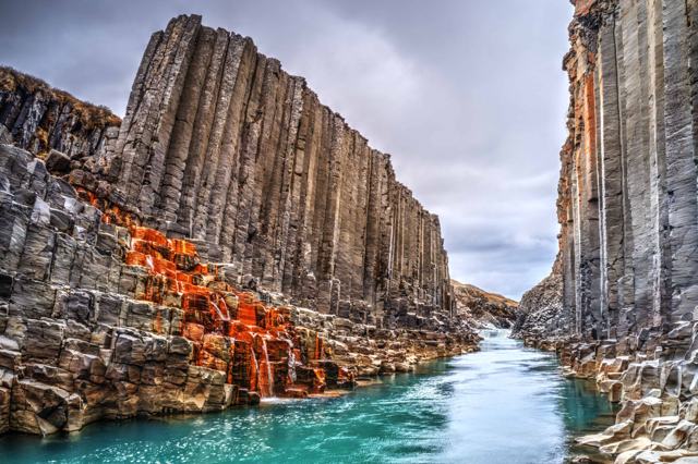
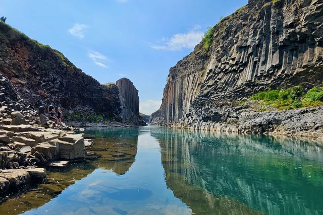
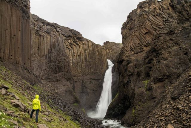
Halfway up the trail you reach Litlanesfoss, a waterfall of about 30 metres in two drops. It is framed by tall, regular columns of basalt, which is why it is also called Stuðlabergsfoss, the basalt column waterfall. Some columns stand straight and others bend, forming a kind of rock choir around the pool. The setting is similar to Svartifoss in the south and Aldeyjarfoss in the north.
Many people find Litlanesfoss just as rewarding as Hengifoss. If time or legs are short, walking to Litlanesfoss and back takes about 45 minutes to an hour. If you like basalt columns, Stuðlagil canyon and Stuðlafoss are also within reach of Egilsstaðir. If you are arriving by ship, our Stuðlagil Canyon Hiking Tour starts at the port in Seyðisfjörður and walks in to the canyon.
The trail step by step
The walk starts at the car park by the bridge over the Hengifossá river. Go through the gate and up the wooden staircase. From the top of the steps you get your first view of Hengifoss far up the valley.
Carry on through a second gate. The path is well worn, with arrows on wooden posts to show the way. It is steep at first, then eases as it crosses green slopes above the river and follows the gorge upwards. There are benches along the way for a rest, a picnic and a view back over Lagarfljót. You pass a smaller waterfall, Jónsfoss, and the gorge below turns reddish, the same colour as the stripes at Hengifoss. After 20 to 30 minutes the path reaches the rim of the gorge at Litlanesfoss, about 1.2 km from the car park.
From Litlanesfoss the trail carries on up the side of the gorge for another kilometre or so. Hengifoss comes closer with every step until the path meets the stream where the sandy gorge narrows. Signs here show where you can cross the stream and go a little further into the rocky bowl below the falls. In summer, when the river is low, it is sometimes possible to walk behind the waterfall into a small cave. Do not try it when the river is high or there is ice about.
There are now marked paths on both sides of the river, linked by two footbridges, one near the car park and one higher up, just before the gorge. You can return the way you came, or cross the upper footbridge and walk down the other side to make a loop.
Safety and what to wear
The path is well used and easy to follow, but the gravel is loose in places and the edges of the gorge are high. Keep to the path, watch children closely and take care on the way down, which is harder on the knees than the climb.
In winter and early spring the trail can be icy. Do not go into the gorge close to the big falls in winter, because ice can fall from the cliffs. Check the weather on vedur.is and conditions on safetravel.is before you set off.
Wear sturdy walking boots and bring a waterproof jacket, a warm layer and some water. The weather in East Iceland can change quickly. Our Iceland packing list covers the rest.
How to get to Hengifoss
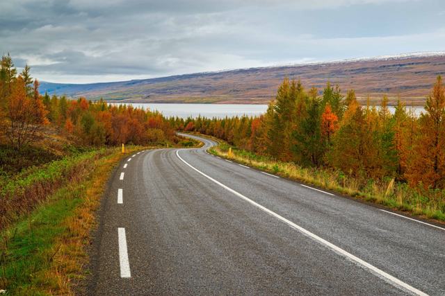
Hengifoss is about 35 km from Egilsstaðir, about 35 minutes by car. The car park is on the west side of Lake Lagarfljót, near its southern end, right by the bridge over the Hengifossá river. You can drive either shore of the lake.
East shore, through the forest: from the junction in Egilsstaðir, drive south on Route 95 (the old Ring Road) for about 11 km. Where Route 95 bends left, keep straight on to Route 931. Follow it for about 23 km, past Hallormsstaðaskógur, Iceland's largest forest, and over the bridge at the head of the lake to a T-junction. Turn left, where the sign points to Snæfell. The car park is about half a kilometre further on, straight after the bridge over the Hengifossá.
West shore: cross the Lagarfljót bridge to Fellabær and follow Route 931 south along the lake. A nice way to do it is to drive one side on the way there and the other on the way back. Route 931 is a paved road that suits ordinary cars in summer. In winter, check road conditions on umferdin.is.
Parking costs ISK 1,000 for a normal car and covers the whole day. Cameras read your number plate, and you pay at the kiosk in the car park or online. Stops of under 15 minutes are free. Pay before you leave, as unpaid fees are billed later with an extra charge, and rental companies may add their own. There is a service building with toilets at the car park, and rangers are on hand in summer. If the car park is full on a busy summer day, the visitor centre at Skriðuklaustur is about 5 km further on.
Lagarfljót and its monster
Lagarfljót is a long, narrow lake and river running through the valley from Fljótsdalur to beyond Egilsstaðir. It is up to 112 metres deep, which puts the bottom about 90 metres below sea level, and its water is milky from glacial silt.
Local legend says a serpent, the Lagarfljótsormur, lives in its depths. It is often compared to the Loch Ness monster, and older people in the area used to say that seeing it brings bad luck. Keep an eye on the water as you climb.
More to see nearby
- Skriðuklaustur: the house of writer Gunnar Gunnarsson, built in 1939, now a cultural centre with exhibitions and a café, plus the ruins of a 16th-century monastery and a Vatnajökull National Park visitor centre, Snæfellsstofa.
- Hallormsstaðaskógur: Iceland's largest forest, with short walking trails along the lake.
- Egilsstaðir: the main town in East Iceland, with shops, fuel, a pool and places to stay.
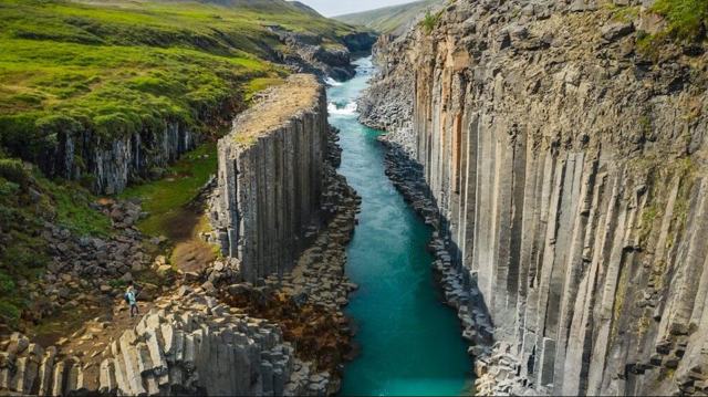
- Stuðlagil canyon: a river canyon lined with basalt columns. See our guide to Stuðlagil east side vs west side.
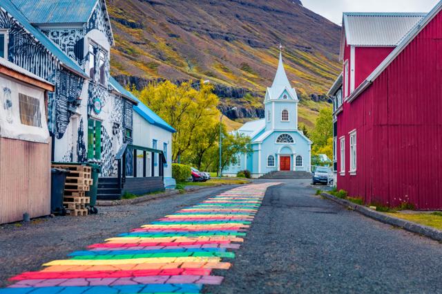
- Seyðisfjörður: a colourful fjord town over the mountain pass from Egilsstaðir. More ideas in our guide to towns to visit in the Eastfjords.
Visiting with a tour
Hengifoss is a good stop on a trip round the Ring Road, and it is easy to combine with Stuðlagil in a day from Egilsstaðir. If you would rather not drive, or you are arriving by ship at Seyðisfjörður, look at our East Iceland tours and Seyðisfjörður shore excursions. For a longer trip that takes in the east, see our Ring Road tours and hiking tours.
None of these stops at the Hengifoss trail itself, which is easy to walk on your own, but they cover the rest of the region well:
- Stuðlagil Canyon Private Jeep Tour: your own jeep and guide from Seyðisfjörður harbour for up to five guests, with Stuðlagil, the Kárahnjúkar Dam and Hallormsstaðaskógur.
- Highlands of East Iceland: a shore excursion from Seyðisfjörður into the highlands and back through Fljótsdalur valley and along Lake Lagarfljót, the valley Hengifoss looks over.
- 8 Day Tour Around Iceland: a guided Ring Road trip for travellers who want East Iceland as part of the whole country, without doing the driving.
Questions people ask
How long is the hike to Hengifoss?
About 2.5 km each way, so roughly 5 km return. Most people take 40–60 minutes to walk up and 1.5–2 hours for the whole trip, including stops.
Is the Hengifoss hike difficult?
It is moderate. The path climbs around 250–300 metres and is steep at the start, but it is well marked and suits most people with reasonable fitness and good shoes.
How high are Hengifoss and Litlanesfoss?
Hengifoss is 128 metres high and one of the tallest waterfalls in Iceland. Litlanesfoss is about 30 metres high in two drops, framed by basalt columns.
Can you hike to Hengifoss in winter?
It is possible, but the trail is often icy, so bring traction spikes and check the weather first. Do not enter the gorge near the main falls in winter because of falling ice.
How far is Hengifoss from Egilsstaðir?
About 35 km, or about 35 minutes by car along Route 931 beside Lake Lagarfljót.
Is there a parking fee at Hengifoss?
Yes. Parking costs ISK 1,000 per car for the day. Cameras read your number plate and you pay at the kiosk in the car park or online. There is no entry fee for the trail itself.
Can you walk behind Hengifoss?
Sometimes. When the river is low in summer it is possible to cross the stream and walk behind the falls into a small cave. Do not try it in high water or in winter, when ice can fall from the cliffs.