SVÖÐUFOSS IN SHORTSvöðufoss is a waterfall on the Hólmkelsá river in the western part of the Snæfellsnes peninsula, just off Route 574 between Ólafsvík and Rif. Parking and the path are free, it is open all year, and most people spend 30–45 minutes there including the walk from the car park.
About Svöðufoss
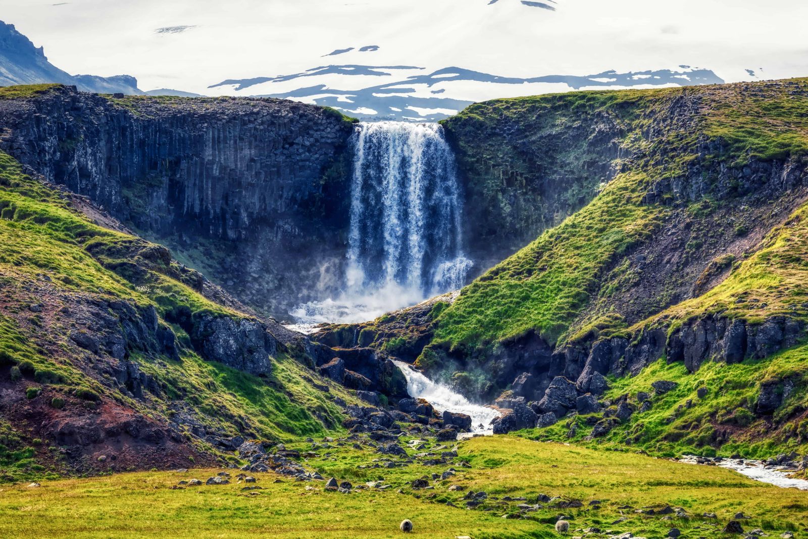
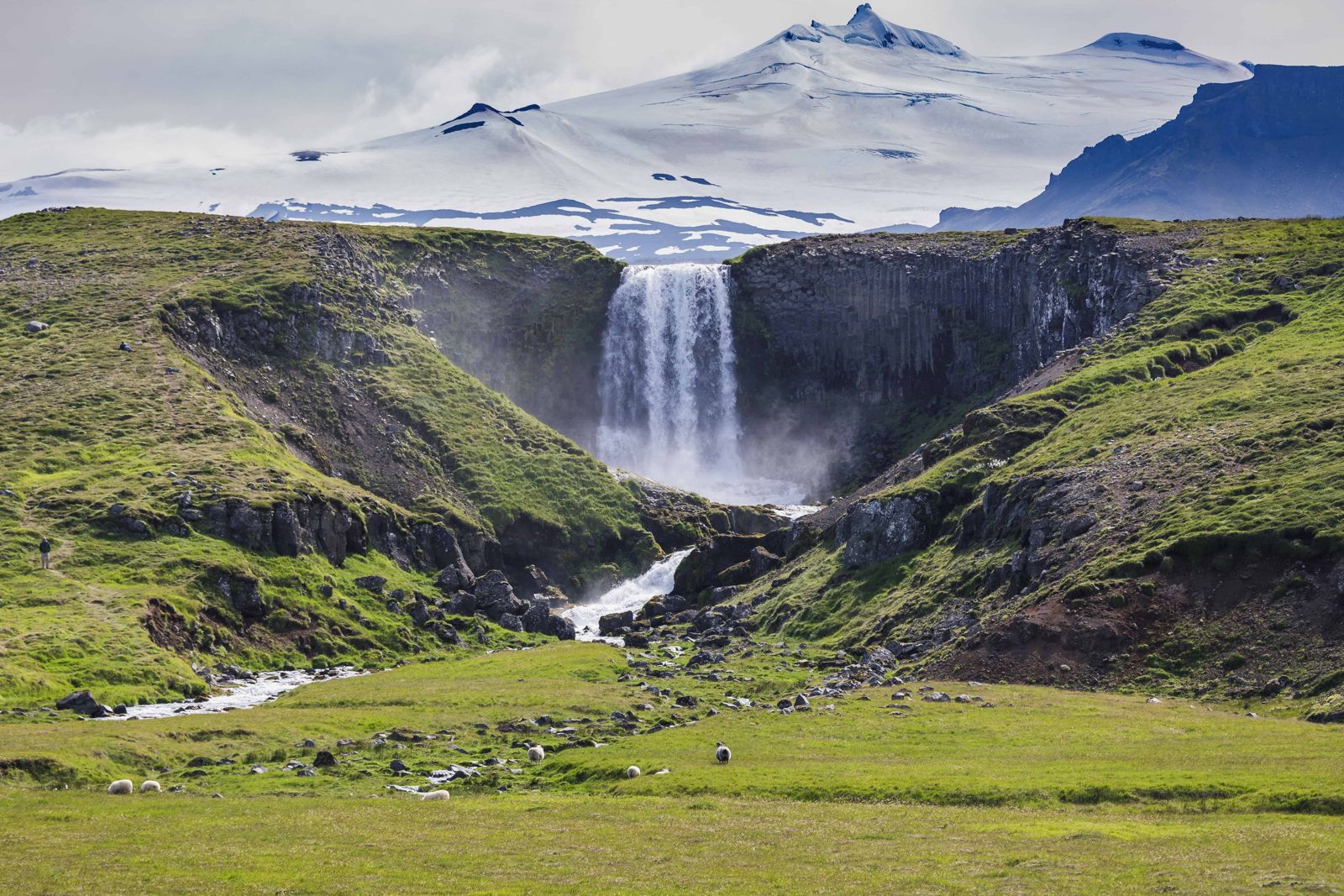
Svöðufoss drops over a cliff of columnar basalt, the tall, many-sided rock columns that form when thick lava cools and cracks. The falls are not huge, but the dark columns, the river and the setting make them one of the nicest short stops on the peninsula. On a clear day the Snæfellsjökull ice cap rises behind the waterfall, which is why photographers like it.
It is quieter than the better-known stops around Kirkjufell and Arnarstapi. A marked path with mats and iron walkways runs from the car park to the falls, so it is an easy walk for most people, including families with pushchairs.
For a long time few visitors came here. The waterfall is out of sight of the main road and there was no proper access, so it stayed a local spot while travellers drove past. That changed when a car park and a surfaced path were built, and it is now one of the easier waterfalls on the peninsula to reach.
Seen from a distance, the curve of the cliff and the green slopes on either side give the scene something of a heart shape, which is why the wide view is as popular with photographers as the close one. The river comes off the slopes of Snæfellsjökull, so the falls run all year.
Come on a clear day if you can. In sunshine the ice cap is sharp behind the falls and the columns stand out. In low cloud you still get the waterfall, but not the backdrop. Summer gives you the longest light, and the moorland around the river is good for wild flowers and birdlife.
Quick facts
RegionSnæfellsnes, West Iceland
HeightAbout 10 m
RiverHólmkelsá (some sources also call it Laxá)
LocationSouth of the village of Rif, off Route 574 (Útnesvegur), between Ólafsvík and Rif
GPSWaterfall 64.89522, -23.81181; car park about 64.9003, -23.8106
From ReykjavíkAbout 200 km, around 3 hours by car
EntryFree
ParkingFree car park at the start of the path, at the end of a short gravel side road
Walking pathAbout 1.2 km on mats and iron walkways, around 20 m of climb; allow 15–30 minutes to reach the falls
Opening hoursOpen all year, no set hours
Time needed30–45 minutes
Basalt columns and a glacier backdrop
The columns at Svöðufoss are lava that cooled and cracked into tall, many-sided shapes, the same process that formed Svartifoss in Skaftafell and the cliffs at Reynisfjara. Behind the falls, Snæfellsjökull is the glacier-topped volcano at the tip of the peninsula, and it is in view whenever the cloud allows.
How to get to Svöðufoss
By carTake Route 54 to the north coast of Snæfellsnes and continue to Ólafsvík, then follow Route 574 west towards Rif. The turn-off to the car park is signposted but the car park is not visible from the main road.
By public transportBus 82 (Stykkishólmur to Hellissandur) stops in Rif. From there it is roughly a 30-minute walk to the falls. Services are limited, so check the Strætó timetable before planning around it.
On a guided tourSome Snæfellsnes day tours from Reykjavík stop here. Many go straight to Kirkjufell and the south coast of the peninsula, so check the itinerary.
There are few scheduled tours that stop at Svöðufoss. On a private tour of Snæfellsnes you can ask your guide to add it, and on a self-drive trip you can stay as long as you like. An ordinary two-wheel-drive car is enough in normal conditions.
How to find Svöðufoss
The waterfall is on the north side of the peninsula, just south of the small village of Rif. You cannot see the falls or the car park from Route 574, so watch for the sign.
From Ólafsvík (east)Leave Ólafsvík heading west on Route 574, Útnesvegur. A few kilometres on, before you reach Rif, a sign for Svöðufoss points left, inland, onto a side road.
From Hellissandur and Rif (west)If you are driving round the tip of the peninsula on Route 574, you pass through Hellissandur and then Rif. Just after you leave Rif, the sign and the side road are on your right.
The side road and car parkThe side road is gravel and ends at a free car park. There are no toilets or shops there, so stop in Ólafsvík or Hellissandur first.
The walk to the fallsA path of mats and iron walkways leads across the grass to a viewing platform facing the waterfall. It is about 1.2 km with only around 20 m of climb and nothing to step over. Visit West Iceland lists the walk at 17 minutes and also says to allow about half an hour, which is right if you stop for photos.
To the top of the fallsFrom the platform a rougher, unsurfaced path continues uphill towards the top of the cliff for a view of the falls from above. The falls are only about 10 m high, so it is a short climb, but the ground is uneven and can be muddy.
Stay on the path and the walkways. The grass and moss beside the river are fragile and slow to recover.
Exploring the area around Svöðufoss
Svöðufoss fits easily into a drive around the western end of Snæfellsnes. These are the closest stops.
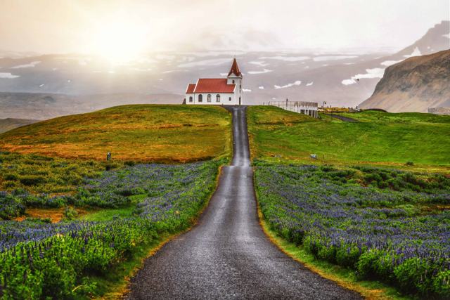
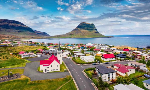
Rif and HellissandurTwo small fishing villages a few minutes west on Route 574. The church at Ingjaldshóll stands on a low hill just inland from them and is easy to pick out from the road.
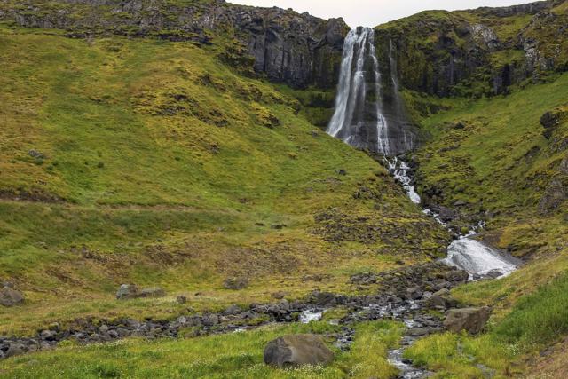
KerlingarfossA taller, narrower waterfall about 2 km east of Svöðufoss, between Ólafsvík and Rif. It is reached by a farm track off Route 574 and a short walk, so respect gates, signs and livestock.
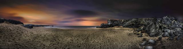
ÖndverðarnesThe outermost point of the peninsula, west of Hellissandur. Lava fields and craters from eruptions thousands of years ago cover the land on one side, and the open Atlantic lies on the other.
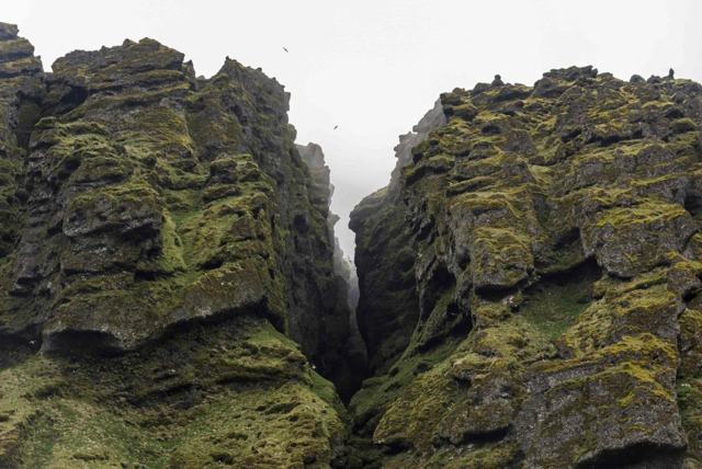
RauðfeldsgjáA deep, high and narrow ravine in the cliffs on the south side of the peninsula, below the glacier. From a distance it looks like a thin crack in the mountain, just wide enough to step into. Going further in means scrambling over wet rocks in a stream, so it is not for anyone unsteady on their feet.
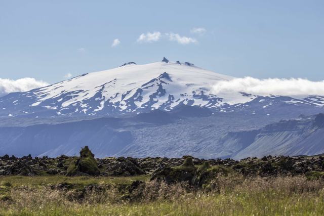
SnæfellsjökullThe glacier-capped volcano behind the waterfall. Svöðufoss lies just outside the northern edge of the national park that surrounds it, with its lava coast, sea cliffs and beaches.
Best time to visit Svöðufoss
Summer (June–August)The best time to come. Long daylight, green surroundings and the easiest walking mean you can stay as long as you like. Late afternoon light on the falls is popular with photographers, and a sunny day gives the clearest view of Snæfellsjökull.
WinterThe path is open all year, but it can be icy and daylight is short. Check road conditions on umferdin.is before driving Route 54 in winter.
Safety and practical tips
- Wear waterproof shoes; the ground near the river is wet, and the water level changes with rain and snowmelt.
- Stay on the marked path and walkways to protect the moss and grass.
- Pick a clear day if your plans allow it. The view of Snæfellsjökull behind the falls is what sets this waterfall apart.
- Bring a wide lens or step well back for the full scene of cliff, river and glacier.
- There are no services at the falls, so bring water and plan food and fuel stops in Ólafsvík.
- Check road conditions on umferdin.is and the forecast on vedur.is before driving around Snæfellsnes in winter.
Facilities and accessibility
There are no services at the falls. The nearest shops, fuel and cafés are in Ólafsvík.
Nearby places worth a stop
Where to stay near Svöðufoss
Ólafsvík, Hellissandur and Grundarfjörður have guesthouses and hotels on the north side of the peninsula, and Stykkishólmur is a larger base to the east.
Svöðufoss FAQ
Is Svöðufoss worth a special trip?
It is a short, easy stop rather than a destination on its own, but it is one of the most photogenic waterfalls on Snæfellsnes, especially when Snæfellsjökull is visible behind it.
How do I find Svöðufoss?
It is south of Rif on the north side of Snæfellsnes. From Route 574 between Ólafsvík and Rif, follow the sign for Svöðufoss onto a gravel side road that ends at the car park. The falls cannot be seen from the main road.
How high is Svöðufoss?
About 10 metres, according to Visit West Iceland. It falls over a cliff of basalt columns into the Hólmkelsá river.
How long is the walk to Svöðufoss?
About 1.2 km on an easy surfaced path. Allow 15–30 minutes to reach the falls from the car park.
Is there an entrance fee or parking fee?
No. Parking and the path are free.
Is the path suitable for wheelchairs and pushchairs?
Visit West Iceland describes the path as easy, with mats and iron walkways that allow strollers and wheelchairs to reach the falls.
Can you visit in winter?
Yes, the path is open all year, but check road conditions first, since Snæfellsnes roads can ice over and daylight is short.
How far is it from Reykjavík?
About 200 km, around 3 hours by car, so it is usually combined with other Snæfellsnes stops on a full-day trip.
 Iceland Travel GuideLOCAL TRAVEL AGENCY IN ICELAND
My trip
Talk to a local