Iceland Travel GuideLOCAL TRAVEL AGENCY IN ICELAND
My trip
Talk to a local
Iceland Travel GuideLOCAL TRAVEL AGENCY IN ICELAND
My trip
Talk to a local
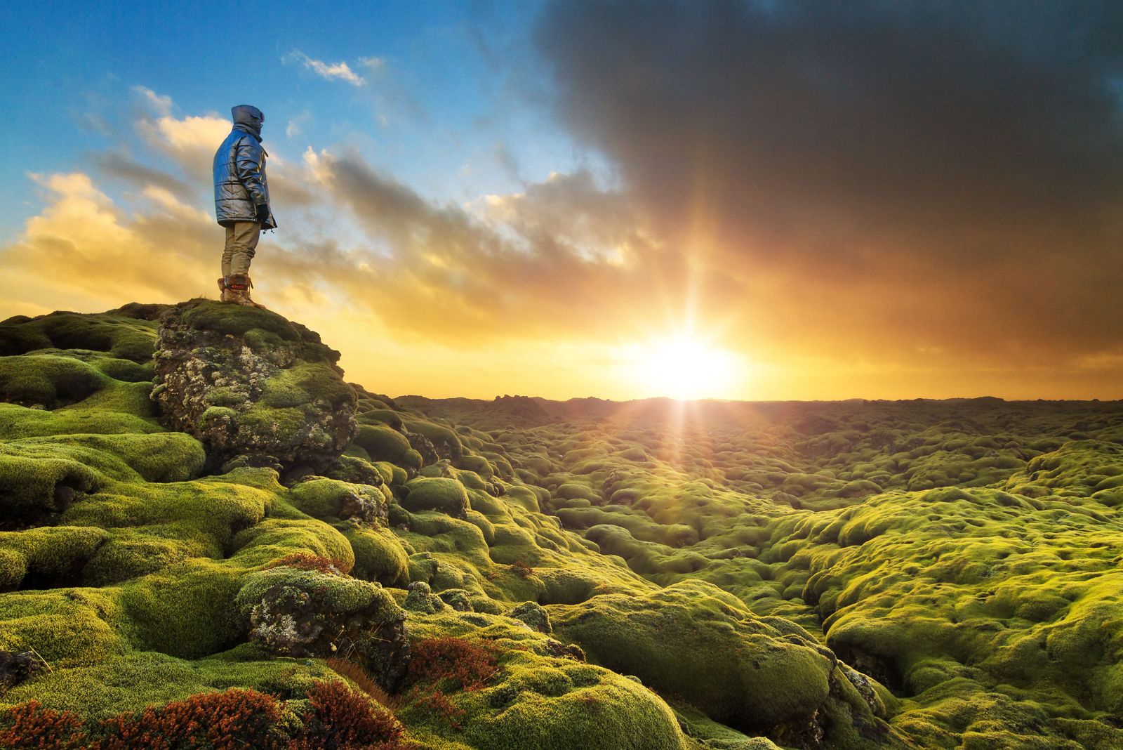
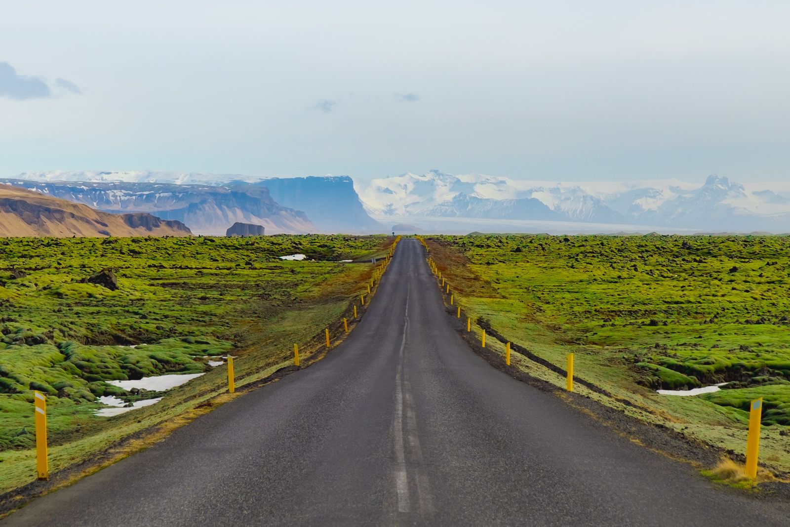
Eldhraun is one of the largest lava fields in the world, covering about 565 km² of South Iceland between Vík and Kirkjubæjarklaustur, right beside the Ring Road. It was formed by the 1783–84 Laki eruption and is now covered in thick, soft moss. It is free to see, about 60 km east of Vík and about 256 km (3.5–4 hours) from Reykjavík, and most people stop for 15–30 minutes.
Eldhraun means “fire lava”, and it is the flow that poured out of the Laki fissure in 1783–84. It is a wide, rolling plain of old lava, and it is covered by woolly fringe-moss (Racomitrium lanuginosum), which turns the black rock into a thick green-grey carpet. In autumn the moss shifts to gold and rust colours.
You see Eldhraun from the Ring Road, and you can stop at small pull-ins and viewpoints along the road. The best-known stop is a small car park with an information board and a short marked path through the moss. It is the kind of place where a short stop is enough. The scale is what stands out: the lava stretches to the horizon in every direction, with the mountains and the Vatnajökull ice cap in the distance on clear days.
The moss is very fragile. It grows extremely slowly, and a single footprint can damage it for decades. That is why visitors are asked to stay on the marked paths and viewpoints and never to walk out onto it.
Under the moss the lava is rough and full of hollows, and the field holds one of the larger lava tube systems in the country. That is one more reason to keep to the paths: the surface hides holes and sharp edges. Because the eruption is recent in geological terms, Eldhraun is also a good place to see how plants slowly take over new rock, with moss first and other plants much later.
The eruption that made Eldhraun is known in Iceland as Skaftáreldar, the Skaftá Fires. It began on 8 June 1783, when a fissure about 25–27 km long with around 130 craters opened at Laki, in the Lakagígar system north of here. It started with explosions as rising basalt magma met groundwater, and then poured out lava for eight months, until 7 February 1784. Most of the lava came out in the first five months.
The numbers are hard to picture. About 14 km³ of basalt lava came out, lava fountains are estimated to have reached 800–1,400 metres, and the flow followed the river gorges down to this part of the south coast. The eruption ranks 4 on the Volcanic Explosivity Index. The ash and gases, including around 120 million tonnes of sulphur dioxide, poisoned grass and livestock across Iceland.
The famine that followed, called Móðuharðindin or the Mist Hardships, killed about a fifth of Iceland’s people, about 80% of the sheep and half the cattle and horses. The haze also spread over Europe, bringing crop failures and a hard winter, and Benjamin Franklin wrote about the strange cold summer of 1783 and linked it to volcanic fumes. Some historians have suggested that the failed harvests added to the unrest that led to the French Revolution. Today the same lava is a calm, green landscape, but it is a reminder of how powerful Icelandic eruptions can be.
The Ring Road here is exposed to strong wind and winter ice, and road closures can happen. Check umferdin.is and vedur.is before you drive.
You drive through Eldhraun for many kilometres, so the question is where to pull over. These are the practical options.
There are no major facilities at Eldhraun itself. Kirkjubæjarklaustur, a short drive east, has restaurants, toilets, a fuel station, a shop and places to stay. Vík is the nearest larger town to the west.
Kirkjubæjarklaustur has hotels, guesthouses and a campsite, and there are farm stays along the Ring Road. Vík has more options to the west. Book ahead in summer.
No. The moss is very fragile and takes decades to recover. Stay on marked paths and viewpoints.
About 565 km², and it is one of the largest lava fields in the world.
During the Laki eruption of 1783–84, which lasted about eight months and caused a famine in Iceland.
From the Ring Road between Vík and Kirkjubæjarklaustur. The main stop is a small car park about 60 km east of Vík, with an information board and a short marked path. Route 204 also runs through the lava.
About 256 km, or around 3.5–4 hours by car. It is on the Ring Road between Vík and Kirkjubæjarklaustur.
No. You can stop and see it for free. There is no entrance fee.
You will often read that they did. NASA brought astronauts to Iceland for geology training in the 1960s, and several guides say Eldhraun was one of the places they saw. We have not found a firm record of exactly where and when, so treat it as a good story until you see it confirmed.