Iceland Travel Guide logo Iceland Travel GuideLOCAL TRAVEL AGENCY IN ICELAND My trip Talk to a local
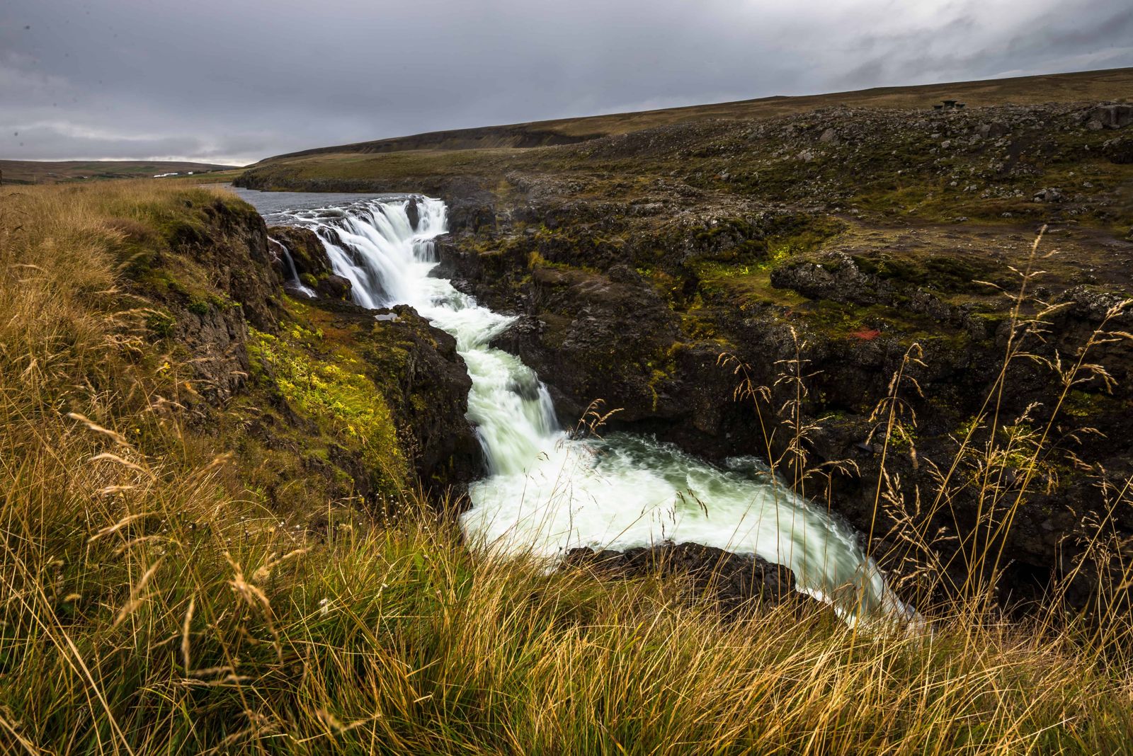
Kolugljúfur Canyon

North IcelandCanyonFree entryOpen all year
KOLUGLJÚFUR IN SHORT

Kolugljúfur is a narrow canyon on the salmon river Víðidalsá in Víðidalur, North Iceland, with a run of waterfalls known as Kolufossar. It is about 1 km long and 40–50 m deep, around 6 km off the Ring Road on Road 715 and about 200 km (around 2 hours 30 minutes) from Reykjavík. It is free to visit, open all year, and most people spend 30–45 minutes there.

ON THIS PAGE
Quick factsHistoryGetting thereWhat to seeSafetyBest time to visitSafety tipsFacilitiesMapNearbyWhere to stayFAQ

About Kolugljúfur

Kolugljúfur, also called Kolugil, is a gorge in the salmon river Víðidalsá, which runs through the valley of Víðidalur in the north-west. The river drops into the canyon in a cluster of falls, together called Kolufossar, and then runs for about 1 km between steep rock walls. The canyon is 40–50 m deep at its deepest and up to about 60 m across.

It lies in front of the farm Víðidalstunga, only a few minutes' drive from the Ring Road, so it is an easy stop on the way between Reykjavík and Akureyri. You do not have to hike to see it: a road bridge crosses the gorge right above the falls, with a small viewing platform beside it, and short paths run along the rim.

The setting is green and brown farmland with white water in the gorge below, calmer than the lava canyons further east. It is still one of the quieter stops in North Iceland. Even in summer you will often share it with only a few other cars.

The canyon is named after the giantess Kola, and the edges are steep and mostly unfenced. Both are good reasons to slow down here: read the story below, and keep well back from the drop while you take your photos.

Quick facts

RiverVíðidalsá, a well-known salmon river
WaterfallsKolufossar (Kolufoss), a cluster of falls at the head of the gorge
Canyon sizeAbout 1 km long, 40–50 m deep, up to about 60 m wide
RoadRoad 715 (Víðidalsvegur), about 6 km of gravel south of the Ring Road
Car park GPS65.3328, -20.5695 (65°19'58"N 20°34'10"W)
RegionVíðidalur, North Iceland, near Hvammstangi
From ReykjavíkAbout 200 km, around 2 hours 30 minutes by car
From AkureyriAbout 190 km
From HvammstangiAbout 25 km, around 25 minutes by car
From BlönduósAbout 47 km
Entry and parkingFree
Opening hoursOpen all year, day and night
Time needed15 minutes for a quick look, 30–45 minutes to walk the rim

A canyon named after the giantess Kola

The gorge is named after Kola, a giantess (some say troll-woman) who is said to have dug the canyon herself and lived in it. In the folklore the whole landscape around the gorge was shaped by her daily life: where she slept, where she fished and where she cooked.

Kola is said to have lived on a ledge on the west side of the gorge, and to have slept there too. The ledge is known as Kolurúm, Kola's bed. From it she would reach down into the river with her bare hands and pull out a salmon, which she mostly ate raw.

When she wanted a cooked meal she used Koluketill, Kola's kettle or cauldron, a hole in the ground nearby that was said to hold boiling water. The old farm name Kolugil comes from the same story, and the falls and rock shelves are still pointed out as places tied to her.

How to get to Kolugljúfur

By car from the Ring RoadKolugljúfur is easy to reach from the Ring Road (Route 1) between Hvammstangi and Blönduós. Watch for Road 715, Víðidalsvegur, and turn south. Drive about 6 km on a gravel road and you are there. Road 715 is a loop that joins the Ring Road again further on, so you can drive in one way and out the other.
Parking and the last few stepsThere is a small free parking space by the road, next to an information sign about Kolugljúfur. You can see the bridge from the car park. Walk onto the bridge and you are standing over the gorge, with the Kolufossar falls just upstream.
By public transportLong-distance buses on Route 1 pass the valley, but there is no stop near the canyon and it is too far to walk from the main road. A rental car is the practical option.
In winterThe canyon is open all year, but Road 715 is gravel and can be snowy or icy from about October to May. A 4x4 is the safer choice then. Check road conditions on umferdin.is before you leave the Ring Road.

The gravel on Road 715 is normally in good condition and fine for an ordinary car in summer. Drive slowly, especially where the road narrows at the bridge.

What to see at Kolugljúfur

Everything is within a few minutes' walk of the car park. Give yourself half an hour and see the canyon from both sides.

The bridgeThe road bridge crosses the gorge at its head. From the middle you look straight down on the falls on one side and along the canyon on the other. Watch for cars: it is a working farm road.
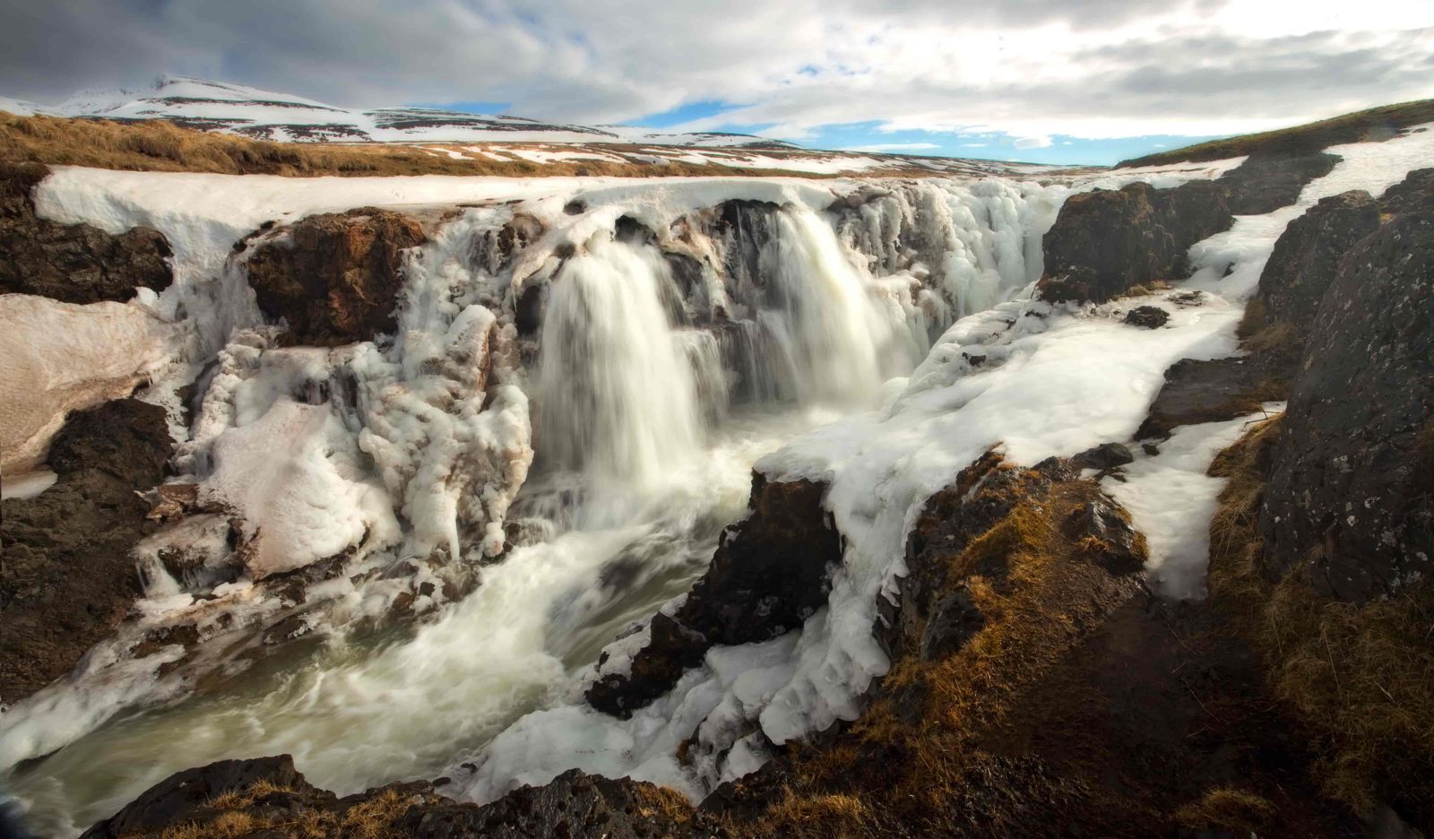
Kolufossar waterfallsThe Víðidalsá drops into the canyon in a group of seven or eight small falls, together known as Kolufossar or Kolufoss. The water is white and foaming in the falls and settles into blue-green pools further down.
The viewing platformA small viewing platform by the bridge gives a safe place to stand for photos of the falls and the first stretch of the gorge.
The rim pathA narrow, informal path follows the edge of the canyon downstream. The full walk is about 2.4 km there and back with very little climbing, around 40 minutes. The further you go, the deeper the gorge and the fewer the people.

The path is plain dirt and grass. It gets slippery after rain or snow, and it runs close to the edge in places.

Safety at the canyon edge

Kolugljúfur has been named in Iceland as one of the more dangerous tourist stops in the country. The reason is simple: the drop is 40 m or more, the edges are grassy and can be undercut, and apart from the platform and a short length of fence there are no railings.

Keep your distance from the edge, and do not step backwards while you frame a photo. Hold on to children the whole time and keep dogs on a lead. The river below is strong and cold, and there is no safe way down into the gorge.

Best time to visit Kolugljúfur

SummerGreen farmland, long daylight and easy walking on the rim path. The river is usually at its clearest, and the gravel road suits any car.
Autumn and springFewer visitors and more water in the falls after rain or snowmelt. Paths are wet and slippery, so wear boots with grip.
WinterIce forms on the canyon edges, the path and the bridge, and daylight is short. Go only in good conditions and with a suitable car, and stay on the platform and the bridge. On clear, dark nights from September to April the valley has little light pollution, so Northern Lights are possible.

Safety and practical tips

  • Keep back from the canyon edges, which are steep, unfenced and can be undercut in places.
  • Start on the bridge and the viewing platform for the best combined view of the falls, then walk the rim if conditions allow.
  • Wear footwear with grip, especially if the paths are wet or icy.
  • Use the toilet before you leave the Ring Road. There is none at the canyon.
  • Do not park on the bridge or block the farm road. Use the parking space by the information sign.
  • Bring your camera: the mix of green and brown land and white water photographs well, even on a grey day.
  • It pairs well with Hvítserkur and Borgarvirki on the Vatnsnes side for a half-day off the Ring Road.

Facilities and accessibility

There is a small free parking area with an information sign, a viewing platform and the bridge. There are no toilets, café or shop at the site; the nearest services are in Hvammstangi and at the Ring Road service stops.

On the map

Open in Google Maps →

Nearby places worth a stop

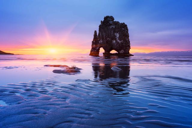
HvammstangiHvammstangiVillage with services and a seal centre · about 25 kmHvítserkurHvítserkurRock stack on the Vatnsnes coast
BorgarvirkiBasalt rock fortress with wide views over the district
Þingeyrar churchHistoric stone church (Þingeyraklausturskirkja) near Blönduós
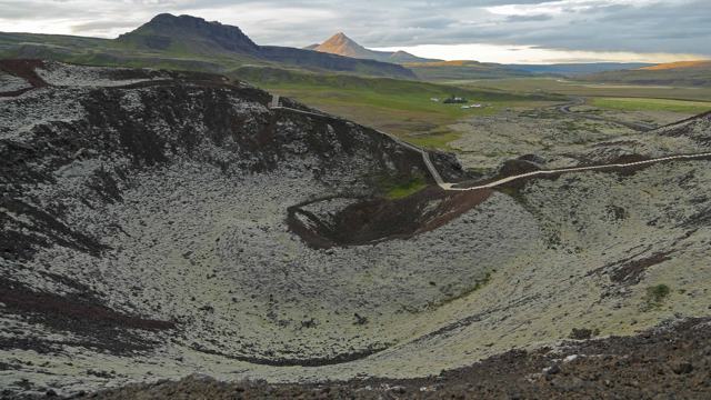
GrábrókGrábrókCrater with a short hiking trail, further south

Where to stay near Kolugljúfur

There are farm stays and cottages in Víðidalur itself, only a few kilometres from the gorge, which suit an overnight stop on the Ring Road; book ahead in summer. Hvammstangi and Blönduós both have guesthouses and hotels within easy reach and make a good base for Kolugljúfur and the wider Vatnsnes peninsula.

Kolugljúfur FAQ

How do I get to Kolugljúfur?

Turn south off the Ring Road onto Road 715 (Víðidalsvegur) and drive about 6 km on gravel. Park by the information sign and walk onto the bridge over the gorge.

Who was Kola?

A giantess or troll-woman in local legend, said to have dug the canyon, slept on a ledge on its west side and caught salmon from the river with her bare hands.

How deep is Kolugljúfur canyon?

About 40–50 m at its deepest. The canyon is about 1 km long.

Is Kolugljúfur free to visit?

Yes, there is no entrance fee and parking is free.

How long does a visit take?

Fifteen minutes is enough for the bridge and the falls. Most people spend 30 to 45 minutes and walk part of the rim.

Is Kolugljúfur dangerous?

The edges are steep and mostly unfenced, so it needs care. Stay back from the drop, keep hold of children and avoid the rim path in ice or strong wind.

Are there toilets at Kolugljúfur?

No. The nearest toilets, fuel and food are in Hvammstangi and at service stops on the Ring Road.
More places in North Iceland