LEIRHNJÚKUR IN SHORTLeirhnjúkur (often written Leirhnjukur) is a steaming lava and geothermal area in the Krafla volcanic system near Mývatn, a short drive from Reykjahlíð and roughly 475 km from Reykjavík. It is free to visit, and the marked loop takes about 1 to 1.5 hours. Snow can make the trail and Route 863 difficult in winter.
About Leirhnjúkur
Leirhnjúkur sits inside the Krafla caldera, one of Iceland's most active volcanic systems. The ground is a mix of black lava from the Krafla Fires of 1975–1984, steaming vents, and mineral-stained earth in shades of red, yellow and grey.
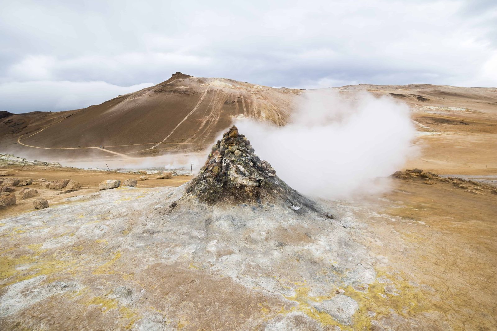
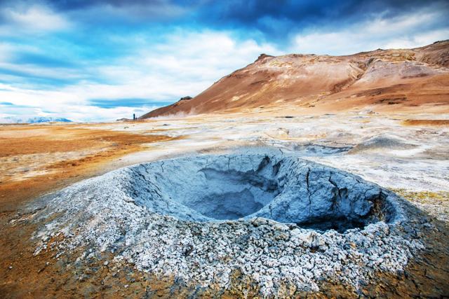
The name means "clay hill" or "mud peak". Leirhnjúkur itself is a low hill of pale rhyolite, usually given as 525 m above sea level, that the heat has baked soft and porous. Mud pots bubble at its foot and fumaroles hiss on its flanks, and steam rises from so many points that the whole slope seems to be smoking.
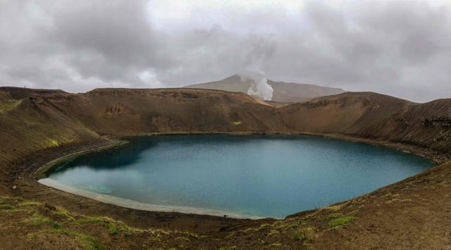
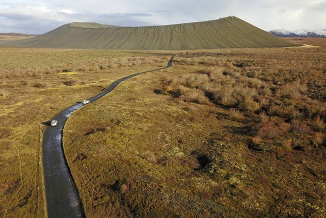
A marked path loops through the area, over young lava that is still bare of vegetation and past steaming vents and mud pools. A short loop takes about an hour, and a longer loop about 1 hour 45 minutes, and there is almost no climbing. The path also passes near Víti, the explosion crater with a bright lake.
If you want something different from waterfalls and parks, this is a good choice. In an hour you walk from grass onto bare black lava that is younger than many of the people crossing it, past a pale blue hot spring and across cracks that are still warm. Bring a camera: the colours of the ground change every few metres.
Quick facts
RegionNorth Iceland, Krafla volcanic area near Mývatn
Name"Clay hill" or "mud peak"
HeightUsually given as 525 m above sea level
From ReykjavíkAbout 475 km, around 6.5 hours by car (about 460 km and 6 hours to Reykjahlíð, then on to Krafla)
From Reykjahlíð (Mývatn)Roughly 15 km, around 15–25 minutes by car: about 6 km east on Route 1, then north on Route 863
EntryFree
ParkingSigned Leirhnjúkur car park on Route 863, past the Krafla power station and before the Víti car park; sources list it as free
Opening hoursNo fixed hours; accessible all year in good conditions, most easily May to October
TrailLoops of about 1 hour (short) or 1 hour 45 minutes (long); sources give 4–5 km for the main loop
Time neededAbout 1–1.5 hours for the main loop, up to 3 hours with Víti
The Krafla Fires
Between 1975 and 1984, Krafla went through nine eruptions and around fifteen episodes of ground rising and sinking, known as the Krafla Fires. Lava from these eruptions flowed across the area crossed by the trail. The ground is still warm in places, and steam rises from cracks and vents.
Earlier, the Mývatn Fires of 1724–1729 opened many vents here and formed Víti. Krafla is still an active volcanic system, and a geothermal power station nearby has used the heat since 1977 to make electricity.
How to get to Leirhnjúkur
By carFrom Reykjahlíð, drive east on Route 1 for about 6 km, over the Námaskarð pass, then turn north onto Route 863 towards the Krafla power station. Route 863 is paved and normally fine for a standard car in summer. The road passes under the power station's pipes; the signed Leirhnjúkur car park is on the left a little further up. If you reach the Víti car park at the end of the road, you have gone too far.
Hiking thereA marked path leads from the back of the car park towards the large brown hill, into the lava field and the geothermal area. Stay on the path, as the ground can be dangerously hot off it.
By public transportThere is no regular public bus to Krafla. Tours from Mývatn and Akureyri visit it, and going with a guide is a good idea if you want the geology explained or are visiting in snow.
Route 863 can be closed if volcanic conditions become hazardous. In winter, snow can make the road and the trail hard to follow, so check conditions locally before setting out.
Step-by-step guide to the Leirhnjúkur walk
There are two marked loops, a short one and a longer one. Both start the same way, and you can decide which to take once you reach the lava.
Step 1: The car parkStart from the back of the car park and head for the big brown hill ahead. The first stretch is an easy path across grass and older lava.
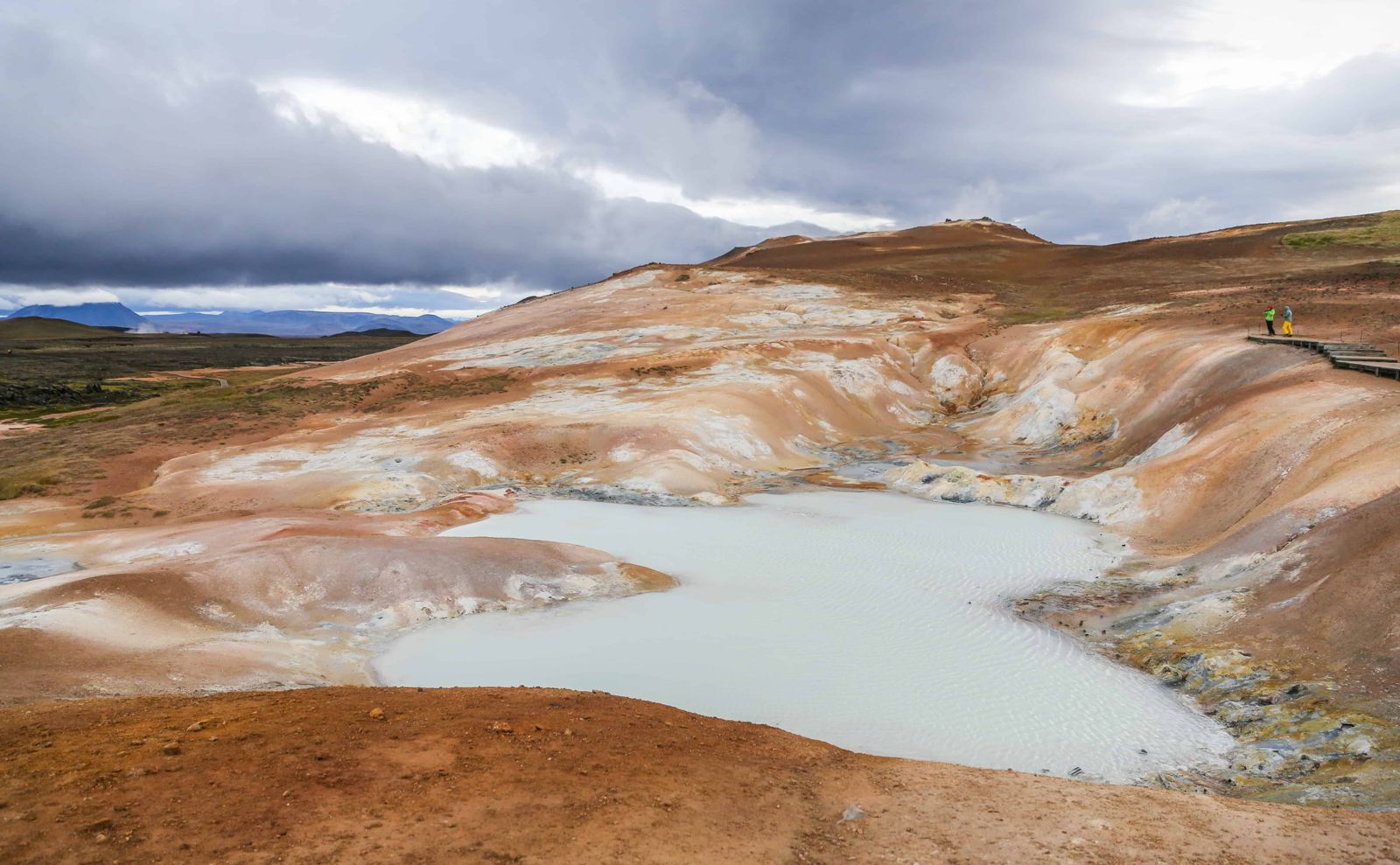
Step 2: The boardwalk and the clay hillA wooden boardwalk carries you over the hottest ground at the foot of Leirhnjúkur. Here are the mud pots, the steaming vents and the bleached, pink and yellow clay that gives the hill its name. Keep to the boards.
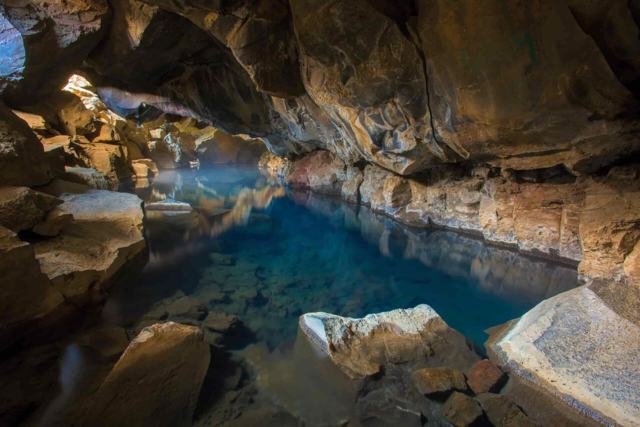
Step 3: The blue hot springBeside the boardwalk is the sight most people remember: a pool of milky, aqua-coloured water set in pale pink ground between small fissures. Do not touch the water or step down to it.
Step 4: The 1984 lavaBeyond the hill the path crosses onto black lava from the Krafla Fires. It is rough and sharp, with steam still rising from cracks more than forty years on. Do not stand in one spot for long where the ground is steaming, because the heat comes through your soles.
Step 5: Short loop or long loopThe short loop turns back soon after and takes about an hour in all. The long loop continues further across the lava field, with black new lava beside older, moss-covered flows from the 18th century, before circling back; allow about 1 hour 45 minutes. Both are close to flat.
The old version of this guide gave three to four hours for both loops together. That is generous, but it is a fair figure if you add the walk around Víti and stop often for photos.
Best time to visit Leirhnjúkur
SummerThe full loop trail is open, with the best access to the colourful ground and lava formations. It is easiest to visit from May to October.
AutumnOur pick for the best season. September and early October are quieter than summer, and the steam shows up well in the cooler air. Watch the forecast, as the first snow can arrive early at this height.
WinterFrom about October to February the lava and the hills are under snow, which is striking against the steam. Snow can also cover the trail and hide hot or unstable ground, and the road can be hard to drive. Storms are frequent and daylight is short. Check locally before setting out, and stay on marked paths.
Safety and practical tips
- Stay strictly on the marked path; the ground nearby can be extremely hot just beneath the surface.
- Wear sturdy shoes with thick, firm soles. The lava is uneven and sharp, and in a few spots the ground is hot enough to soften thin soles.
- Do not linger on steaming ground, and keep well back from vents; the steam can scald.
- The area can smell strongly of sulphur, which is normal for Icelandic geothermal sites.
- Combine a visit with Víti crater, which has its own car park a little further up the same road.
- Bring water, a warm windproof jacket and layers. There is little shelter, and the weather can change fast.
- Follow the forecast on vedur.is and road conditions on umferdin.is, especially from autumn to spring.
Facilities and accessibility
Most sources mention simple toilets and information boards at the car park, though one says there are none. There are no shops or cafés. Bring water, and expect full services at Earth Lagoon and in Reykjahlíð.
Nearby places worth a stop
Where to stay near Leirhnjúkur
Mývatn village has hotels and guesthouses and is the natural base for visiting Leirhnjúkur and the rest of the Krafla and Mývatn area.
Leirhnjúkur FAQ
What does Leirhnjúkur mean?
It means "clay hill" or "mud peak", after the pale hill of heat-softened rock at the centre of the area.
Is Leirhnjúkur safe to walk around?
Yes, if you stay on the marked path. The ground off the path can be dangerously hot and unstable.
How long is the walk at Leirhnjúkur?
The short loop takes about an hour and the long loop about 1 hour 45 minutes at an easy pace. Allow up to 3 hours if you add Víti.
How do I get to Leirhnjúkur from Mývatn?
Drive about 6 km east from Reykjahlíð on Route 1, turn north onto Route 863 and continue past the Krafla power station to the signed car park on the left.
Is there an entry fee?
No, it is free to visit.
Can you visit Leirhnjúkur in winter?
The road to the car park is usually open, but the trail itself can be closed or unsafe when covered in snow; check conditions locally.
 Iceland Travel GuideLOCAL TRAVEL AGENCY IN ICELAND
My trip
Talk to a local